Landscapes

Sunset and Lake Pehoé seen from Mirador del Cóndor, Torres del Paine National Park, Chile. Photo from the book The Most Beautiful Trails of Patagonia, click here to see it.

Aerial photo of Cono de Arita, which is located in the Salar de Arizaro, northwest of Argentina. To read an article about this region, click here.

View from Mirador Tres Lagunas, in the Cordillera Huayhuash, Peru. To read an article about this hike, click here.

Cerro Catedral Massif and Laguna Toncek seen at dawn, from the Refugio Frey camping area, Nahuel Huapi National Park, Argentina. Photo from the book The Most Beautiful Trails of Patagonia, click here to see it.
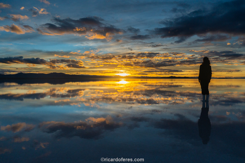
Sunrise in the flooded Salar de Uyuni (Bolivia).

Flooded Salar de Uyuni (Bolivia). The orange light comes from the city of Uyuni and the white light behind the clouds is the moonlight.

Lago Verde, Patagonia National Park, Chile. Photo from the book The Most Beautiful Trails of Patagonia, click here to see it.

To get an idea of its size, notice that there is a person almost at the top of this incredible formation, which is known as Pallay Punchu and is located on the Apu Taqllo mountain, close to the city of Layo, in the province of Cusco, Peru.

Aerial photo of Laguna Parón and Pirámide Peak in the background, in the Cordillera Blanca, Peru. Access is via a dirt road and the lake is at an altitude of 4,200 meters (13,780 feet).

Fitz Roy Massif at dawn and the frozen Laguna de Los Tres, in Los Glaciares National Park, Argentina. The lagoon is 1,250 meters (4,100 feet) above sea level and Fitz Roy is 3,405 meters (11,171 feet) high. Photo from the book The Most Beautiful Trails of Patagonia, click here to see it.
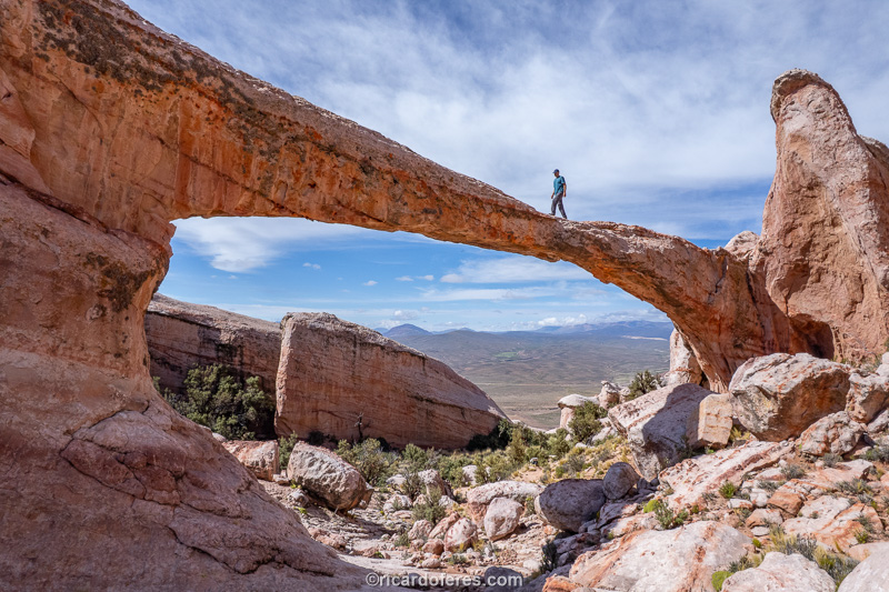
Puente del Diablo, province of Jujuy, Argentina.

The waterfall created by the melting of Castaño Overo Glacier is 366 meters (1,200 feet) high and is the highest in Argentina, located in the Nahuel Huape National Park, Bariloche. Photo from the book The Most Beautiful Trails of Patagonia, click here to see it.

Vinicunca Mountain, also known as Rainbow Mountain, province of Cusco, Peru.

Viedma Glacier seen from Paso del Viento, on the trail known as Vuelta al Huemul. The mountains in the background are approximately 30 km (19 mi) from where I took the photo and this glacier is part of the Southern Continental Ice Field, which is in Los Glaciares National Park, in El Chaltén, Argentina. Photo from the book The Most Beautiful Trails of Patagonia, click here to see it.
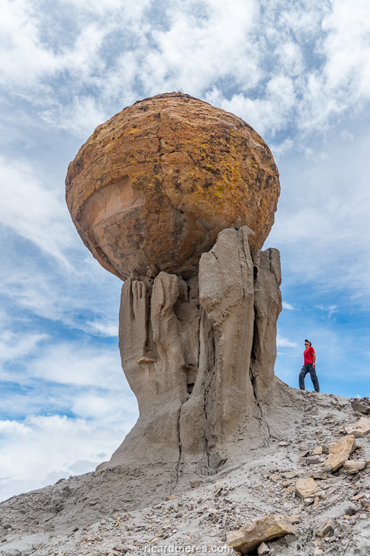
Copa del Mundo, Atocha, Bolivia.

Lake Nordenskjöld seen from Mirador Cuernos. In the background, from left to right, you can see Cerro Paine Grande (3,050 m / 10,006 ft), Valle del Francés, Cuernos del Paine (2,600 m / 8,530 ft) and Monte Almirante Nieto (2,670 m / 8,759 ft). Photo from the book The Most Beautiful Trails of Patagonia, click here to see it.

Iguaçu Falls seen from the walkway of Iguaçu National Park, Brazil. Photo from the book O Brasil da Copa (2013, out of print).

Laguna Sucia (left), Laguna de Los Tres (right) and the Fitz Roy massif in the background. Los Glaciares National Park, El Chaltén, Argentina. Photo from the book The Most Beautiful Trails of Patagonia, click here to see it.

Laguna Ilón and Monte Tronador (3,470 m) seen at dusk. Photo from the book The Most Beautiful Trails of Patagonia, click here to see it.

Perito Moreno Glacier, part of the Southern Continental Ice Field, in Los Glaciares National Park, Argentina. From one side to the other the glacier is 5 km (3.1 mi) long and the highest points are between 60 and 70 meters (200 to 230 ft).

Rio de Janeiro seen from Pão de Açúcar. From left to right are the beaches of Copacabana, Vermelha, Botafogo and Flamengo; In the background is Cristo Redentor Statue. Photo from the book O Brasil da Copa (2013, out of print).

Laguna Escondida and, in the background, the Dientes de Navarino. Photo from the book The Most Beautiful Trails of Patagonia, click here to see it.

Aerial photo of Salar de Uyuni, Bolivia. To get an idea of how big this salt flat is, look for a small black dot in the lower third of the photo, more or less in the center (right/left). This point is the car where I was and the photo only shows the western half of the salt flat.

Sunrise on the trail that leads to Laguna de Los Tres, in Los Glaciares National Park, El Chaltén, Argentina. Photo from the book The Most Beautiful Trails of Patagonia, click here to see it.

Poço Encantado, Chapada Diamantina, Bahia, Brazil. The lake is 60 meters (196 feet) deep and the height above the water line is 40 meters (131 feet). Only during winter does this beam of light invade the cave. Photo from the book O Brasil da Copa (2013, out of print).
Get to know the photo book "The Most Beautiful Trails of Patagonia"
Torres del Paine, El Chaltén, Bariloche, Ushuaia, Villarrica, Cerro Castillo, Dientes de Navarino and Parque Patagonia