Get to know the photo book "The Most Beautiful Trails of Patagonia"
Torres del Paine, El Chaltén, Bariloche, Ushuaia, Villarrica, Cerro Castillo, Dientes de Navarino and Parque Patagonia
Cotahuasi Canyon, Peru – Itinerary and tips
Introduction
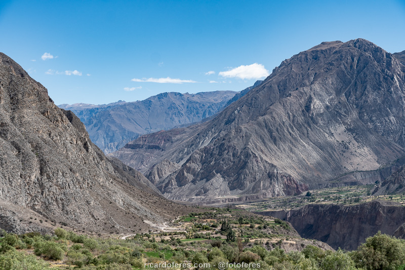
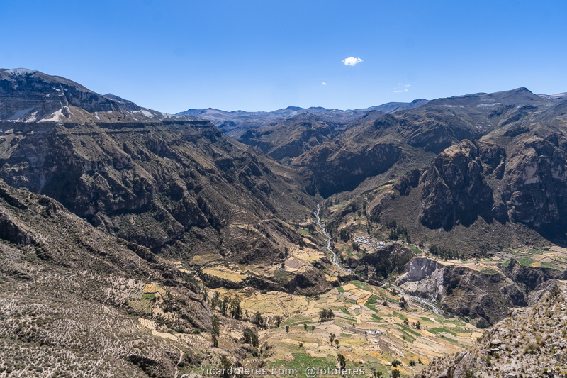
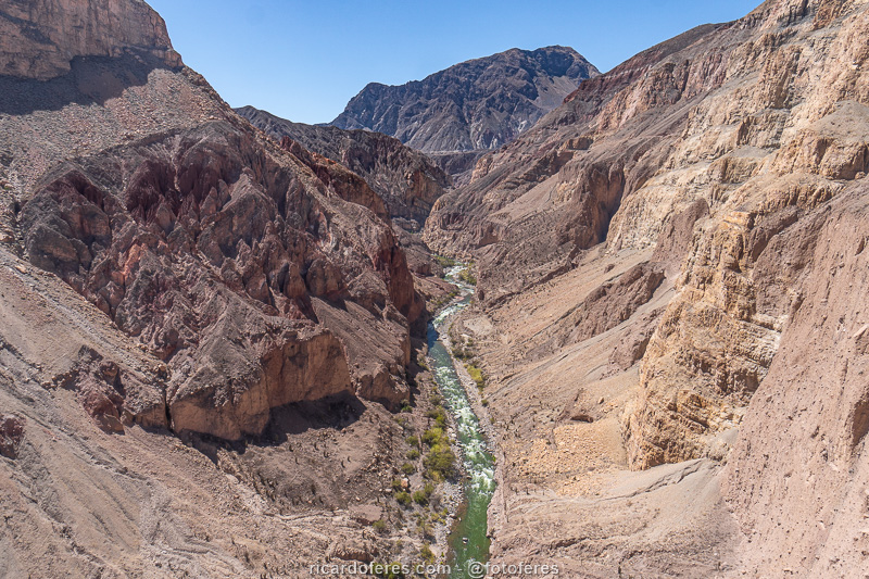
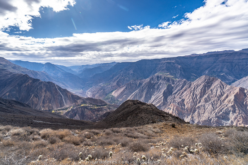
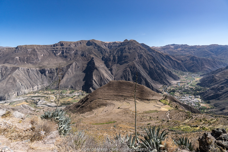
Despite being one of the deepest canyons in the world, the Cotahuasi Canyon is unknown even by many Peruvians. This is due to the proximity to Colca Canyon, which has easier access and a much more developed tourist infrastructure. When I spent two months in Peru, I was planning to visit Colca Canyon, until a Peruvian friend told me “go to Cotahuasi, it’s deeper and there are very few tourists, you’ll like it better”. He was right, I spent 8 days there and could have stayed longer, because I didn’t get to know and photograph everything I wanted.
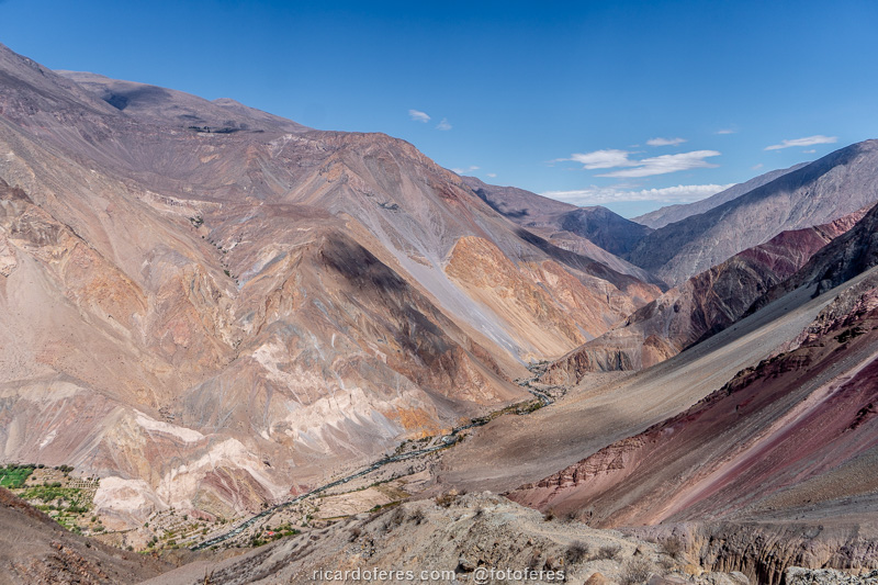
In the paragraph above I mentioned that Cotahuasi is deeper than Colca and one of the deepest in the world, but this is controversial, since there are different measurements, each one based on a criterion and, apparently, there are no official rules accepted by all countries, to measure the depth of a canyon. For example, Cotahuasi is the deepest on the planet according to NASA Earth Observatory list; on the Spanish National Geographic list, it is the third, losing to two canyons in Asia; Peruvian articles sometimes cite Cotahuasi and sometimes Colca as the deepest. Most publications say that its depth is 3,535 meters (11,597 ft), and its length is 100 km (62 mi), so I assume that this is the real measurement but, in fact, the most important thing is its beauty.
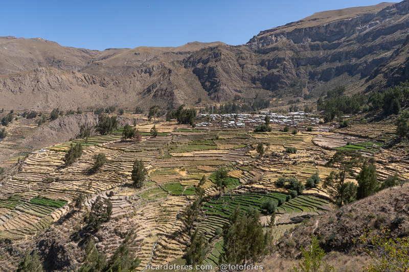
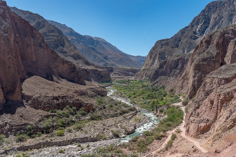
Inside the canyon there are many small villages, which are dedicated to agriculture and livestock, except for those at the top of the canyon, where the temperature prevents agriculture and only cattle, sheep, alpaca and llama are breed. Inside the canyon, the farms are of corn, potatoes, quinoa and several other cereals and tubers, because with so much thermal amplitude between the bottom of the valley and its top, there are altitudes/temperatures suitable for different plants.
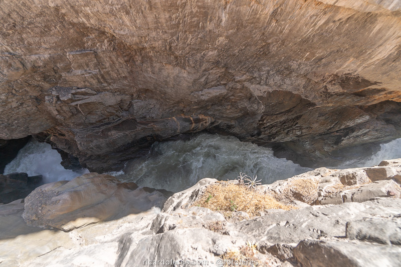
In 2005, the Peruvian government created the Reserva Paisajísica Subcuena del Cotahuasi, covering 490,550 hectares (almost 5,000 square km), with the difficult mission of reconciling the preservation of fauna and flora with the traditional lifestyle of the locals, as well as the tourism development. Speaking of tourism, the vast majority of tourists go to the canyon just to visit Termas de Luicho (thermal waters) and Sipia Waterfall, but the region is great for those who want to hike for a day or more and, even better, for those who like to go mountain-biking, thus avoiding the bad public transport and being able to stop at all viewpoints they want, since the dirt roads offer beautiful landscapes. Another underdeveloped sport is whitewater rafting and kayaking, as the Cotahuasi River, between Velinga and Iquipi, has a 90 km (56 mi) section with class IV and some class V rapids.
Best season
- From May to August is the dry season, with many sunny days, so if you don’t want to worry about the weather, it’s the right time. The lack of rain leaves the landscape arid, except for the sites that have irrigation, where you will see some green.
- From September to November there is a transition, with increasing rainfall and cloudy days.
- From December to March is the rainy season, when some roads get muddy and it can be difficult to drive with 2WD cars, but the canyon is much greener.
- April is a transition month, and it can be a good choice to find landscapes with more green without having to face the rainy season.
How to get there
The city of Cotahuasi is the gateway to the canyon and is 371 km (230 mi) away from Arequipa, the second largest city in Peru. There are only night buses and the trip takes around 8 hours, arriving at dawn in Cotahuasi. If you don’t have accommodation already booked, you will have to wait for several hours on the bus until dawn and be able to look for a place, which is one of the reasons why I highly recommend you to go by car, either with your own car or with a rented one. Another reason is that public transport between the villages is terrible, but I will explain this better in the next topic.

Leaving Lima, it is possible to make a beautiful itinerary uniting Arequipa, Cotahuasi, Puno (Titicaca Lake) and Cusco.
What to do
Below are the places I visited, with the attractions grouped according to their locations. I won’t put the transport schedules because they are not reliable, you have to go to Cotahuasi and ask several people, because even the locals don’t know it well. In fact, not even the person responsible for organizing the transport was able to inform me and had to make a phone call to get the answer, which was wrong! Precisely because of the changes in days and times, do not trust the information you find on the internet, as some are correct and others are not.
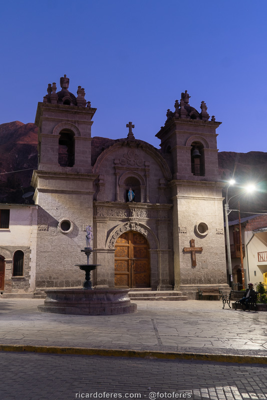
Cotahuasi City
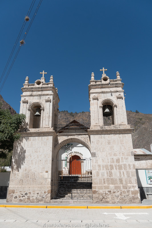
The city of Cotahuasi is the largest in the canyon and is the final stop for the bus that comes from Arequipa. Even being the biggest of the canyon, it is a small village, but it has a few inns and restaurants, as well as some small markets.
I stayed at Hotel Los Andenes, which is well located, has comfortable (but not luxury) rooms and good wifi. You can find it in Booking, but if you go straight to the counter, the price is much lower.
I’ve been to two restaurants, but I can only recommend one, as I didn’t like the other. What I liked and I went four times is Sumac Micuy, which is very close to Hotel Los Andenes, has good food and price.
In the small central square is La Placita snack bar, a good option to eat a sandwich (I had a choripán) or even some dishes, but these I have not tried.
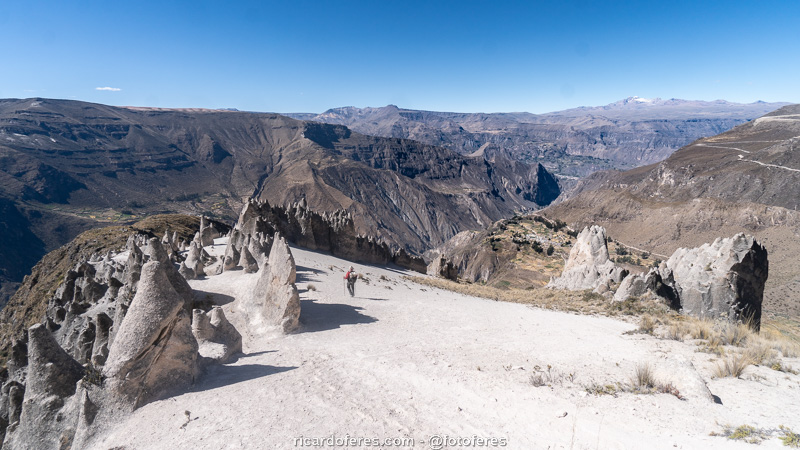
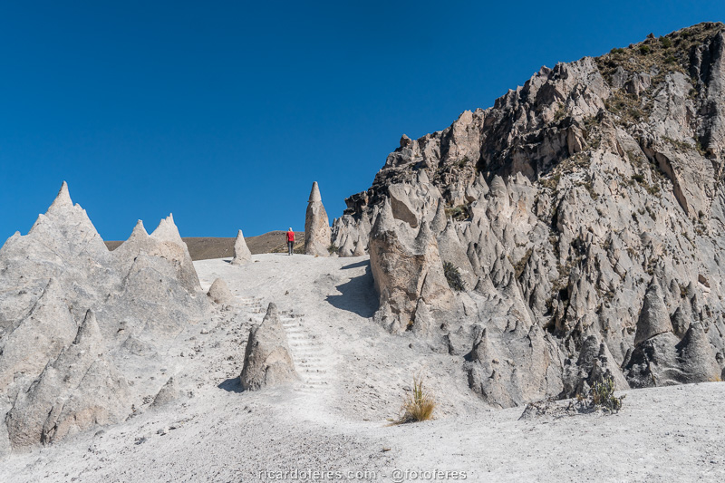
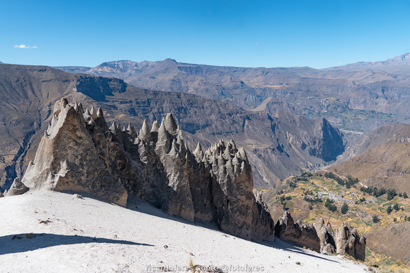
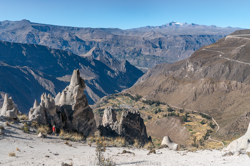
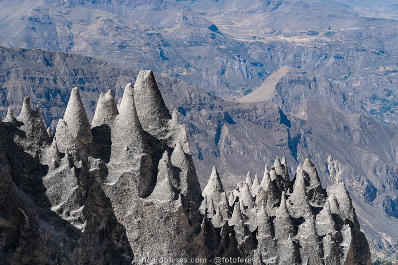
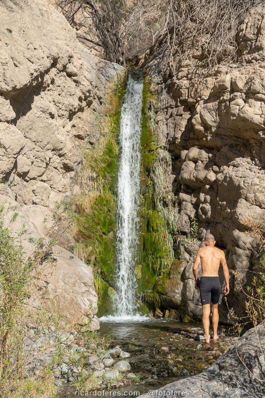
Bosque de Piedras Huito and Uskune Waterfall, in Pampamarca
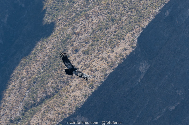
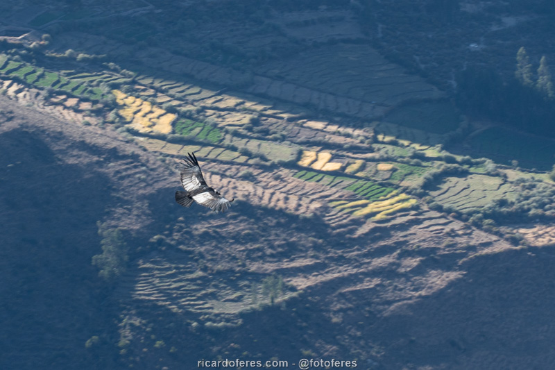
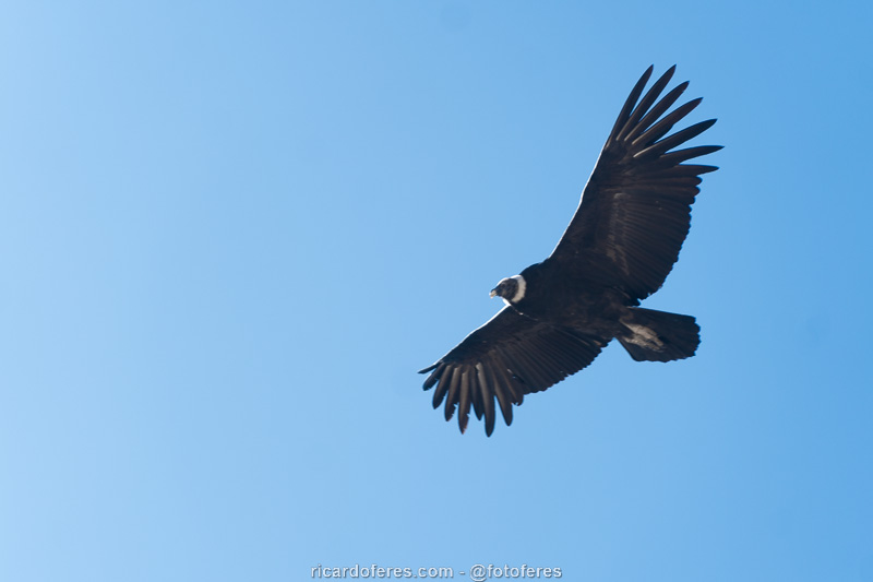
- The trail to Bosque de Piedras has 7 km (4.3 mi) round trip and elevation of 600 meters (1,968 ft), so it is a short and steep trail, and the altitude of 3,600 meters (11,800 ft) takes its toll, especially for those who are not acclimatized. Erosion caused by the action of wind and rain resulted in beautiful formations and the view of the canyon is also impressive. To top it off, it’s a great spot to spot condors, especially in the morning.
- The trail to Uskune Falls Lookout has 2.5 km (1.5 mi) round trip and is almost flat, making it easy even for people who are not used to hiking. The view from the viewpoint is beautiful, but the waterfall is 700 meters (2,300 ft) away, so you won’t see it in detail if you don’t have binoculars or a good lens on your camera.

Click to open a 360-degree photo of Bosque de Piedras.
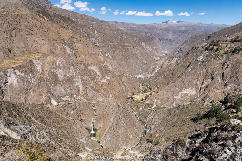
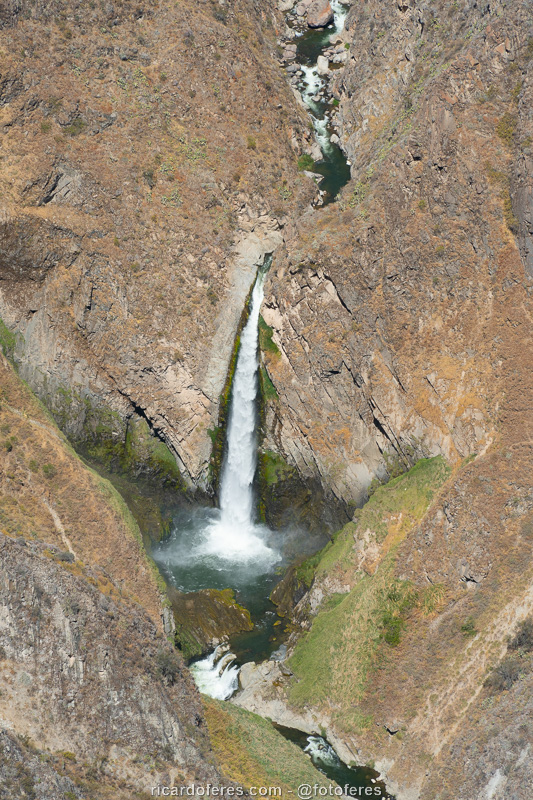
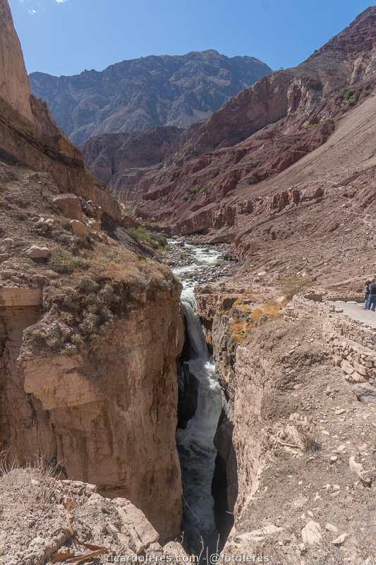
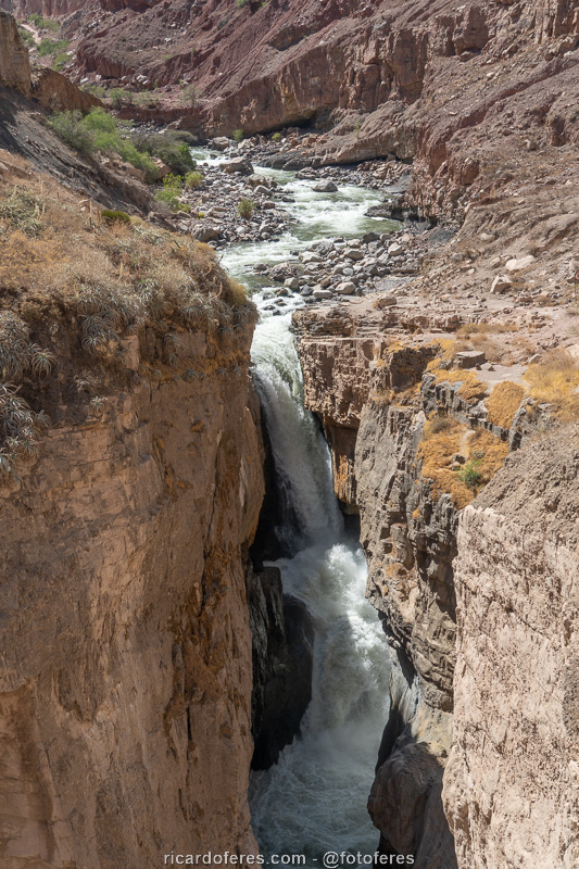
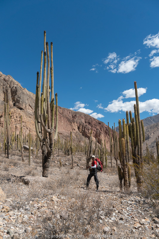
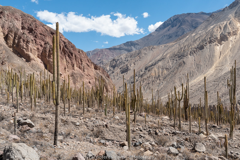
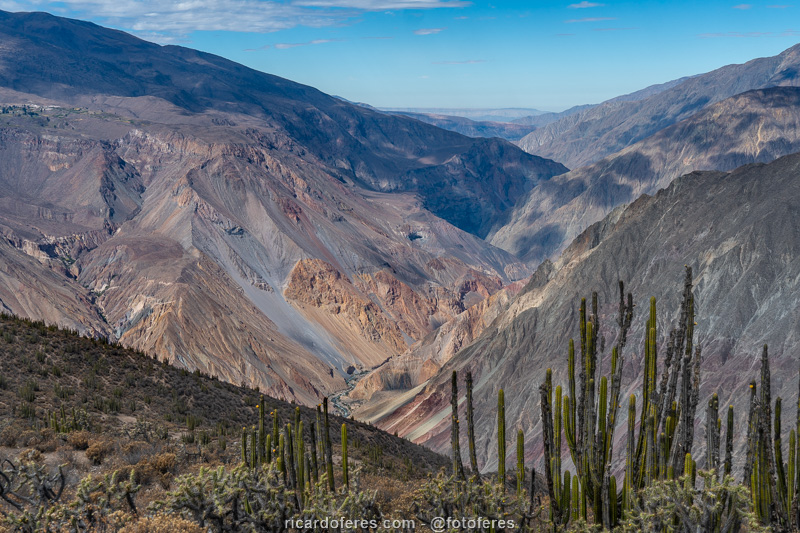
Sipia Waterfall, Chaupo Lookout and Judiopampa Cactus Grove
These three points are between Cotahuasi and Velinga, and can be visited in a morning, if you have a car. By bike, it’s a full day tour, but if you go by bus, you’ll have to get off at Bosque de Cactus and get back on foot, as there’s only one bus a day and it will pass to Cotahuasi before you’ve see everything. If you don’t want to walk more than 22 km (13 mi) on a dirt and asphalt road, you can sleep in Velinga, where there is a very simple accommodation at Mrs. Angelica house, and take the bus the next day.
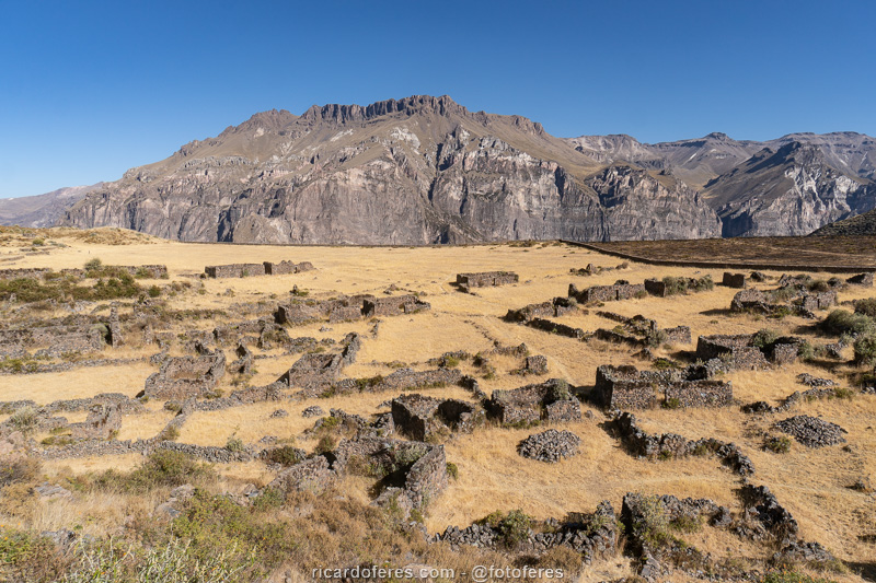
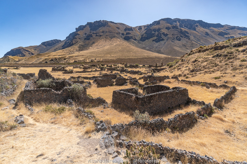
Maukallacta Ruins
The Maukallacta Ruins are reached by a trail of only 2 km (1.2 mi) round trip and 170 meters (550 ft) of ascent. This was the largest settlement in the region, built by the Huaris even before the Inca reign, and several buildings are in good condition. The ruins alone are worth the trip from Cotahuasi to Puyca, the village from where the trail begins, but it is worth mentioning that the view from Maukallacta to the canyon is incredible and the road that goes up to Puyca also offers impressive views.
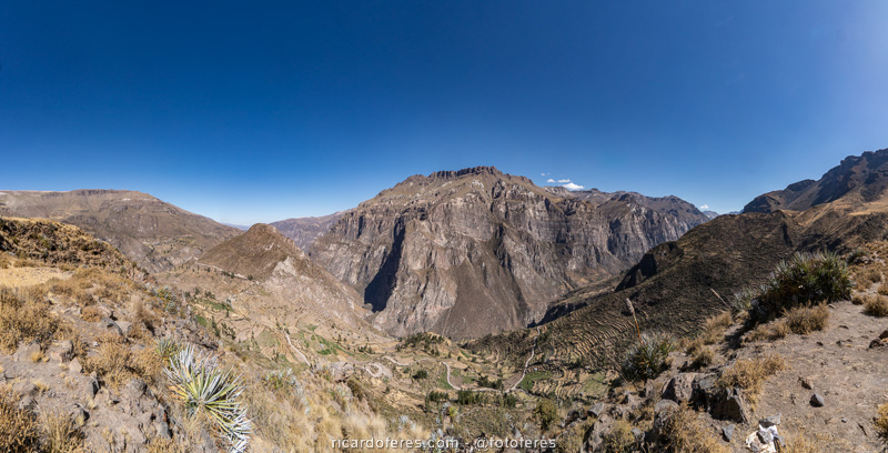

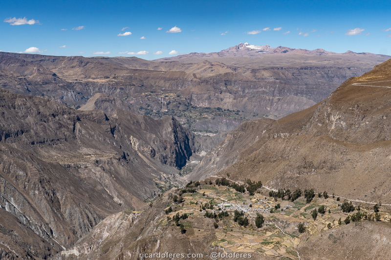
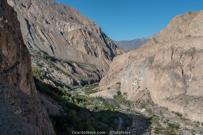
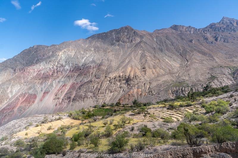
Charcana to Quechualla trail
Charcana is a village on a high plateau, at 3,417 meters (11,210 ft) of altitude, while Quechualla is the lowest village in the canyon, at 1,804 meters (5,918 ft). The two can be reached by bus or car, but between them you have to walk along a beautiful trail, which at the beginning has an impressive view of the bottom of the canyon and, as you go down, you have a view of mountains with beautiful colors and the Cotahuasi River.
Considering that there are some climbs along the way, in total, the accumulated descent is almost 2,000 meters (6,600 ft), so it is recommended to use walking poles to protect your knees.
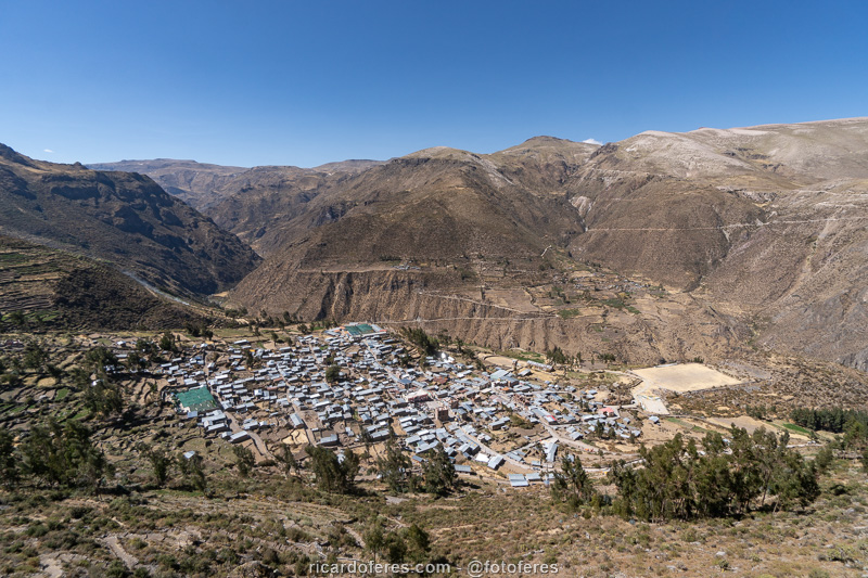
Once you reach the bottom of the valley, you can go straight to Quechualla or walk another 4 km (2.5 mi) round trip, almost completely flat, to take a cold shower at Ushua Waterfall.
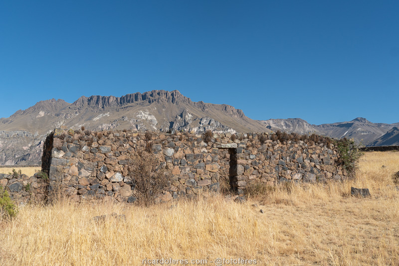
In Quechualla, in front of the square, there is a very simple accommodation, owned by a very friendly family, and their balcony is the only place where there is a cell signal from Claro. If you want a meal, they can cook it for you.
Click here to download this track at Wikiloc.

Click to open an aerial 360-degree photo showing Charcana, Quechualla and Velinga.

Locrahuanca Lookout
Locrahuanca is a small village on top of a hill overlooking Taurisma and Tomepampa, from where the trail begins. It is also possible to reach Locrahuanca by car or bus, on the other side of the hill, but it is worth mentioning that the view from there is beautiful, but not as beautiful as the other viewpoints I have already described. Go only if you have time to spare, otherwise it is better to know the attractions I mentioned above.
The trail has 7 km (4.3 mi) round trip and an elevation of 650 meters (2,132 ft), it is not as easy as I read on some websites, in which I believe they wrote without even having done the trail, since there was no photo.

Other attractions
Above I described the points I visited, but in Cotahuasi Canyon there are many more things to see, which I didn’t go for lack of time, transport or interest. I will quote some of them so that, if you are interested, you can find more information on the internet or in the villages themselves.
- Baños Termales: there are several places with thermal waters, the most famous being Luicho, but there are also Lucha, Josla and, as they say, others that are not explored for tourism. I didn’t meet any of them because at the bottom of the valley it’s quite hot during the day, so I didn’t feel like going into hot waters if it was already hot.
- Bosque de Piedras Santo Santo and Huarmunta: besides the Bosque de Piedras that I visited, there are two more that I haven’t had time to visit, so I can’t say which is the most beautiful. If you go to the 3 and can compare, I’d appreciate it if you write to me on the email cadastro@ricardoferes.com to tell which one you liked best.
- Allhuay Lookout: this viewpoint is on the road that gives access to Cotahuasi, but as I was on the bus, I couldn’t stop. I couldn’t find a transport in Cotahuasi to take me either, but if you’re driving, I believe you’ll have a beautiful view.
- Bañadero del Cóndor Lookout: close to Mirador Allhuay but with access by a dirt road, in summer there is a thin but very high waterfall and, at its base, a small lake where you can see the condors. As I went in winter, there was no water and I didn’t even try to visit it.
- Fuysiri Waterfall: I saw few photos on the internet of this waterfall, as well as few reliable information, but I was curious to know because it looks beautiful. It is reached by a 3 km (1.8 mi) trail that starts in Tecca, but to get to Tecca, from what I researched, just walking, so I appreciate it if you can get more precise information and send it to me on the email cadastro@ricardoferes.com
Get to know the photo book "The Most Beautiful Trails of Patagonia"
Torres del Paine, El Chaltén, Bariloche, Ushuaia, Villarrica, Cerro Castillo, Dientes de Navarino and Parque Patagonia