Get to know the photo book "The Most Beautiful Trails of Patagonia"
Torres del Paine, El Chaltén, Bariloche, Ushuaia, Villarrica, Cerro Castillo, Dientes de Navarino and Parque Patagonia
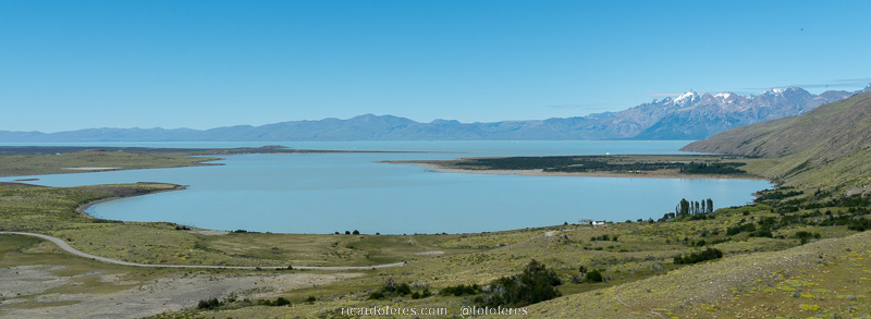
Vuelta al Huemul, El Chaltén, Argentina – Hiking report
Overview
El Chaltén, in Argentine Patagonia, is famous all over the world because of its trails, climbs and even among those who don’t like to make any effort, since the most famous mountain in the region, Cerro Fitz Roy, can be seen from the village. However, this article will not talk about the trails or the iconic Fitz Roy, but about a little-known hiking circuit called Vuelta al Huemul.
With 2,677 meters (8,782 ft) of altitude, Cerro Huemul is much smaller than Fitz Roy (3,405 m / 11,171 ft), Cerro Torre (3,102 m / 10,177 ft) and other mountains in Los Glaciares National Park, and it lacks the striking beauty of the granite towers that attract so many experienced climbers. This means that, despite giving the circuit its name, Huemul is not the main attraction of this hike, wich is the Viedma Glacier, a part of the Southern Patagonian Ice Field, one of the largest ice fields in the world.
The circuit has 72 km (45 mi) and 3,200 meters (10,500 ft) of accumulated elevation, already including the walk on the road back to El Chaltén. If you hire a car to pick you up at Bahía Túnel, you will save 7 km (4.3 mi) of a tedious walk, as the last few kilometers are not pretty.
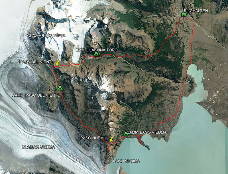
Circuit around Cerro Huemul with three overnight campsites.
Base city
El Chaltén was created in 1985 in order for Argentina to maintain its sovereignty over the region, which was in dispute with Chile. However, in 1991, there were only 41 people living there permanently and, in 2001, only 371 people. Its development took place just with the beginning of tourism and currently around 3 thousand people live in this small town that calls itself the Hiking Capital of Argentina.
To get to Chaltén, the easiest way is to fly to El Calafate and, from there, take a bus. If you do this route, be sure to visit the Perito Moreno Glacier, which is impressive and is also part of the Southern Patagonian Ice Field, as well as the Viedma Glacier, which you will see during the circuit.
In the three times I’ve been to El Chaltén, I’ve stayed in three inns and I can recommend them because the staff are good, the rooms too and they have a great breakfast. I also stayed at a campground with plenty of space for tents and motorhomes, as well as a good kitchen, bathroom and dining area. See below the websites of the inns and the camping:
Hostería El Paraiso – https://www.hosteriaelparaiso.com.ar/
Hostería Fitz Roy – https://www.hosteriafitzroy.com.ar/
Hostería Vertical Lodge – https://www.verticallodge.com.ar/
Camping El Relincho – https://elrelinchopatagonia.com.ar/info/index.php/es/camping
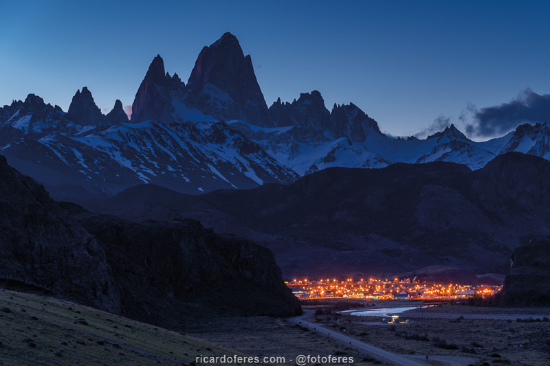
El Chaltén and the Fitz Roy massif seen from the road.
Best season
Try to go between December and mid-March. If you go right at the beginning of the driest season (November), the lakes can still be frozen if it’s a year with a long, cold winter. In summer, temperatures will be more pleasant, the chance of rain is lower and, above all, there is a greater probability of seeing the mountains, which can be hidden for days behind the clouds, despite the fact that the city is sunny. As the wind in the summer is usually very strong, do not be fooled when you see forecasts with pleasant temperatures because with the strong Patagonian wind, the thermal sensation will be much lower.
If possible, go to El Chaltén with some days to spare, so you can wait for the good weather windows, otherwise there is a good chance of traveling so far and not seeing what you want..
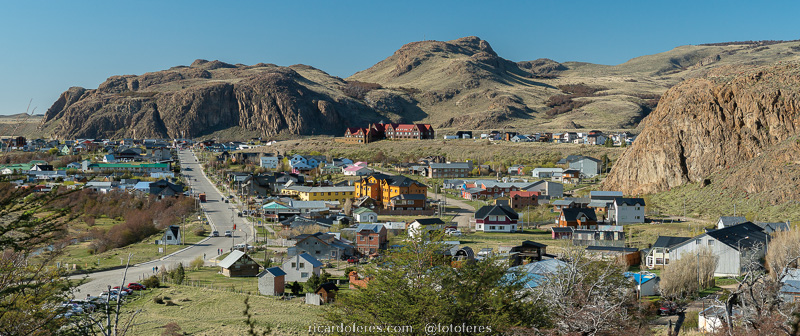
The charming town of El Chaltén in a sunny summer day.
Costs
Entrance to Los Glaciares National Park is free, as are campsites.
It is not mandatory to hire a guide, but if you don’t have enough experience on trails, I recommend you hire one, this circuit is not like the trails near Fitz Roy.
Reading the report below, you will see that there are two zip lines used to cross the Túnel River, so you need to bring a harness, strap to secure your backpack and two carabiners (at least one made of steel), one for you and one for your backpack. If you don’t have it, you can rent it in the city and, depending on the season, the park rangers allow you to do the circuit without this equipment, because if the river levels are low, it is possible to cross them next to the lakes, but don’t count on that because may not be safe.
Hiking clockwise or counterclockwise?
The advantage of doing the trail clockwise is that you can take a taxi/remis to Bahía Túnel, as this stretch to the city is not attractive. On the other hand, it is recommended to do it counterclockwise for three reasons: the first, which is not very important, is that the steepest section will be done going down, although some people may prefer to go up, as it is safer. The second reason is that the prevailing wind, on the hike overlooking the ice field, will hit your back and not your face, but I don’t think this is a very strong reason either. Finally, the reason why it’s best to do it counterclockwise is that the pulley stops on that side of the river, so if you arrive on the other side, you’ll have to wait for someone to cross to hand you the pulley.
Tracklog
Click here to open my Wikiloc page and download this route to use in your GPS.
Report
Day 1 – El Chaltén to Laguna Toro Campsite (17.4 km / 10.8 mi – Accumulated ascent of 770 m / 2,526 ft)
After six days in the city waiting for the weather to improve, there was finally a good weather window. I left Chaltén one day before the forecast said it would be sunny, as the first day of the trail I had already photographed the week before, in my first attempt to do the circuit, which was aborted on the second day because of the arrival of rain and low clouds, which prevented the view of the mountains.
As expected, the day turned out to be cloudy and with small openings of sun. As for the hike, it started with a 10 km (6.2 mi) climb, but not steep, and at the end of it I had a beautiful view with Cerro Huemul and the Túnel River valley ahead, and Lake Viedma to the left. The descent is just a little steeper and then the walk takes place through the valley, following the Túnel River to Laguna Toro Campsite, just before the lagoon.
On the way, I met an Argentine couple and their two children, aged 6 and 8, who were also going to the campsite, and it was a pleasure to see two children so young doing a trail like this. Anyway, nothing like showing them that there is a lot of fun without televisions, video games and cell phones.
Upon arriving at the camp, after finding a good spot for the tent, I spent the end of the day reading and hoping for the forecast to be right for the following days.
View at the end of the first climb. On the left is Cerro Huemul (2,677 m / 8,782 ft) and on the right is the Túnel River valley. At the bottom of the valley is Toro Lagoon, the camping area and then the Túnel River glacier.

Descent to the Túnel River valley.
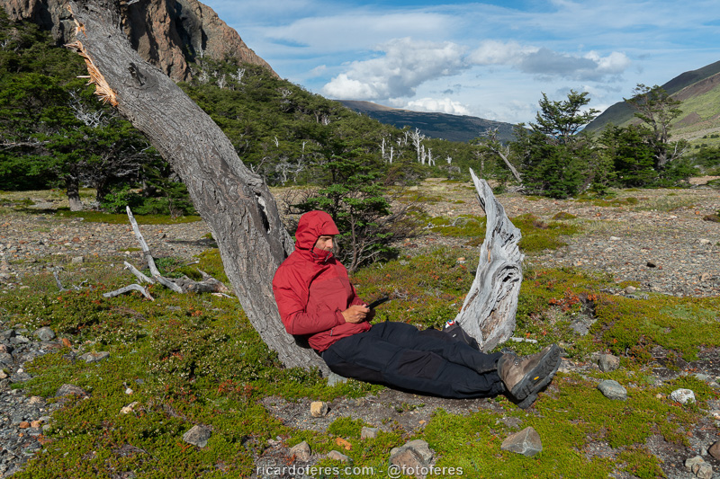
Taking advantage of the sun to warm me while I read and wait for night time.
Day 2 – Laguna Toro Campsite to Paso del Viento Campsite (13.4 km / 8.3 mi – Accumulated ascent of 693 m / 2,273 ft)
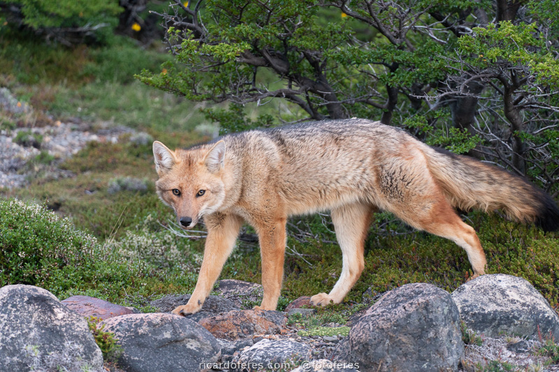
In the summer, days in Patagonia start early and I wake up even earlier so as not to miss the sunrise. Shortly after 05:00 I was already photographing and, even better, I found a sleeping fox, which also became the target of my camera.
A little after Toro Lagoon is the first zip line of the circuit, and after crossing it, I met Thibaud, a nice French guy who, like me, was also doing the circuit by himself. We chatted a bit, I took some photos of an English couple crossing the zip line and then I headed to Paso del Viento so as not to miss a moment of a day with blue skies, after so many days of waiting.
This part of the hike can be done where the Túnel River Glacier meets the hill, or along the slope of the hill, walking over rocks that often slide with the person’s weight. I believe it is safer to walk by the glacier, but as I wanted to photograph it from a higher angle, I went along the slope, always looking for the safest path until I reached the marked trail that goes up to cross the pass.
As for the Paso del Viento, it offers one of the most impressive views I’ve ever seen, but unfortunately, the photos fail to convey the feeling of being there. After taking a lot of pictures, I still spent a long time admiring the landscape and talking with the Frenchman and also with José, an Argentinean who went to the Paso and later would return to the camp.
Despite the desire to continue at the lookout, I still had to photograph the path to the next camp and I left with Thibaud towards Laguna del Refugio. As we were the first to arrive, we were able to choose the best places for the tents and swim a little in its icy water, washing away the dirt from the two hiking days. We also walked around the lagoon, walking along a ridge, thinking that there would be a view of the ice field, but we were wrong. Either way, the lagoon view was worth the extra walk.
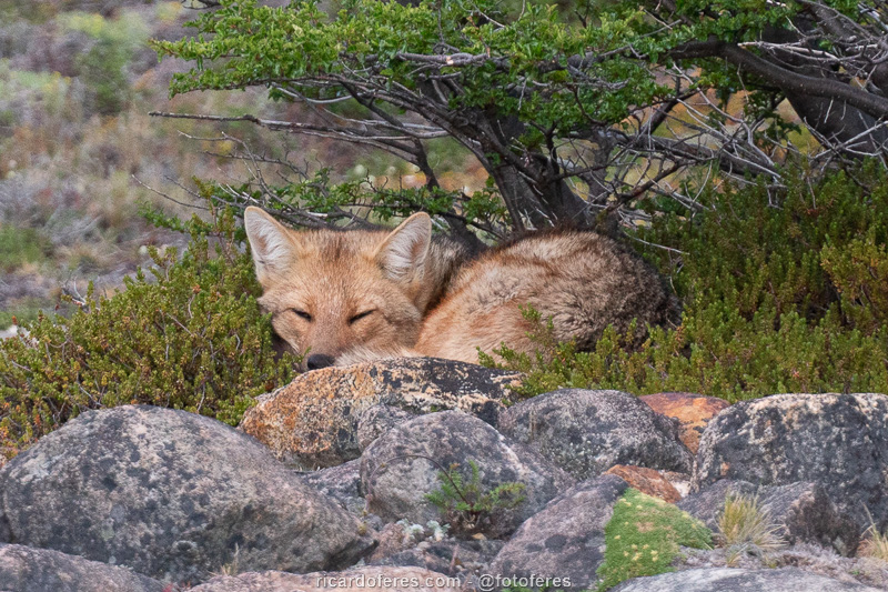
Fox sleeping 200 meters (650 ft) from the camping area.
At night, foxes tend to look for food outside the tents.
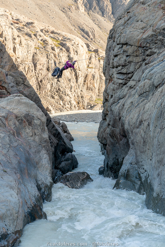
First zip line over the Túnel River. It is worth mentioning that it is possible to cross the river next to the lagoon, but using the zip line it is not necessary to get wet.

Lower part of the Túnel River Glacier.
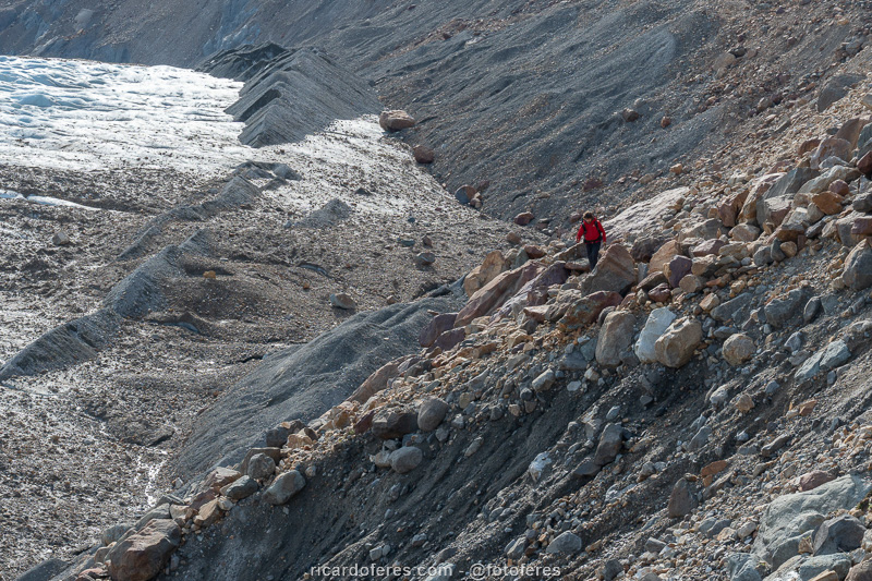
I believe the safest path is next to the glacier, where it meets the mountain, but as I wanted a higher point of view to photograph, I walked on the slope.
View of the Túnel River Glacier almost at the top of Paso del Viento. At the very bottom is Toro Lagoon and, after it, the campground.

360º photo on the way up of Paso del Viento, with a view to Río Túnel Glacier. Click to open and rotate the photo using the mouse.
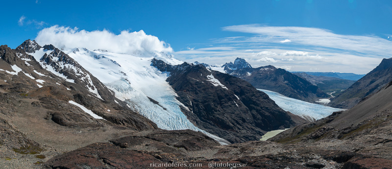
Southern Patagonian Ice Field seen from Paso del Viento.

360º photo from the top of Paso del Viento, overlooking the Viedma Glacier, part of the Southern Patagonian Ice Field. Click to open and rotate the photo using the mouse.
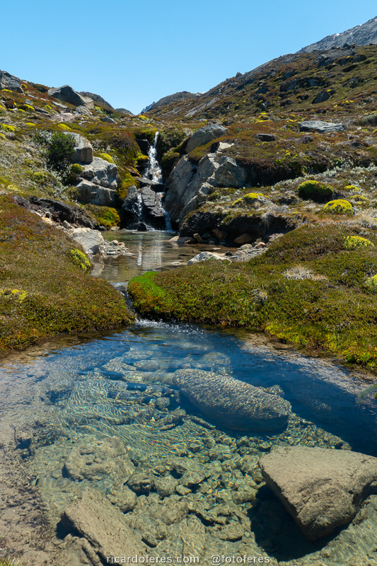
Stream that feeds the Laguna del Refugio.
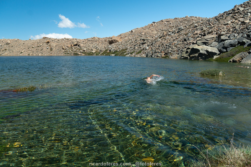
Despite the cold water, I found the courage to swim a little and remove the dirt from the first two hiking days.
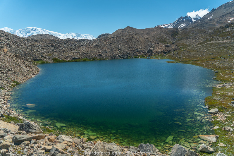
Laguna del Refugio. The camping area is on the other side and it is worth mentioning that it is not always so full, usually there is less water.

360º photo of Laguna del Refugio. Click to open and rotate the photo using the mouse.
Day 3 – Paso del Viento Campsite to Lago Viedma Campsite (16.8 km / 10.4 mi – Accumulated ascent of 680 m / 2,230 ft)
The third day of the hike goes parallel to the glacier and, as you gain height to cross Paso Huemul, you can see the ice field again. In fact, I found the view from this point even more impressive than that of Paso del Viento. When I arrived at the top of the Paso, I met the Frenchman and we walked for 40 minutes to a lookout point to see the end of the glacier and the beginning of Lake Viedma. By the way, we were the only ones to do this, the other people arrived tired at the top of the Paso and went straight down to the beach, but I highly recommend going to the lookout point as it was one of the most beautiful views of the entire trip I did to publish the book The Most Beautiful Trails of Patagonia.
Then came the famous descent of Paso Huemul, which everyone says is very steep and dangerous, you have to hold on to trees and rocks so as not to fall, etc. I don’t know if it was because I had already heard terrible reports of this stretch, but for me, what was worse were the countless horseflies that were surrounding me. As I had to use my hands to support myself on the poles, from time to time I would stop for them to land and I could kill them. During this descent, 17 horseflies discovered if there is life beyond death, so come psychologically prepared because there is no repellent to scare them away.
Camping on Lake Viedma is another place that nobody forgets, not so much because of the beach itself, which is made of stones, but because of the countless icebergs that reach the beach. As it was a sunny and windless day, getting into the water was easy even for a Brazilian who doesn’t like cold water, after all, when would I have another chance to swim surrounded by icebergs? Without a doubt it was a good way to end the last day of 2019, since the turn of the year I spent sleeping soundly.
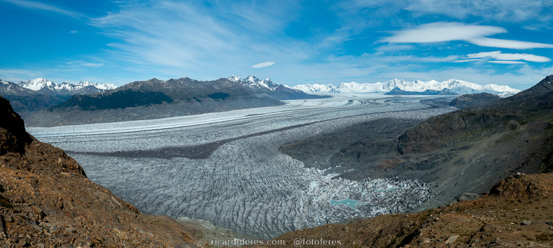
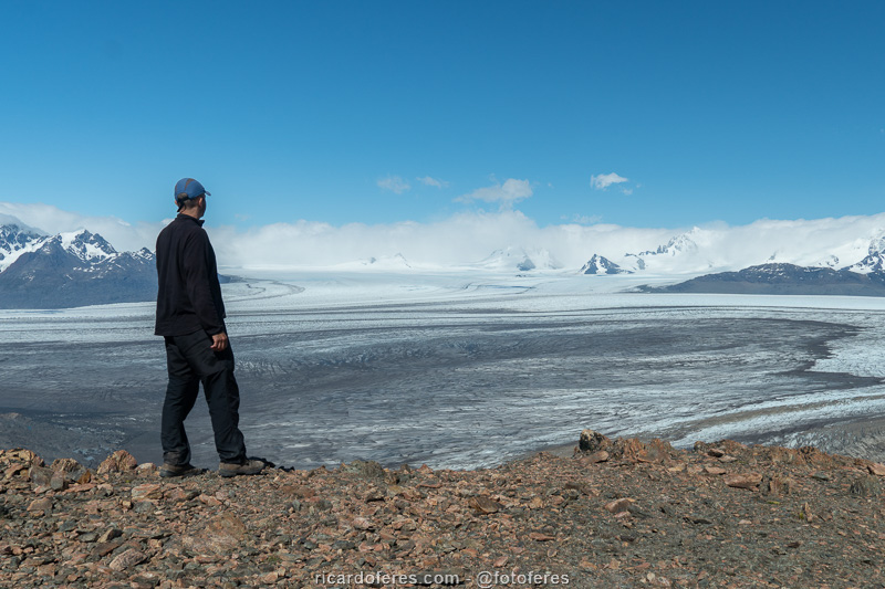
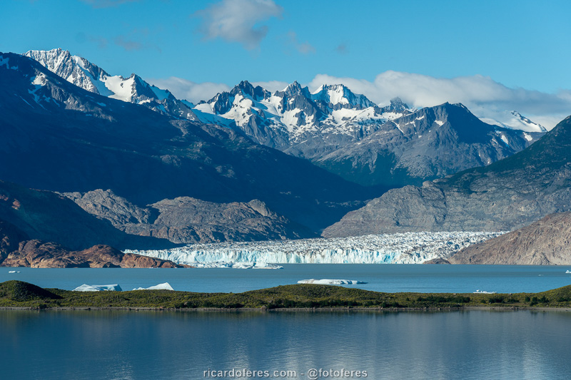
Viedma Glacier seen from the ascent of Paso Huemul. To get a better idea of the size of this glacier, the mountains in the background are more than 25 km away..
A glacier is a river, but of frozen water. Debris that falls on the ice are transported as the ice advances and the curves that can be seen in this photo show the relief of the valley floor, which causes the ice to make these curves, just like the water of a river, but at a much slower pace.
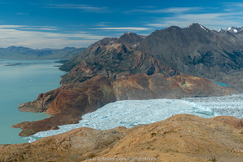
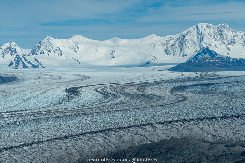
Viedma Lake and glacier, which is part of the Southern Patagonian Ice Field.

360º photo from the lookout to Viedma lake and glacier. Click to open and rotate the photo using the mouse.
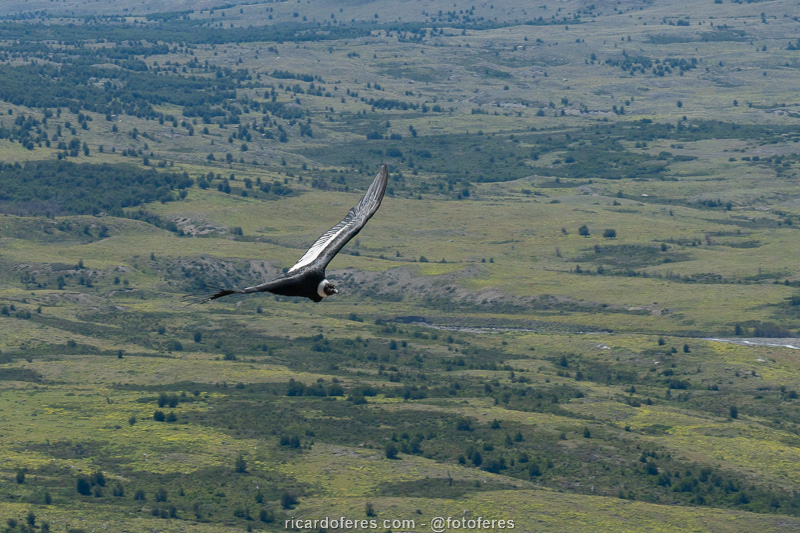
Condor seen on the way down from Paso Huemul.
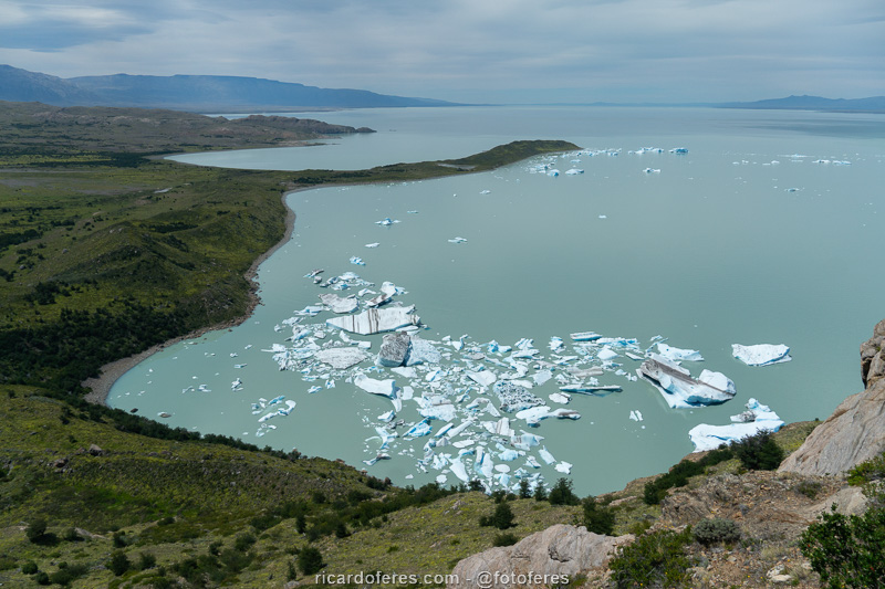
The beach on the lower left side is where the camping area is located. The two photos below show the small icebergs that are very close to the beach and can barely be seen in this photo, so look at the size of the bigger ones, which ran aground farther from the beach.
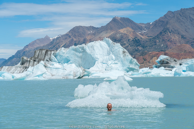
The water was freezing cold, of course, but with the sun and no wind, it wasn’t as difficult as it seems.

My orthopedist told me to put ice where I had pain, so…
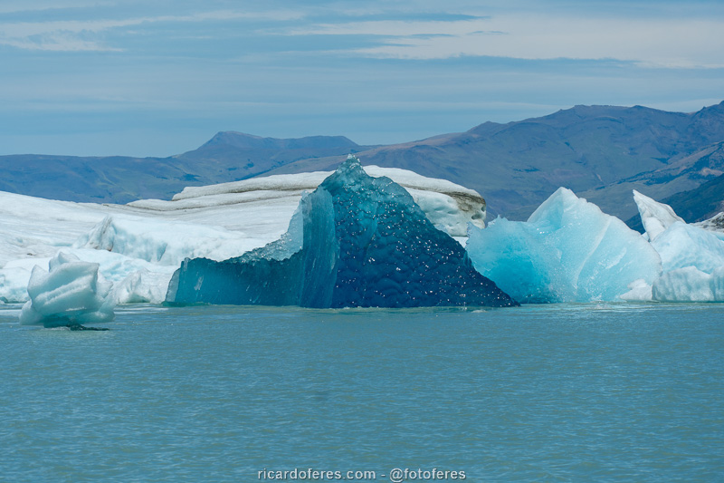
The dark blue ice is the underside of an iceberg that has just turned upside down. Blue ice, which is denser, turns white on contact with air.

360º photo at the beach in front of the campground by the Lake Viedma. Click to open and rotate the photo using the mouse.
Day 4 – Lago Viedma Campsite to El Chaltén (28.7 km / 17.8 mi – Accumulated ascent of 680 m / 2,230 ft)
The first day of 2020 started early because I wanted to be in a peninsula with view to Viedma Glacier before the sunrise, as you can’t see the glacier from the beach. Again the sunrise was beautiful, so I did my pictures and then started the long way back to El Chaltén.
On this day there is another zip line, over a river that I first tried to cross on foot because there were people using the zip line, but I gave up in the middle because it is deeper than it looks and I was afraid of getting the photo equipment wet.
I followed the trail to Bahía Túnel, where it is possible to get there by car, but I didn’t hire a taxi to pick me up because I didn’t know when I would end the hike, as I often don’t manage to photograph everything I want in the planned time. So, all that was left for me was to take a trail that leads to the city, but it is not pretty and, without beautiful landscapes to entertain me, adding to the sleepless nights and the natural fatigue of the walk, I did this stretch dragging myself, but very happy for completing the photos of one of the most beautiful hiking circuits I’ve ever done!
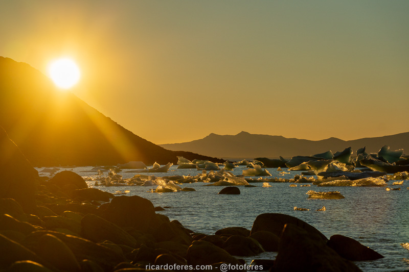
This was my first sunrise in 2020, I couldn’t start the year better.
Lake and glacier Viedma.
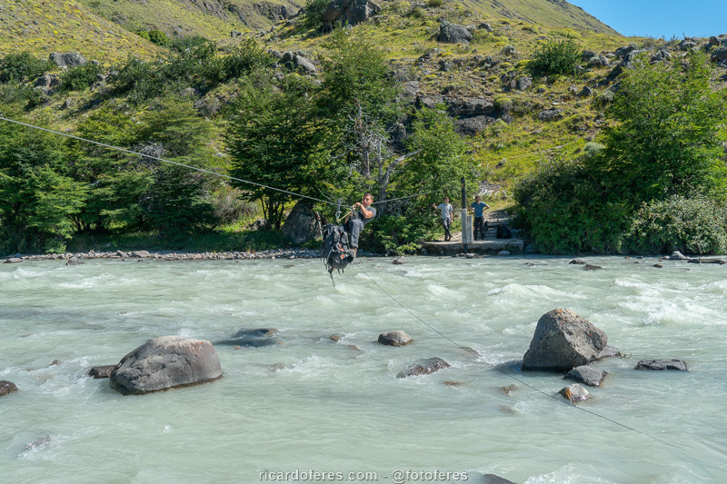
Second zip line over the Túnel River.
This is the Bahía Túnel, a point where it is possible to reach by car to be picked up and save 7 km (4.5 mi) of walking in an unattractive stretch.
Get to know the photo book "The Most Beautiful Trails of Patagonia"
Torres del Paine, El Chaltén, Bariloche, Ushuaia, Villarrica, Cerro Castillo, Dientes de Navarino and Parque Patagonia