Get to know the photo book "The Most Beautiful Trails of Patagonia"
Torres del Paine, El Chaltén, Bariloche, Ushuaia, Villarrica, Cerro Castillo, Dientes de Navarino and Parque Patagonia
O Circuit in Torres del Paine, Chile – Hiking report
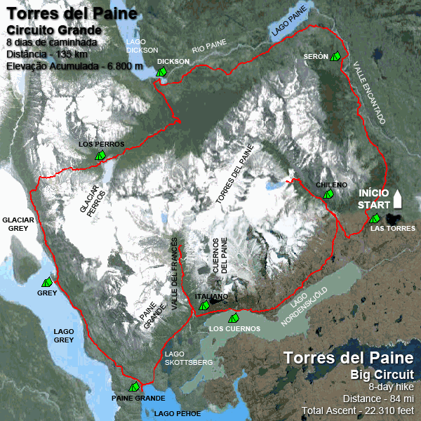
The red line shows the O Circuit, the W Circuit uses the same trail, from Grey to Las Torres campsites.
Considered as one of the best hiking destinations in the world, Torres del Paine has two hiking routes that are becoming more popular each year, the O Circuit and the W Circuit, which is part of the O and covers almost all of the most beautiful landscapes.
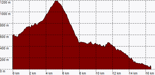
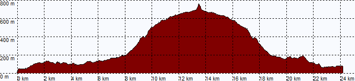
Located in the south of Chile, in 1959 it was transformed into National Park and, in 1978, declared by Unesco as Biosphere Reserve. In its 181,000 hectares there are several trails that can be done in a single day, as well as areas that can be visited by car or boat, making the park accessible to anyone, from those who like to spend several days camping to the ones that want to travel with all comfort. My choice was the O Circuit, a 135-km (84 miles) trail that is usually done in 8 days.
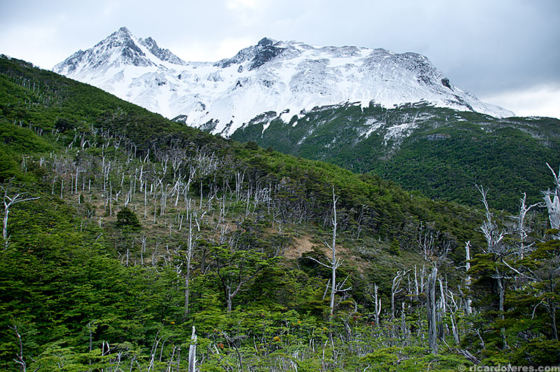
Despite not having high altitudes, with a maximum of 1,200 meters (3,940 feet) in Paso John Gardner, the winter is very cold and even in the summer it is possible to snow, although it is not very common. What is common, when it comes to climate, is that there are big variations in a short time. Not to mention the wind, which can make the thermal sensation drop below 0 ºC (32 ºF) even during the day. Or, if you’re luckier than I am, you can spend a few days just walking in a T-shirt.
Tickets purchased, itinerary studied, photo and camping equipment, clothes and food for 9 days in the backpack. Who could guess that the 80-liter backpack would be small? The weight of it all: little more than 30 kg (66 lbs), which fortunately was diminishing every meal.
Despite the long distance, you don’t need to be a super athlete to do this circuit, especially if you choose to sleep and eat at the refuges or to rent a tent every night. The total accumulated elevation is 6,800 meters (22,300 feet), which is not much if we divide by the distance of 135 km (84 mi).
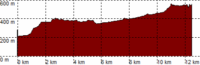
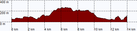
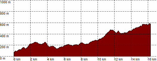
Day 1- Hosteria Las Torres to Serón Campground
Distance: 14 km (8.7 mi) – Total ascent: 350 meters (1,148 feet)
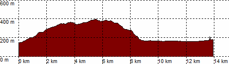
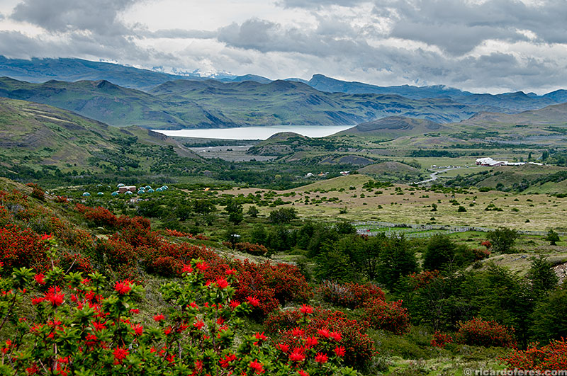
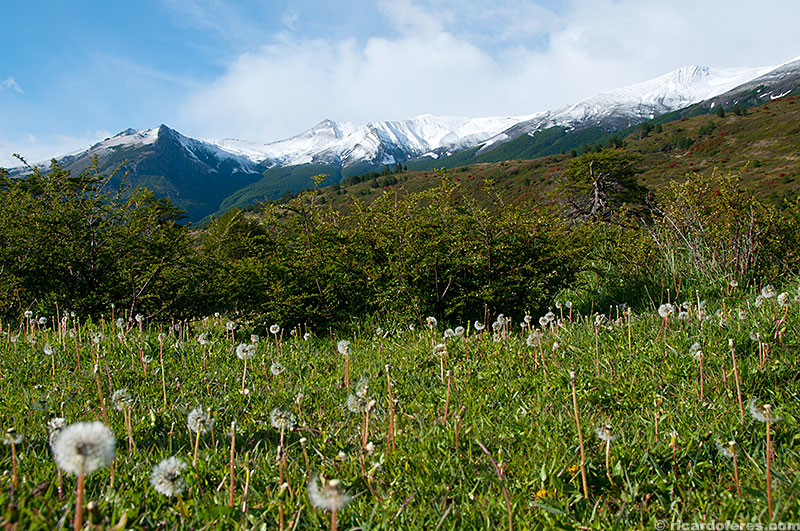
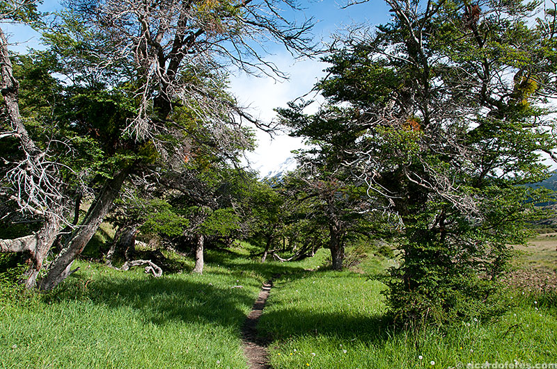
The first day is the easiest, even the few climbs of the path are not steep, being good to adapt the body to the rest of the circuit. After four hours walking slowly and chatting with a Californian guy based in Hawaii, we arrived at the Serón camp. People told me that when it gets warmer, Encantado Valley is all covered with daisies, but when I went, by the end of November, they had not yet appeared, probably because of the cold that insisted in not leaving.
On the right is Hosteria Las Torres, the beginning of the trail
Encantado Valley
View from Serón Campground
Day 2 – Serón to Dickson Campground
Distance: 19.5 km (12 mi) – Total ascent: 550 meters (1,804 feet)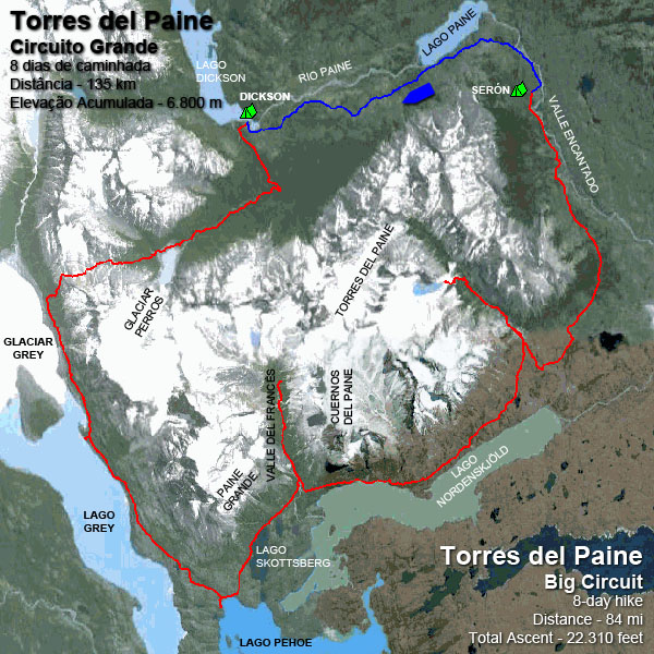
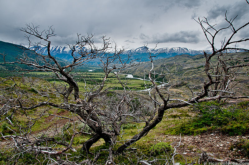
At seven in the morning, inside the tent, 8 ºC (46 ºF). Good temperature, but at night it must have been quite cold, as in the mountains around the camp there was much more snow than the day before. But there was sun, confirming what they had told me about the constant changes of climate.
Breakfast on the belly, backpack on my back and foot on the trail, which already gets prettier than on the first day, among beautiful trees and bordering the Paine River.
Too bad the sun went away one hour later, as the view of Paine Lake should be beautiful with the blue sky reflected in its water. Patience, it will change again … Or not! From there, the walk was made with a totally white sky and low clouds, which blocked the view of the mountains and the Dickson Glacier.
View from Serón Campground
Almost all the trail is very easy to follow

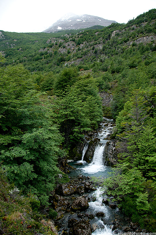
Paine River
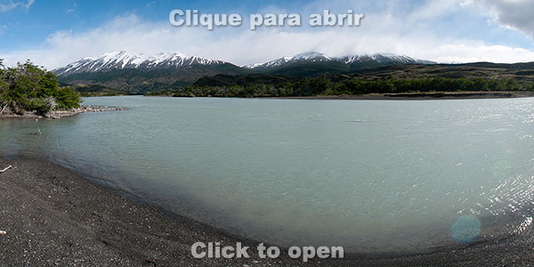
360° image of Paine River
Paine Lake
Dickson Campground
Day 3 – Dickson to Los Perros Campground
Distance: 12.5 km (7.7 mi) – Total ascent: 700 meters (2,300 feet)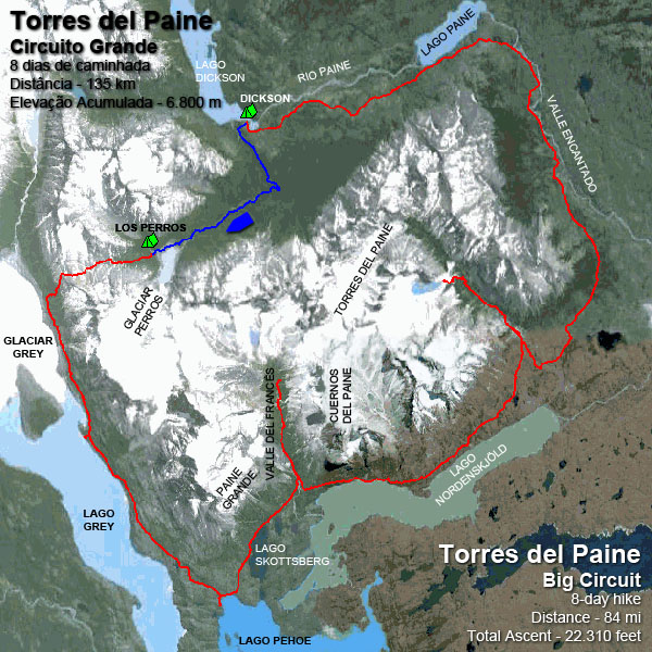
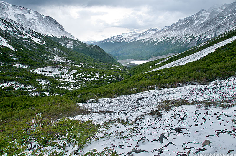
This should not be a difficult day, because although it is the start of the ascent to the John Gardner Pass, the distance is short. But it was not like that … The rain that had begun the previous afternoon varied in intensity but didn’t stop. I had my breakfast inside the tent, from where I did not leave until 10:00 am, when I realized that the weather doesn’t always change quickly in Torres del Paine. At least now the rain was weak and it was easier to pack the gear and start walking, but all day long the camera was kept inside the bag, since I hadn’t yet passed through the most beautiful landscapes and didn’t want to put the equipment at risk.
The trail is beautiful, among a forest not very dense but with huge trees. Several times the path crosses a beautiful river and its rapids, but the moment I left the shelter of the trees, the headwind was so strong that it was very hard to walk, and with only 500 meters (1,600 ft) of altitude the rain gave way to the snow.
When I arrived at Los Perros, I went straight to a tent where there was a heater and everyone was trying to warm up, dry clothes and equipment, a big relief! In addition, the hours spent in this shelter were great to meet the other people who were doing the O Circuit, including the only four Chileans I talked to during the eight days. Germans, Israelis, French and Americans I met a lot, but Chileans were a few in their own country.
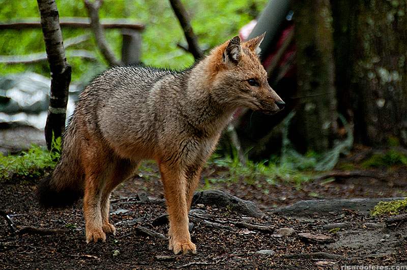
Fox looking for food around the tents
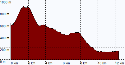
Day 4 – Los Perros to Grey Campground
Distance: 18 km (11.2 mi) – Total ascent: 1,350 meters (4,430 feet)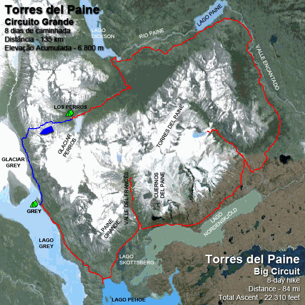
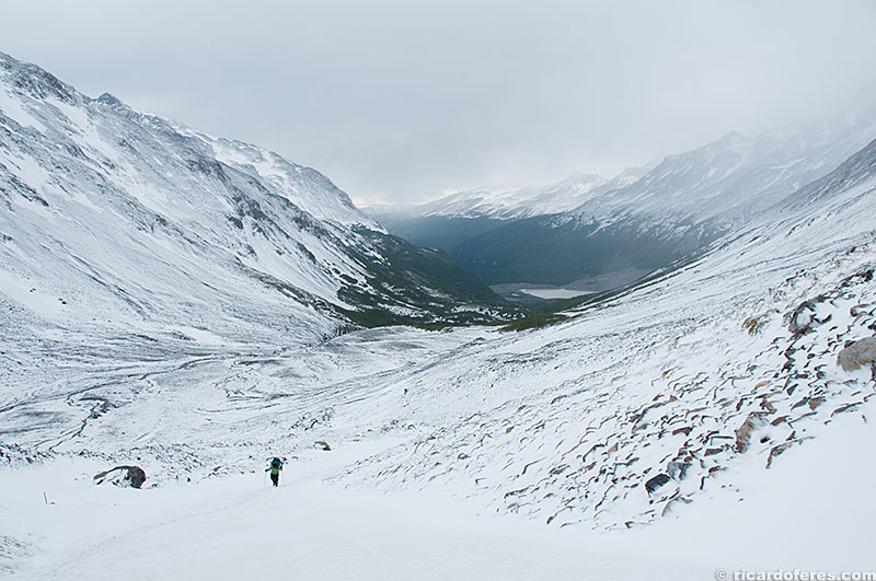
As this promised to be the most tiring day, I woke up very early (inside the tent, only 3 ºC / 37 ºF) and, when I left, I saw a group from USA leaving, so I joined them for safety and to have someone to chat.
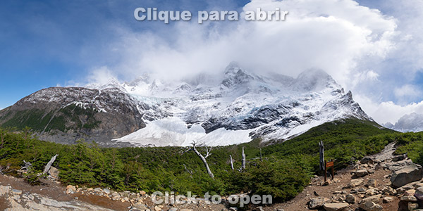
I don’t know if it was because I was psychologically prepared for the uphill of if it was because of the good conversation, but John Gardner Pass uphill wasn’t as difficult as I thought. At first we passed muddy areas, but it was always possible to step on logs thrown over the mud. Then came the snow, which at some points was going up to the knee, but we just had follow the path marked to reach the summit, always enjoying incredible views!
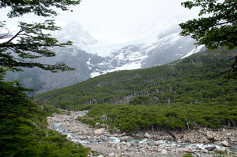
Speaking of the visual, the view at the summit of the Paso is one of the most impressive I’ve ever had! Unfortunately I can’t show you the size of the Grey Glacier in the photos, as I can’t put a reference point on it, but even with the weather overcast, the view takes more breath than the walk!
When the climb is over, you only have to go down, down and down … From 1,200 meters (3,940 feet) to the campsite, just 50 meters (164 feet) above sea level. The Grey Camp is already part of W Circuit, the most civilized side of the park, so the amount of people is much bigger. If in the O Circuit the campings there were on average 10 tents, here there were well over 30. Unfortunately, there are also many people unprepared to camp in a region that is as fragile as it is beautiful. As an example, on December 27, 2011, a few weeks after my leaving, an Israeli lost control of the fire he made and the wind spread the flames quickly, burning an area of 14,000 hectares, 7% of the park! Some years ago it was a Czech who caused a great wildfire, also by carelessness, but the damage is the same, whether intentional or not.
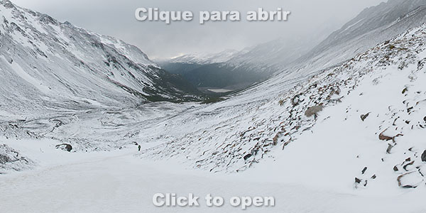
Beginning of John Gardner Pass uphill
Crossing John Gardner Pass
Crossing John Gardner Pass
360° image of Paso John Gardner uphill
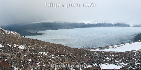
360° image of John Gardner summit with view to Grey Glacier
Grey Glacier view from the summit of John Gardner pass
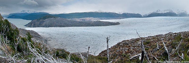
Grey Glacier
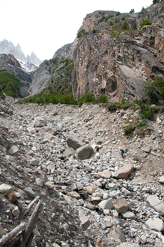
Hikers walking towards Grey Camp

Woodpecker at Los Guardas Campground
360° image of Grey Glacier
Day 5 – Grey to Paine Grande Campground
Distance: 17,5 km (11 mi) – Total ascent: 650 meters (2,130 feet)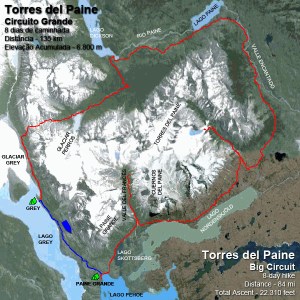
Easy hike with few climbs and incredible views to Grey Lake and glacier, but the best view is close to Paine Grande’s campground. Just behind the hotel is a fantastic viewpoint, and luckily the sun showed up when I arrived, after a cloudy day. Time to shoot, then sit back and enjoy the view… Until the rain restarts and send me back to the tent.
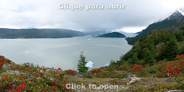
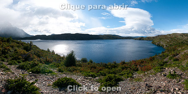
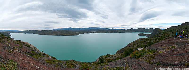
360° image of Grey Lake
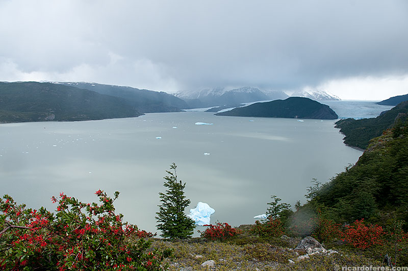
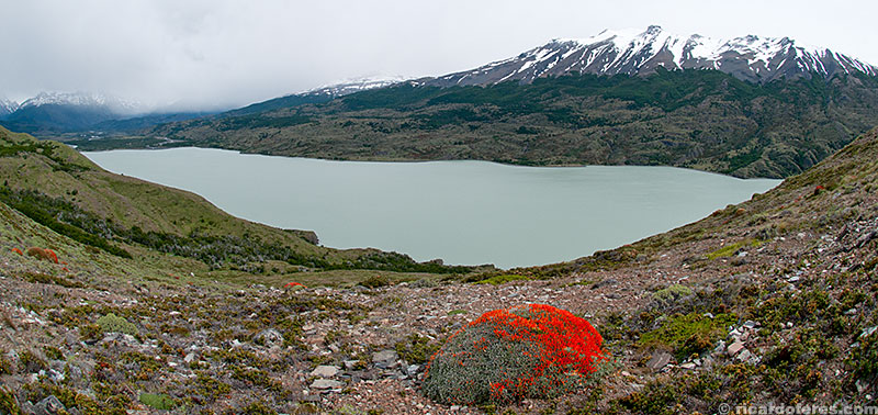
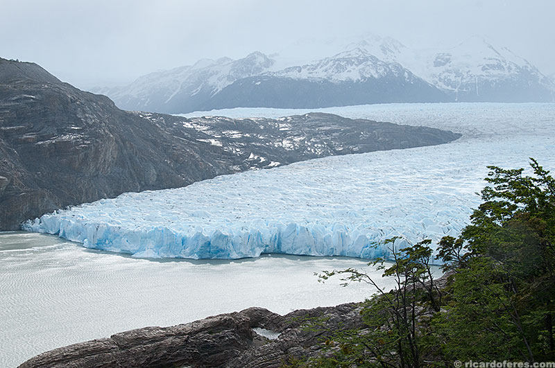
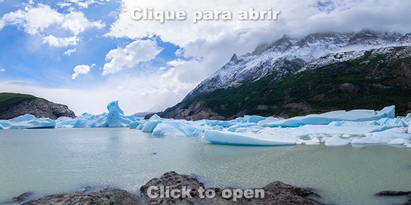
Grey Lake and glacier
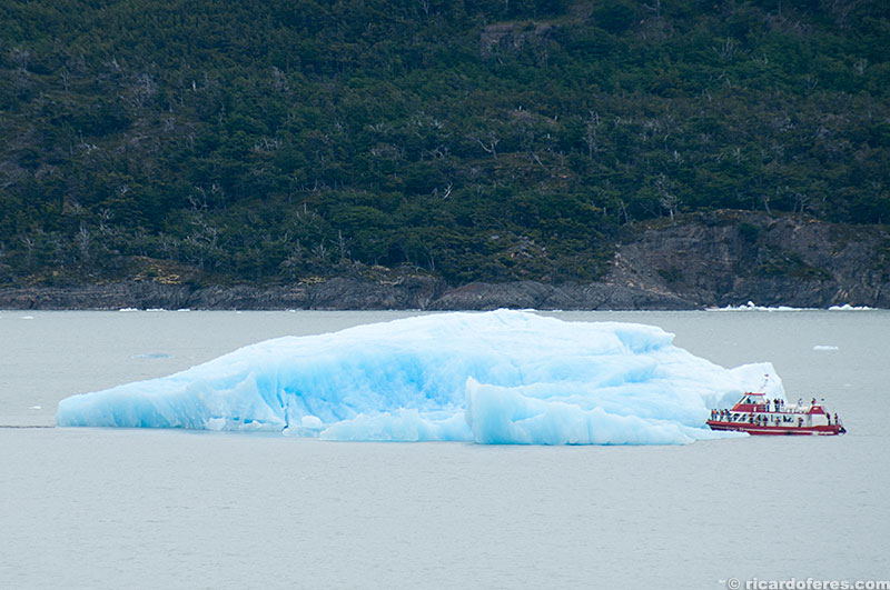
Iceberg at Grey Lake
Olguín River
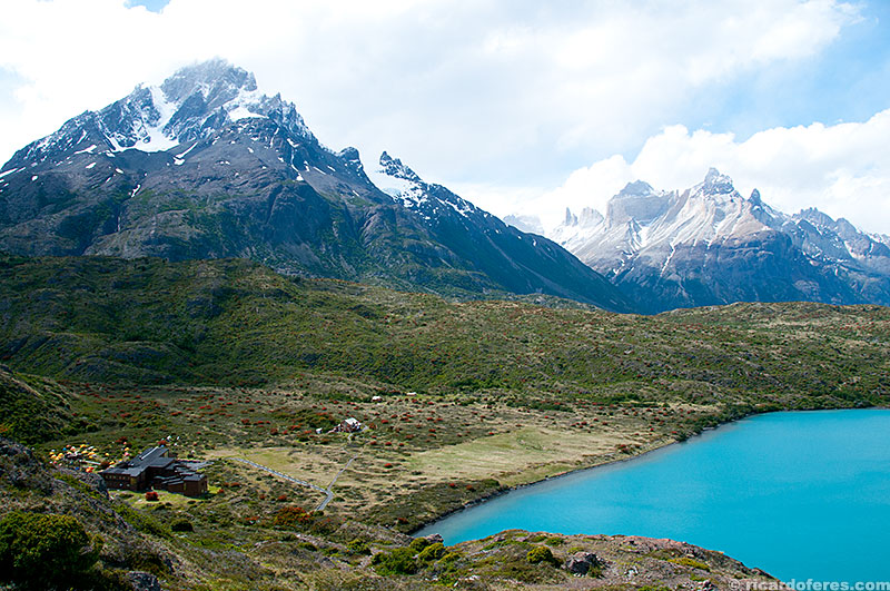
Paine Grande hotel and campground
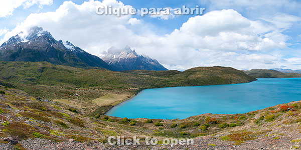
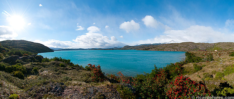
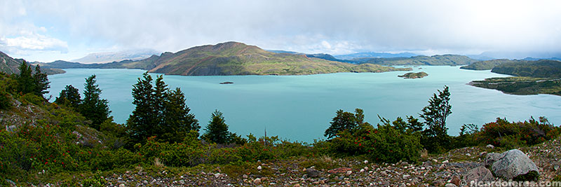
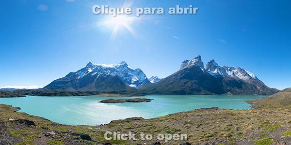
360° image from Pehoé Lookout to Pehoé Lake, Paine Grande and Cuernos del Paine
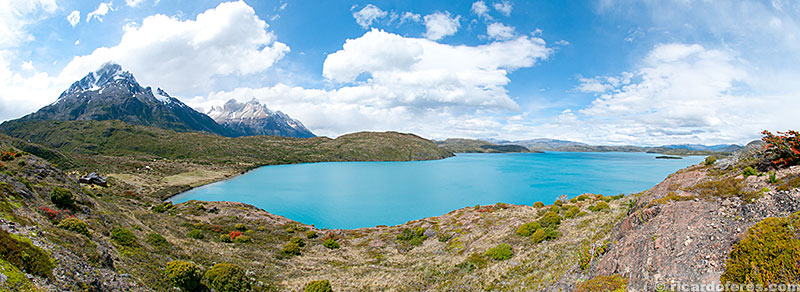
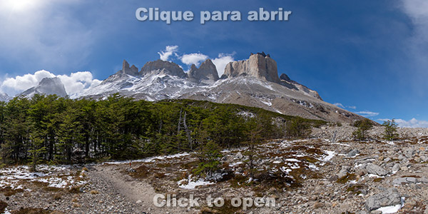
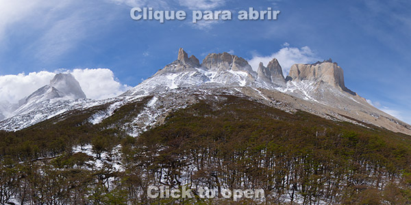
Pehoé Lake, Paine Grande (on the left) and Cuernos del Paine (to the right of Paine Grande). Between these two mountains is Francés Valley.
Day 6 – Paine Grande to Los Cuernos Campground
Distance: 25 km (15.5 mi) – Total ascent: 1,700 meters (5,580 feet)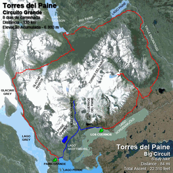
Although it is the day with the longest distance and accumulated ascent, it is only 13 km (8 mi) carrying the backpack, since it is possible to leave it in the Italian Campsite before climbing up and down the French Valley. The valley has some of the most beautiful landscapes in the park, with rivers, glaciers and views to Paine Grande and Cuernos del Paine mountains. Unfortunately, on that day the clouds were low, covering the peaks almost all the time.
360° image of Skottsberg Lake
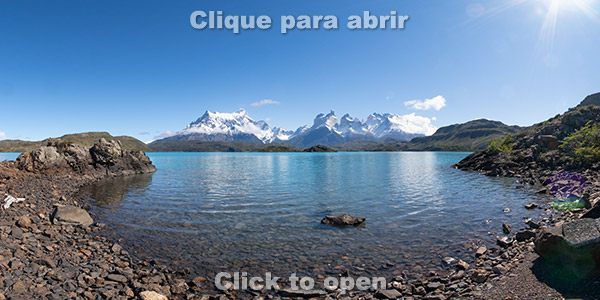
Pehoé Lake
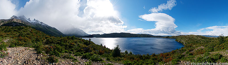
Skottsberg Lake
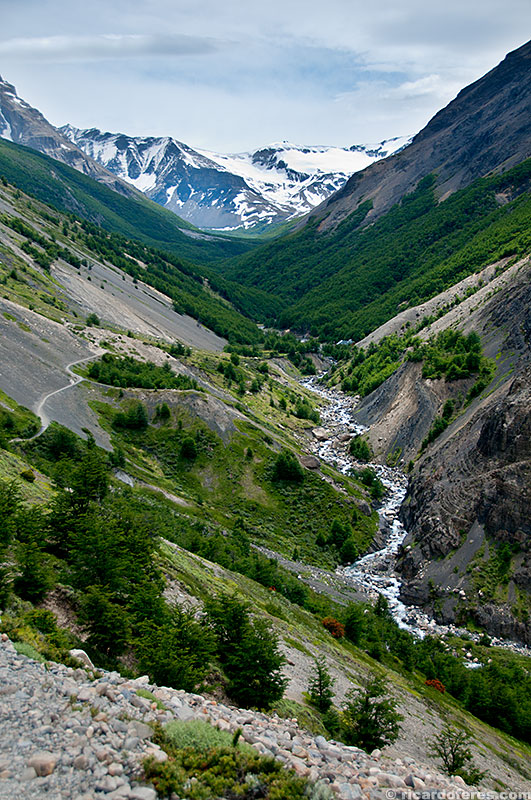
Francés Valley
360°image of Francés Lookout
360° image taken just before Británico Lookout. The view is similar to Británico Lookout, but not so close to the mountains, so I like the view from this point more than the official viewpoint.
360°image of Británico lookout at Francés Valley
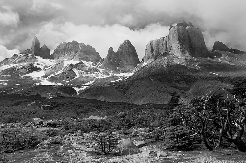
Cuernos del Paine
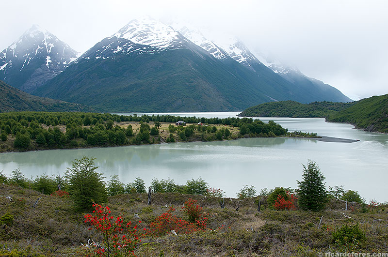
Nordenskjöld Lake
Nordenskjöld Lake
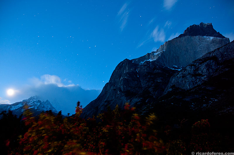
Paine Grande and Cuernos del Paine lit by the moon
Day 7 – Los Cuernos to Torres Campground
Distance: 17 km (10.5 mi) – Total ascent: 950 meters (3,120 feet)
The first half of the trail is made by the Nordenskjöld Lake, until the uphill to the Torres del Paine. The last campground and shelter with good structure is the Chileno, but I chose to move on and sleep in the Torres campground (attention, this campground does not exist anymore), which despite having as a structure only a dirty bathroom, it is only 45 minutes from the belvedere. As the most beautiful view happens at sunrise, it is worth sleeping closer to have an extra hour of sleep.
Nordenskjöld Lake
Uphill to Torres del Paine
Day 8 – Torres Campground to Hosteria Las Torres
Distance: 12,5 km (7.8 mi) – Total ascent: 500 meters (1,640 feet)
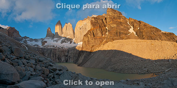
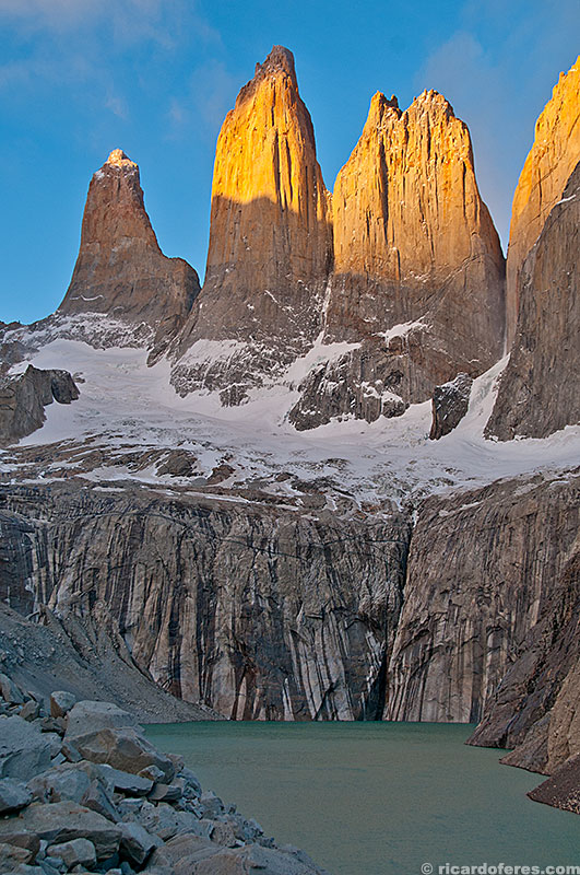
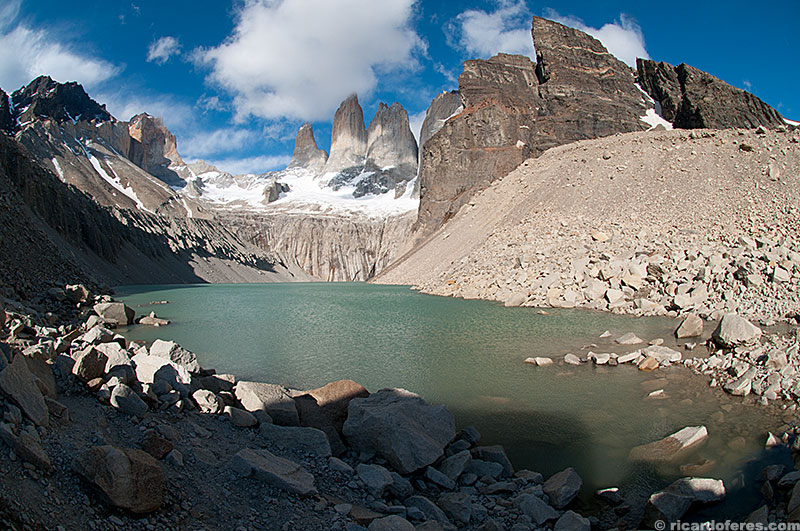
Waking up at three thirty in the morning after a week of hiking may seem difficult … And that’s right! But okay, watching the sun paint the mountains that give name to the park is worth a last effort by everyone who left behind the comfort of their homes to spend eight days feeling cold, sleepy and tired but were rewarded with stunning views of one of the most beautiful and diverse hiking circuits of the world!
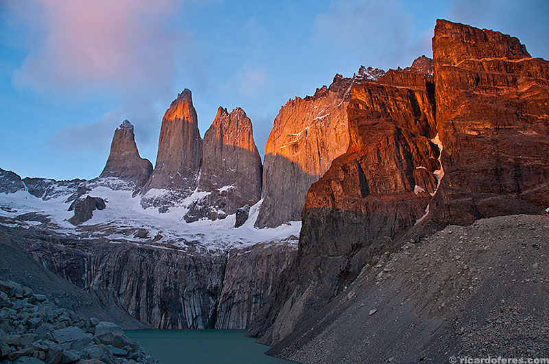
Dawn at Torres del Paine
360° image at dawn
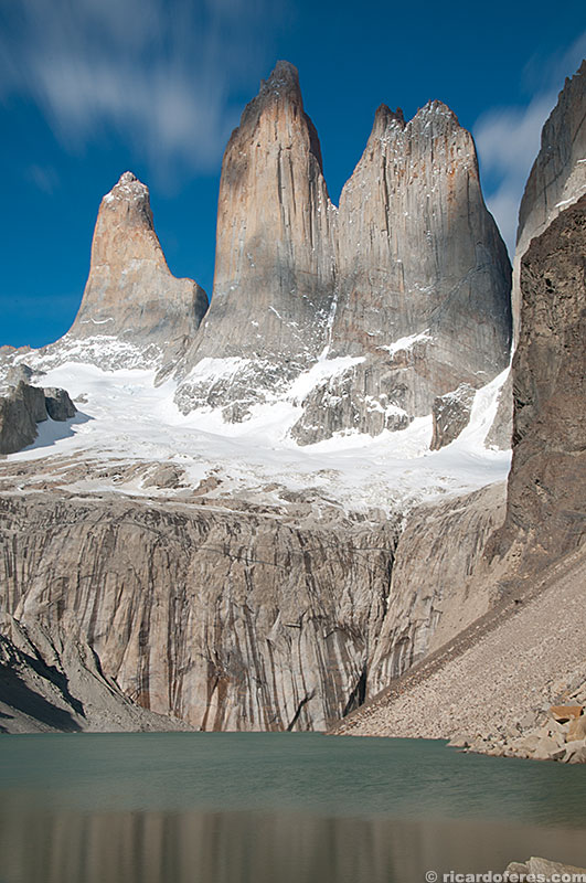
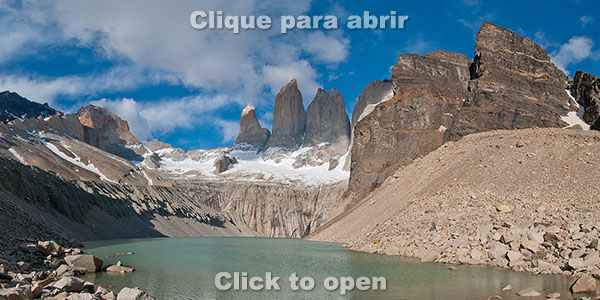
360° image of Torres del Paine
Below I show some 360º photos taken outside the hiking circuits, with access by dirt road or short trail.
360° photo at Mirador Los Cuernos

360° photo at Camping Pehoé lookout.
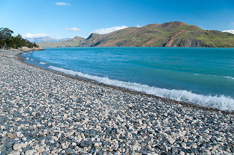
360° photo at the beach close to Camping Pehoé.
Get to know the photo book "The Most Beautiful Trails of Patagonia"
Torres del Paine, El Chaltén, Bariloche, Ushuaia, Villarrica, Cerro Castillo, Dientes de Navarino and Parque Patagonia