Get to know the photo book "The Most Beautiful Trails of Patagonia"
Torres del Paine, El Chaltén, Bariloche, Ushuaia, Villarrica, Cerro Castillo, Dientes de Navarino and Parque Patagonia
Southern Bolivia – Uyuni, Eduardo Avaroa, Atocha, Tupiza and Sucre
Introduction
Just like northwest Argentina and the Atacama Desert in Chile, the southern highlands of Bolivia are also a place of spectacular beauty, with landscapes that mesmerize tourists who are willing to travel through a region that does not have the same level of tourist infrastructure as the neighboring countries cited before, except for the city of Uyuni, which has many accommodation options, restaurants and agencies.
In this itinerary, I will show you the most beautiful spots in southern Bolivia, starting with the Eduardo Avaroa Andean Fauna National Reserve, on the border with Chile, going to the incredible Uyuni salt flat further north and returning south, towards Argentina, to the attractions near the cities of Atocha and Tupiza, which are rarely visited even by Bolivians, due to their distance from big cities.
This itinerary can be done clockwise or counterclockwise, but I recommend doing it clockwise because of the difficulty in getting fuel, read the topic below and you will understand.
Click here to open my Wikiloc page and download this itinerary for your GPS.
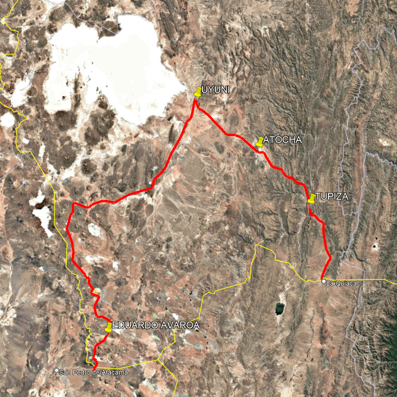
Map taken from Google Earth showing the route through southern Bolivia.
Fuel
Fuel is subsidized by the government, but foreign vehicles pay the full price, more or less three times what Bolivians pay. So far so good, the problem is that the gas station needs to enter the driver’s passport and vehicle license plate into a system so that the price at the pump can be adjusted, and many gas stations don’t have this system or the attendants, out of laziness, say that it doesn’t. I can’t say which is the true option, but I know that the most common thing when you go to a gas station is to hear that they don’t sell to foreigners. Those that do sell to foreigners usually charge the same price as foreigners, but without changing the price at the pump, so the attendant ends up with the difference. There are some who do something in between, charging an intermediate price and also pocketing the difference in a less greedy act. And finally, there are those who change the price at the pump, but these are rare.
Depending on the time of year, fuel may run out or there may be long lines, so if you are driving your own vehicle, be prepared with a lot of patience and flexibility to deal with any problems that may arise.
I imagine you are reading this and thinking “I will take containers so I don’t have to fill up too often”, but foreigners are prohibited from filling up containers, or at least that is what three gas station attendants told me. At customs, they told me that I could only take a maximum of 20 liters in a container, so even if you find a gas station that doesn’t care about this selling prohibition, you won’t be able to take much extra fuel.
Finally, as in any country, it is forbidden to cross the border with fuel in containers, but at the border between Atacama and the Eduardo Avaroa Reserve, customs lets cars pass because there is no place to fill up the tank until you get to Uyuni, which would make it impossible for most cars to do this route. That is why I recommend that you follow the route in a clockwise direction, and that you can only fill up your car in Uyuni, and from there to La Quiaca, in Argentina, it is only 289 km (180 mi), so any car has the range to drive this far, even if you can’t fill up in Tupiza. When I went through Tupiza, the first gas station I stopped at said they didn’t sell to foreigners, the second one didn’t have any gas, and the third (and last) one did, so I had to wait in line for 39 minutes, but I managed to fill up.
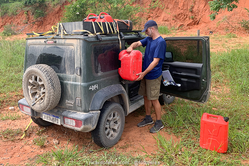
Containers seem like an easy solution, but if you read what I wrote in the paragraphs above, you already know that the reality is quite different.
Customs for foreign vehicles and highway patrol
Every country has its own rules for the temporary import of vehicles, but Bolivia has a… Let’s say, very different law. This is because when you enter with your car, you must fill out the “Ingreso y salida termporal de vehículos” form, which is the official document for your vehicle to be able to circulate in the country and you will have to show it several times during your trip, at police and army stops. If you do not have this document, the vehicle will be confiscated and quickly auctioned off, meaning you will lose it. The first time I heard about this, I thought it might be an exaggeration, but see the text below, which I copied and pasted from the Brazilian official website. This problem usually occurs with those entering Bolivia through Mato Grosso do Sul (Brazil), but here’s the warning:
“Drivers who have their Brazilian vehicles seized always claim that, upon entering Bolivian territory, they did not find authorities from the Bolivian National Customs Office at the border, which are the only authorities authorized to issue the respective permit for the vehicle. They also claim that the Bolivian authorities present there, from the National Migration Directorate and the National Police, said that there was no need for such a document and that Brazilians could circulate freely until the city of Santa Cruz de la Sierra, where they should request permission to travel throughout Bolivian territory at the Bolivian National Customs office. According to Brazilian drivers, the police stations on the route from Puerto Suárez to Santa Cruz would allow the car to pass without this document, as long as the driver paid certain ‘fees’. They report that the problem could be resolved in Santa Cruz. This information is false and has serious implications for Brazilians who enter Bolivian territory with their vehicles without proper authorization from Customs. When they arrive near Santa Cruz, their vehicles are detained under the accusation of illegal entry into the country, even though the drivers have been informed otherwise.”
I entered Bolivia driving twice, once from Chile and once from Argentina. I was treated very well at both customs offices and the documents were issued correctly, but I would like to warn you and advise you to take photos of them once you have your documents and also make a copy when you arrive in a city.
Regarding the highway patrol, before traveling there I heard a thousand stories about corrupt police officers, but I crossed the country from north to south and from east to west on two different trips, and all the police officers were honest and polite, so I have serious doubts that these stories really happened the way they told me.
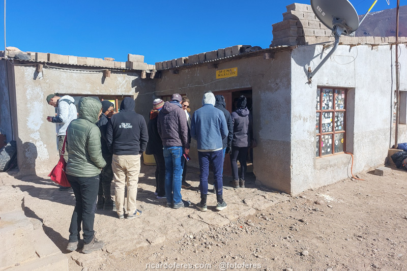
Bolivian immigration in Eduardo Avaroa. In the morning, with the large number of agencies taking tourists from Chile to Bolivia, the line starts even before immigration opens.
Eduardo Avaroa Andean Fauna National Reserve
Located in the extreme southwest of Bolivia and bordering Argentina and Chile, this reserve was created in 1973 with the main objective of protecting the fauna of the Bolivian highlands (especially flamingos, vicuñas and rheas), as well as geological formations and landscapes such as Laguna Verde, Laguna Colorada, Sol de La Mañana geyser and Árbol de Piedra (Stone Tree), which are the main attractions of this conservation unit.
With an area of 6,800 km² (2,625 mi²), the maximum altitude in the reserve is 6,014 m (19,730 ft), and the attractions mentioned here are between 4,000 and 5,000 m (13,100 and 16,400 ft), requiring prior acclimatization to avoid altitude sickness.
The best time to visit is during winter, when the sky is blue and it almost never rains, but it is also possible to travel during the rainy season, which runs from January to March. As you would expect from a place at this altitude, the temperature is always low, with an annual average of 3° C (37° F), according to ABT, the Bolivian government agency responsible for the care of natural areas. At night, the temperature is always below 0° C (32° F) and, in the coldest months (May, June and July), it can often reach -10° C (14° F).
Even though it is the conservation unit in Bolivia that receives the most visitors every year, it is not a place where you will find hundreds of people because it is far from large cities, has almost no tourist infrastructure, with the exception of a few accommodations in Chalviri and Laguna Colorada, and also because it is good to have a 4×4. I will not say that it is mandatory because the main road is usually in good condition and I did not need to use the 4×4 once, but if you want to leave this road to visit some attractions or if you go during the rainy season, you may have problems with a 4×2 car.
Laguna Verde
For those coming from Chile, Laguna Verde and Laguna Blanca are the first attractions. The two lagoons were once just one, but over time they separated and the one that is now called Blanca lost its green color. Located at an altitude of almost 4,300 m (14,104 ft), Laguna Verde is 17 km² and is at the foot of Licancabur Volcano, which is 5,916 m (19,409 ft) high.
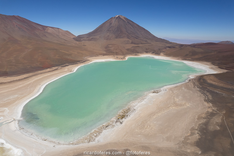
Laguna Verde and Licancabur Volcano.
Chalviri
In front of Laguna Chalviri there are some lodgings and hot springs, making it a good place to spend the night. On the way between Laguna Verde and Chalviri are Piedras de Dalí, a set of formations that didn’t catch my attention after having seen Monjes de la Pacana and Monjes Blancos in the Atacama Desert. In addition, I also found Árbol de Piedra, which appears in this article, to be more beautiful than Piedras de Dalí.
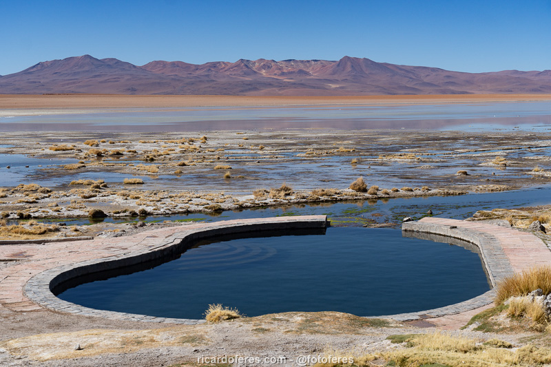
Hot spring pool in Chalviri.
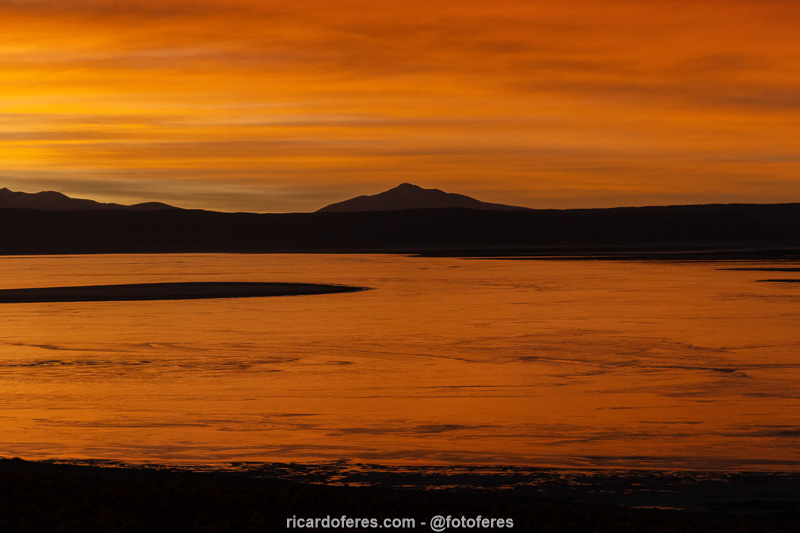
Sunrise in Chalviri.
Laguna Kollpa
This lagoon is not as beautiful as Verde or Colorada lagoons, but if you have time, it is worth visiting to see the flamingos and see a little more the Reserve. A little further on is Hedionda Lagoon, which is not home to flamingos and is not very beautiful.
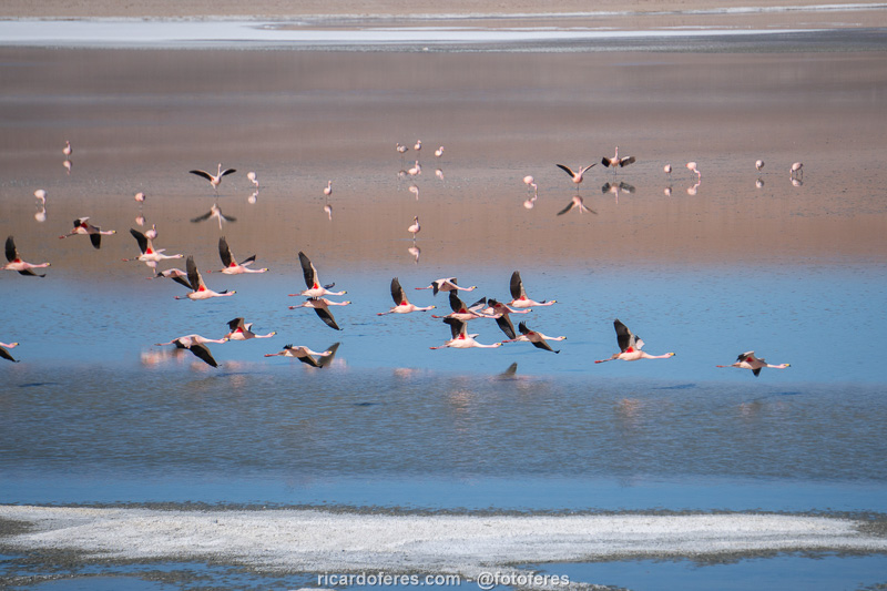
Flamingos at Kollpa Lagoon.
Flamingos at Kollpa Lagoon.
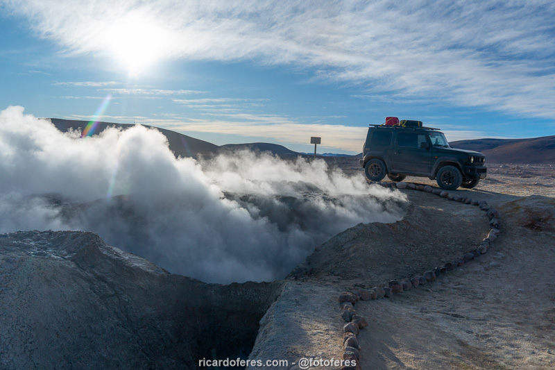
Geyser Sol de la Mañana
If you stayed overnight in Chalviri, go to this geothermal field as soon as possible because the greater the difference in temperature between the air and the hot water that comes out of the ground, the more fumaroles are created. The area is free to visit, but do not go beyond the points marked by rocks because the ground may collapse. If you have been to Tatio Geyser in Atacama, you will not be impressed by this field, but since it is on the way to Laguna Colorada, it is worth visiting.
Sol de la Mañana Geyser
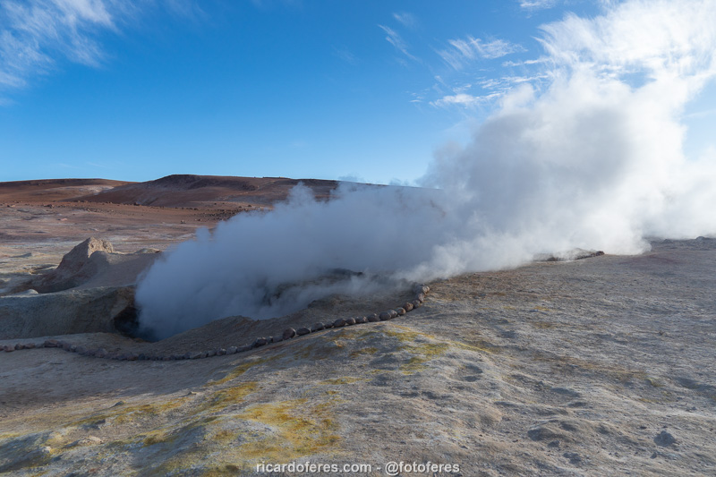
Sol de la Mañana Geyser

There are several bubbling mud pools in this geothermal field.
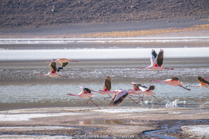
Laguna Colorada
With 60 km² and at an altitude of 4,300 m (14,107 ft), Laguna Colorada is the most beautiful spot in Eduardo Avaroa and there are accommodation options close to the lagoon. Its red hue is caused not only by sediments, but also by microorganisms that create a food chain that attracts three of the six species of flamingos that exist in the entire world.
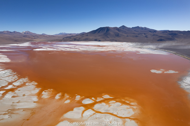
Salt islands in Laguna Colorada.
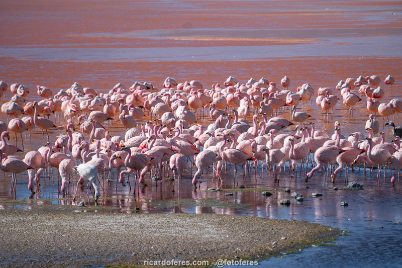
Flamingos in Laguna Colorada.
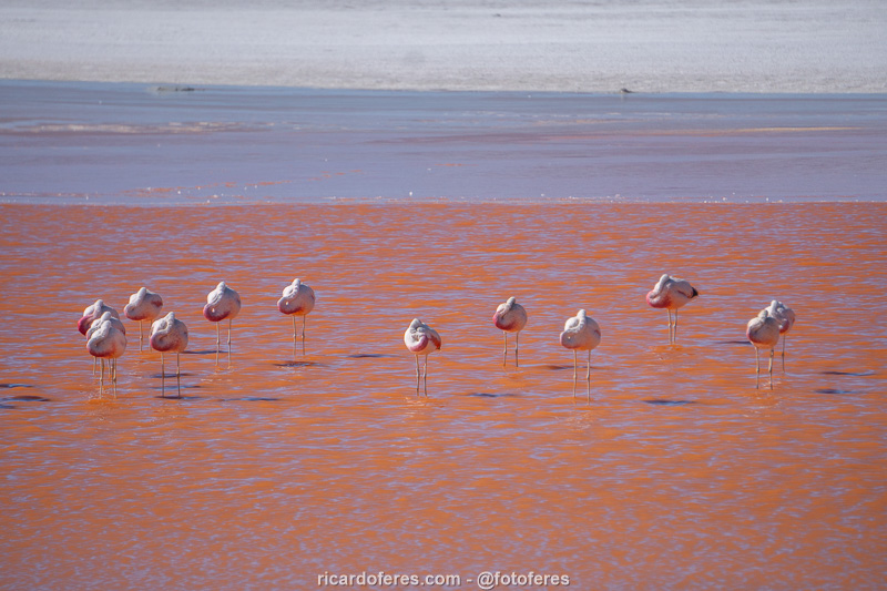
Flamingos in Laguna Colorada.
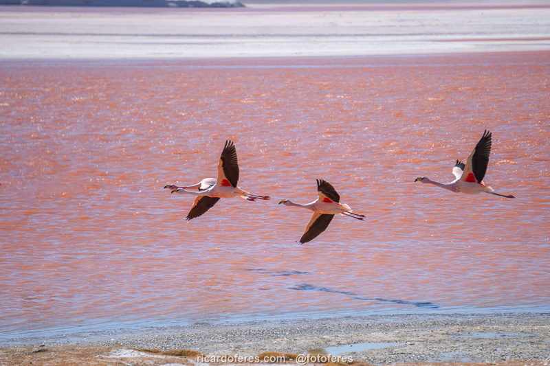
Flamingos in Laguna Colorada.
Árbol de Piedra
This incredible formation is 5 m (16 ft) high and it is obvious why it is called Stone Tree. Be sure to visit it, but read what I am going to tell you below to avoid any problems: when I arrived, I parked in front of some stones that were lined up on the ground and walked towards Árbol de Piedra. A poorly dressed man came along shouting some things that I did not understand and, when he got closer, he said very rudely that I could not park there, that I should park somewhere else and pointed to the place. I told him that there was no sign and that I could not know, but that I would move the car to another location, to which he replied that I would have to pay 100 bolivianos for having parked in the wrong place. At that moment it was clear that he was just a crook trying to extort a tourist, but of course I did not pay, so we continued arguing until another car arrived, which parked in a place that he also considered wrong and he went to the new car. I don’t know what they talked about, but the car left, but I wouldn’t do the same, so I walked the rest of the way to Árbol de Piedra, took my photos and we left without giving a single cent to that crook.
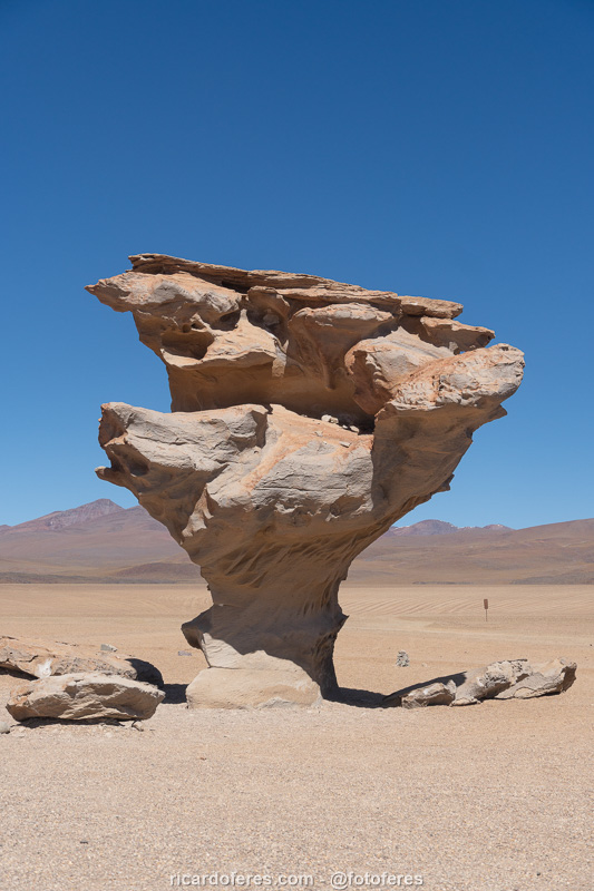
The Árbol de Piedra (Stone Tree) is 5 m (16 ft) high.
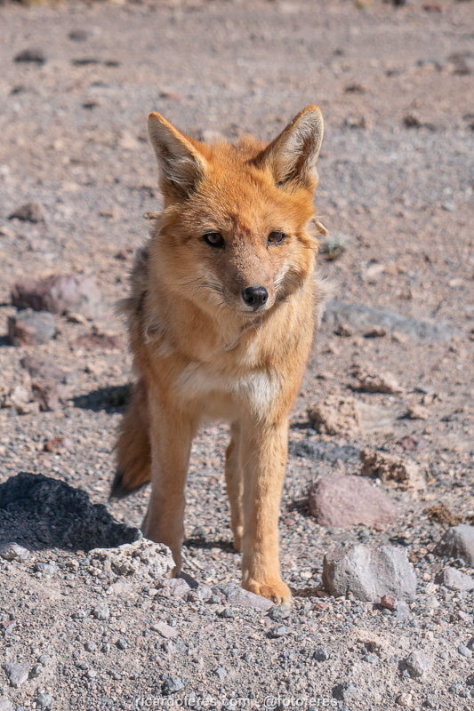
Fox in the north of the Eduardo Avaroa Reserve.
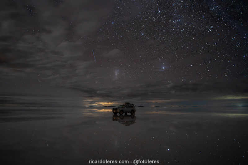
Salar de Uyuni
The Salar de Uyuni is the largest salt flat in the world, with over 10,000 km², and is located at an altitude of 3,650 m (11,975 ft). It was formed thousands of years ago, when huge salt lakes dried up due to climate change. The thickness of the salt flat varies, but in its center the layer of salt reaches 10 m (33 ft) deep. While the landscape created by the salt attracts tourists, what draws the attention of the Bolivian government and large companies is the fact that it is estimated that 50 to 70% of all the lithium on the planet is located here.
From January to March the sky is often cloudy and there is rain that can flood parts of the salt flat, which makes many people travel to Uyuni in search of the incredible mirror effect that occurs when there is no wind. On the other hand, during the dry season, you can drive your vehicle around the entire salt flat, admiring its immensity and the patterns that the salt creates on the ground, as if it were a giant beehive. Personally, I was more impressed when I visited in the winter, but I can’t deny that the photos of the salt flat when it’s flooded are more impressive.
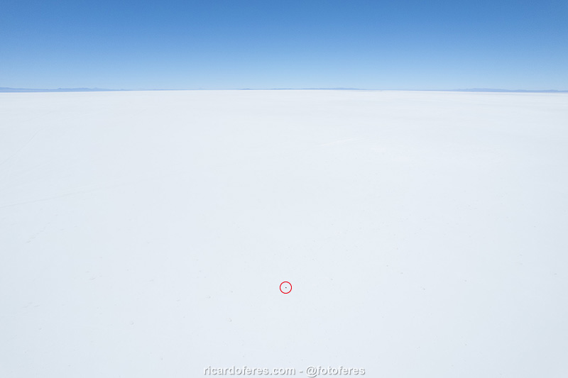
This aerial photo was taken in the middle of the salt flat and, to give you an idea of its size, the black dot inside the red circle is my car.
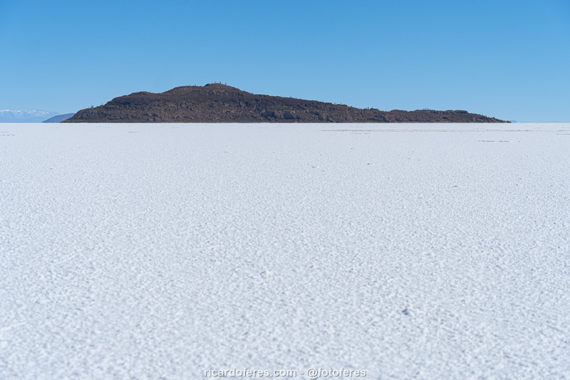
Among the islands of the Salar de Uyuni, the most famous is called Incahuasi.
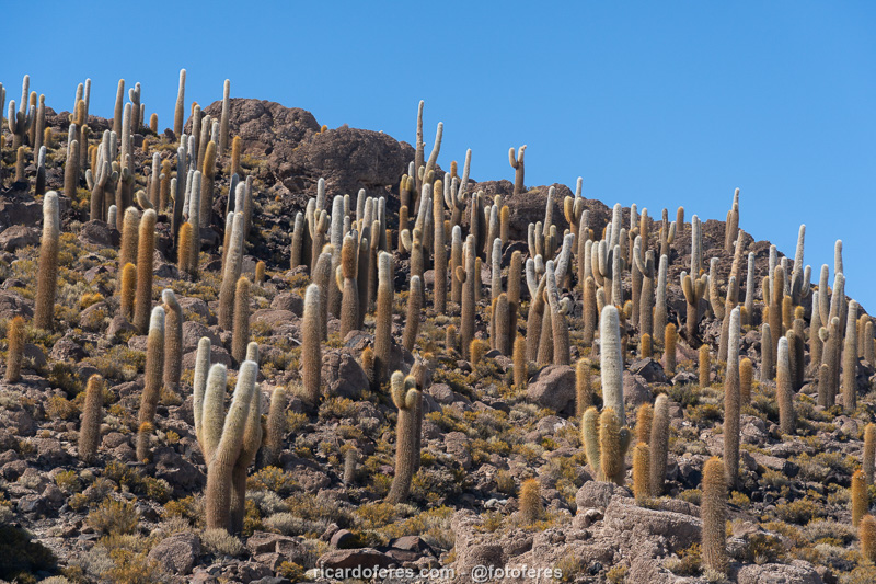
Incahuasi Island is one of the islands open to visitors, but you have to pay to walk in it.
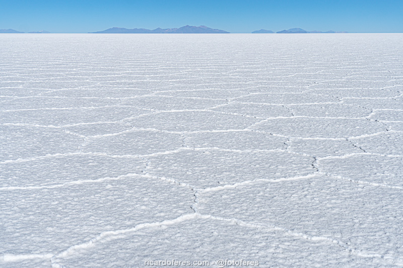
There are some theories about how this geometric pattern created by the salt forms, but from everything I’ve read, there’s no consensus. If you know of any studies, I’d appreciate it if you could send them to me.
When there is no wind and the salt flat is covered by a thin layer of water, the mirror effect occurs, but it is worth mentioning that even during the rainy season, it is not always guaranteed that there will be water.
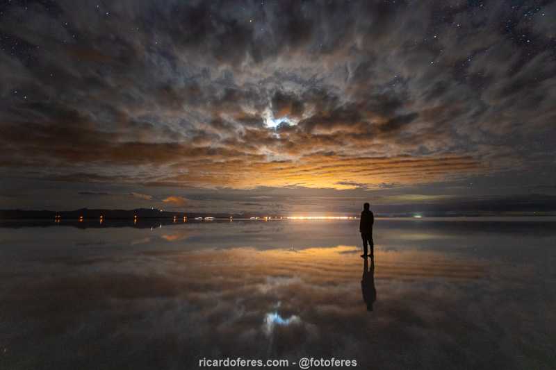
The orange light comes from the city of Uyuni and the white light between the clouds is moonlight.
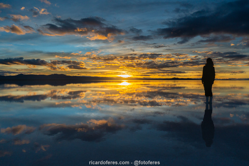
Sunrise at Salar de Uyuni. There are tours for both sunset and sunrise, but in the morning it is more likely of having no wind.
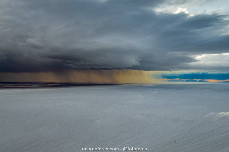
Storm lit by the sunset.
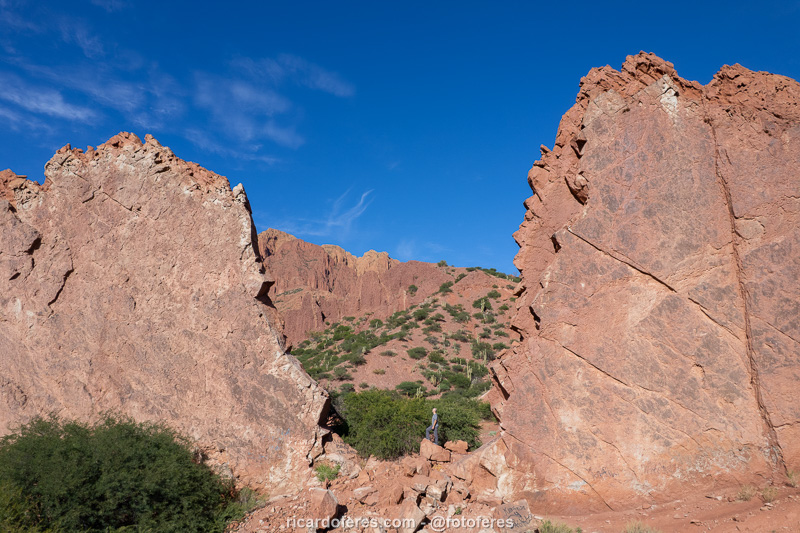
Atocha
I had never heard of Atocha until I saw a photo on Facebook of a geological formation so incredible that it looked like it had been created in Photoshop. I started researching more about this formation called Copa del Mundo (World Cup) and, when I saw that it really exists, I added it to my list of places that I needed to visit. I found out that it is close to the city of Atocha, but I couldn’t find any tracklog (a route recorded by a GPS) available on the Wikiloc website, just a few points on maps that diverged, so we went looking for it and, after almost 3 hours of walking, we found it!
So that you don’t have to walk in a zigzag pattern looking for this point, I put the tracklog on Wikiloc and you can download it by clicking here.
If you go during the dry season, you can follow the dry riverbed until you start walking through the ravine, if you have a 4×4, but if you go during the rainy season, leave the car in the community of Telamayu because if it rains while you are walking, your can can be stranded.
The city of Atocha is ugly, so don’t set aside time to visit it, but the small village called Atocha Vieja is charming and worth a visit.
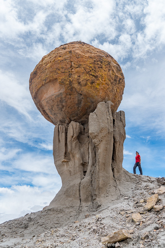
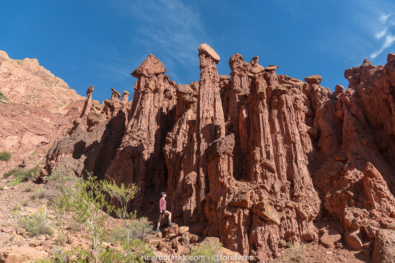
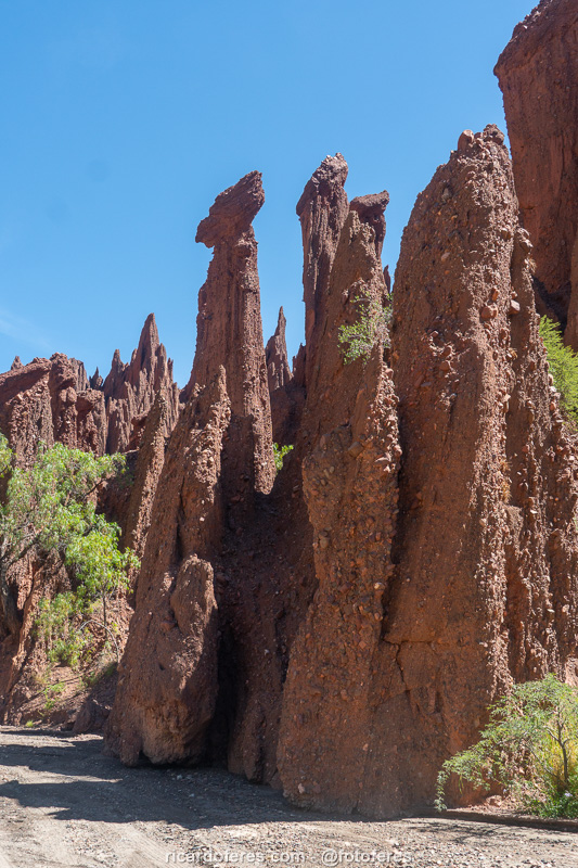
Copa del Mundo de Atocha.
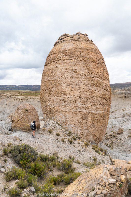
Near Copa del Mundo is Jardín de Huevos, an area with several formations that look like eggs.
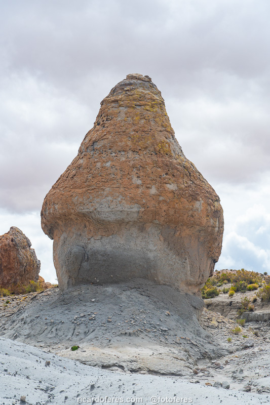
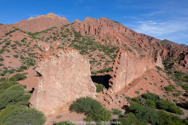
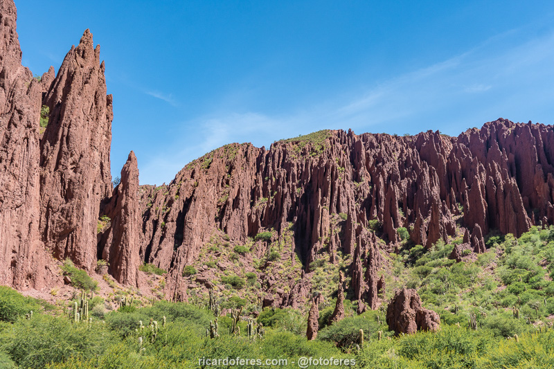
Valle de las Rocas, on the same trail of Copa del Mundo.
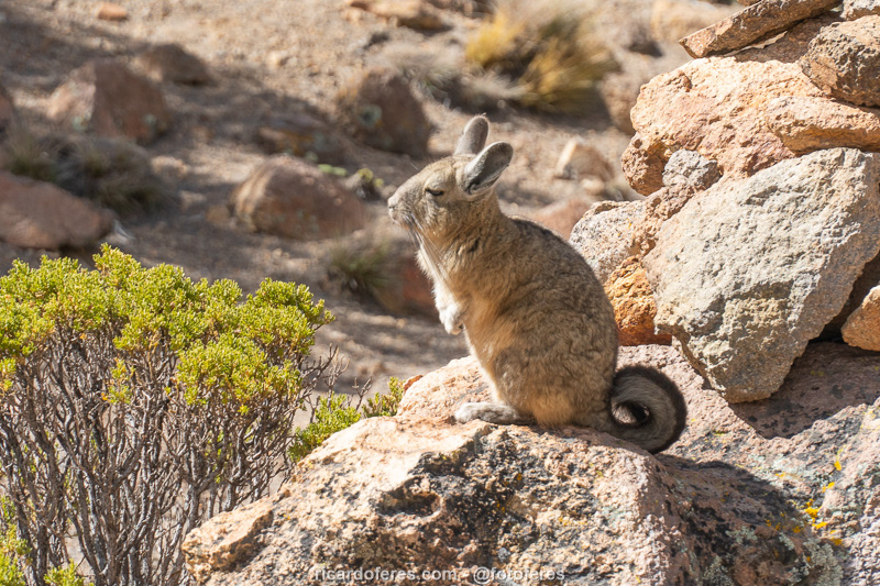
The viscacha is a small rodent that can be found in the Andes mountains of Argentina, Chile, Bolivia and Peru.

As it has the same color as the rocks where it lives and because the viscacha is shy and runs away when people approach, you need a good lens to photograph it.
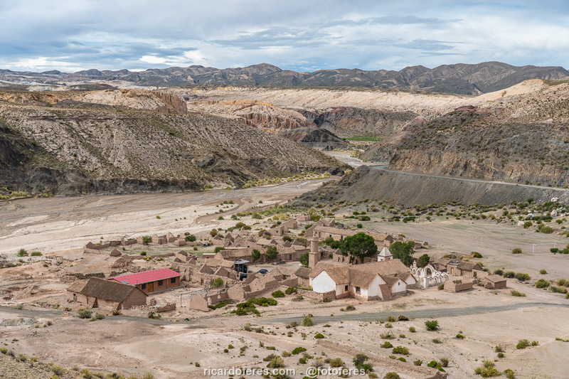
There are only a few families living in the village of Atocha Vieja and, when I was there, they invited me to watch a religious ceremony and gave me coca leaves to chew.
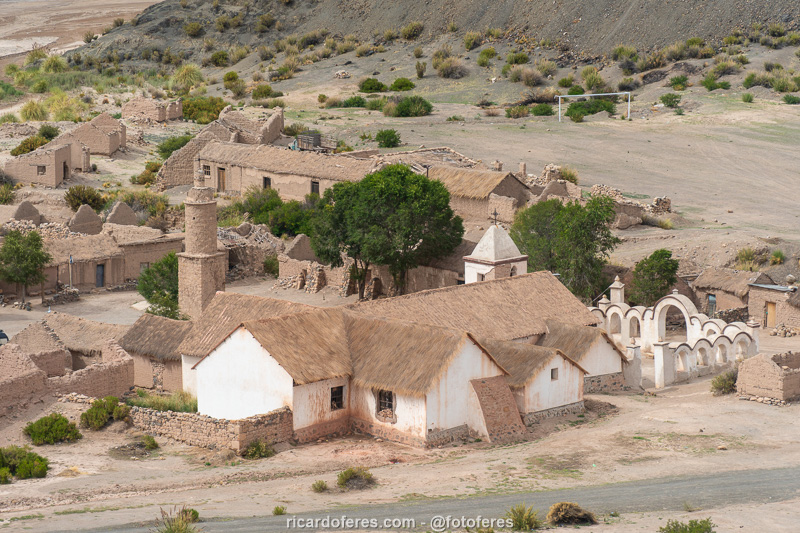
Atocha Vieja.
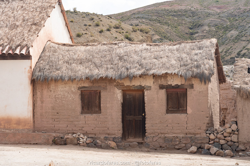
Atocha Vieja.
Tupiza
Although it is the capital of the province of Sud Chichas, Tupiza is a small city and, according to the National Institute of Statistics of Bolivia, has around 50 thousand people. The city does not attract attention for its buildings, since there are few beautiful buildings, but there are beautiful landscapes in its surroundings and it is worth spending at least two nights here.
The tour I found most interesting was to Puerta del Diablo, Valle de los Machos and Cañón del Inca, which can be accessed by 4×4 (except the canyon).
Puerta del Diablo looks like a wall built by humans, but it is a natural formation. Note that I am at the “door”, to give you an idea of it’s size.
Puerta del Diablo.
It is easy to understand why Valle de los Machos has this name.
Valle de los Machos.
Path to Valle de los Machos.

Cañón del Inca.

El Sillar Lookout is accessed by a dirt road and offers an incredible view.
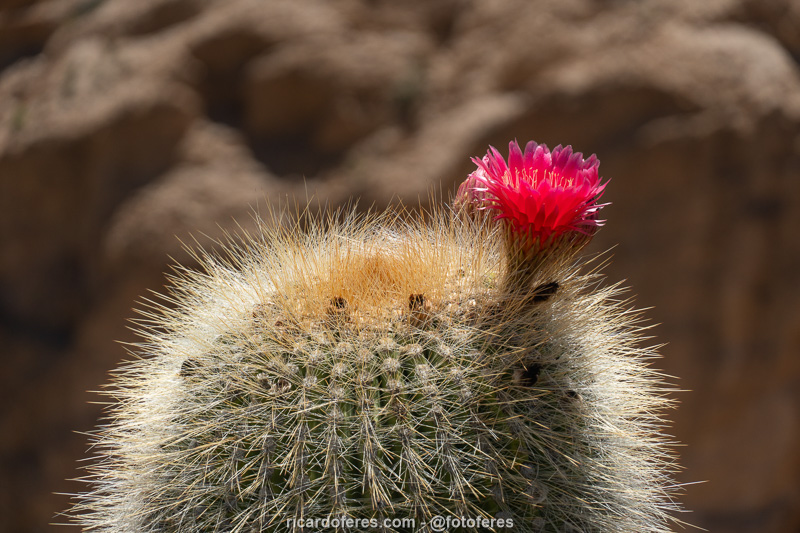
Cactus at El Sillar Lookout.
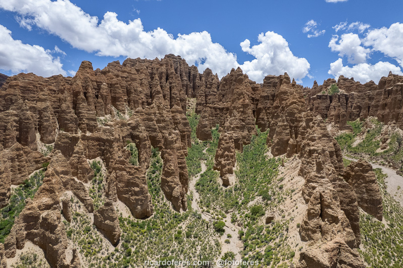
Aerial photo of Torre Huayco region.
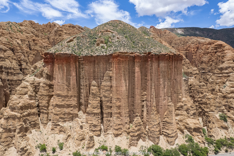
Aerial photo of Torre Huayco region.
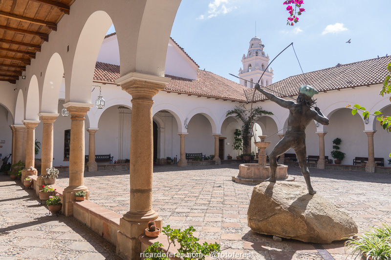
Sucre
This article is about the south of Bolivia, and Sucre is in the center of the country, but since it is the most beautiful city in Bolivia, I made an exception because it deserves to be visited if you have free time.
Founded in 1538 with the name Ciudad de la Plata de la Nueva Toledo, it was renamed in 1839 to honor Antonio José de Sucre, a hero of Bolivian independence. With the name change, it was also defined as the country’s first capital, but in 1898, when the capital was moved to La Paz, protests broke out and it was decided that La Paz would be the administrative capital and Sucre, the judicial capital.
According to the National Institute of Statistics, in 2017 Sucre had 284,000 inhabitants in an area of 11,800 km² (4,556 mi²), but the most interesting part of the city is the historic center, which can be explored on foot. There are many historic buildings in good condition and, of all of them, the most important is Casa de la Libertad, which was built in 1621 and currently bears this name because it was there that many events took place that led to Bolivia’s independence.
The excellent conservation of the buildings that mix local style with European architecture led UNESCO to declare the historic center a World Heritage Site in 1991, a title that is truly deserved.
The Casa de la Libertad offers guided tours every hour, don’t miss the chance to learn about the country’s history.
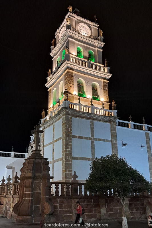
The Metropolitan Cathedral of Sucre began construction in 1559 and was completed 250 years later!
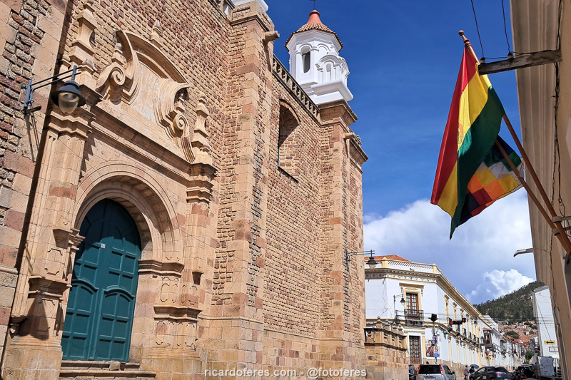
San Felipe de Neri Church.
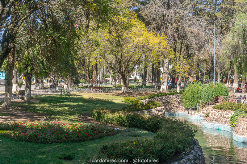
Simón Bolívar Park.
Get to know the photo book "The Most Beautiful Trails of Patagonia"
Torres del Paine, El Chaltén, Bariloche, Ushuaia, Villarrica, Cerro Castillo, Dientes de Navarino and Parque Patagonia