Get to know the photo book "The Most Beautiful Trails of Patagonia"
Serra do Lopo, Brazil
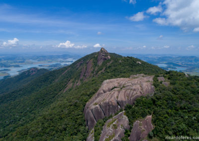
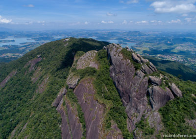
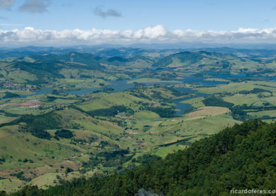
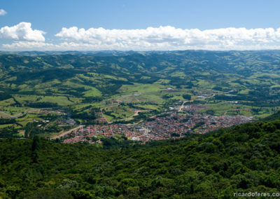
Marking the border between Minas Gerais and São Paulo states, in the in the Brazilian southeast, Lopo Range is a small region of the Mantiqueira Range. Serra do Lopo is looked for not only by those who want to do hiking but also by those who just want to drive and enjoy a beautiful view, as it’s possible to reach the hang-gliding ramps driving and spend the night in one of the inns at the top of the mountain.
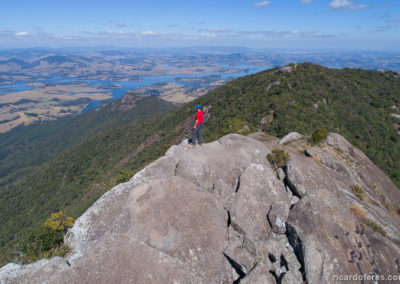
But it’s undeniable that the most beautiful views are enjoyed only for hikers, such as the view of Pedra das Flores (Flowers Stone) and, especially, Pedra do Cume (Summit Stone), facing the Jaguari Dam (better known as the Bragança / Piracaia Dam) and, on clear days, with a view to the south to Pedra Grande de Atibaia and, to the north, to the mountain range of Monte Verde.
Unfortunately this ease of access has also attracted many people who don’t know how to behave in nature, and every time I go there I find more trash on the trails and camping areas. So, if my photos make you visit Lopo, please be aware and do not make noise, do not bother the animals and, especially, don’t do fire and take all your trash away.
Virtual Tour with 360° interactive images
Open the photos using the map or thumbnails below the map. Pictures can be rotated and the viewing angle can be zoomed in or out. Clicking on the ‘360‘ symbol opens another photo and the ‘i‘ symbol provides information about that location.
Pedra do Cume
Aérea
Pedra das Flores
Pedra da Bauducco
Pedra dos Cabritos
Lago
Pedra do Marino / do Altar
Pedra Cinco Dedos
Rampa de voo livre (norte)
Rampa de voo livre (sul)
Pedra Sacerdotisa
Pedra Sapo
Pedra do Cume trail
The photos below are sorted from the furthest point to the nearest hostels and parking places.
Pedra do Cume

To enjoy the most beautiful view of the mountain range, at 1,780 meters (5,840 feet) of altitude, it is necessary to walk 6.5 km / 4 mi (round trip) on a trail with some forks. There is only one steep but short climb and a small metal ladder.
Pedra das Flores

The trail to Pedra das Flores has 4.5 km / 2.8 mi (round trip) and few ascents, with a view almost as beautiful as Pedra do Cume.
Pedra da Bauducco

The Pedra da Bauducco stands just before Pedra das Flores and has view to the other side of the mountain, making it a good place to enjoy the sunset. Trail with 4 km / 2.5 mi (round trip).
Pedra dos Cabritos

The view from Pedra dos Cabritos is almost as beautiful as that from Pedra das Flores, and its trail is even shorter with only 3 km / 1.8 mi (round trip).
Lake

Small, shallow and with a muddy bottom, so it’s not suitable for bathing. As it’s next to the trail (2.5 km / 1.5 mi round trip), it’s worth taking a quick look.
Pedra Cinco Dedos

The trail to Pedra Cinco dedos has only 1.8 km / 1,1 mi (round trip) and has partial views to both sides of the mountain, besides being an interesting rock formation.
Pedra do Marino / do Altar

At the very beginning of the trail (1,5 km / 0.9 mi round trip), Pedra do Marino, also known as Pedra do Altar, faces west and is a good place to watch the sunset.
Hang gliding ramps
With access for 2wd cars, the two ramps offer a beautiful view for those who don’t want to go for a hiking trail.

The ramp facing south has view to Joanópolis (São Paulo State) and the Jaguari Dam, also known as Bragança Dam or Piracaia Dam.
Pinheirinho trail
For hikers who want to climb the mountain range instead using a car, there is a trail that starts in Extrema and arrives at the top of the road. But if you want to arrive at the points of the photos below without walking from the city, it is possible to leave the car near Embratel Tower and walk to them with almost no difference of elevation.
Pedra Sapo

Walking from Extrema via Pinheirinho Trail, there are 300 meters (985 feet) of elevation to be gained in 1.5 km / 0.9 mi (one way). To go via Embratel Tower, it’s only 1.7 km (1 mi) in a descent of 150 meters (492 feet).
Pedra Sacerdotisa

