Get to know the photo book "The Most Beautiful Trails of Patagonia"
Torres del Paine, El Chaltén, Bariloche, Ushuaia, Villarrica, Cerro Castillo, Dientes de Navarino and Parque Patagonia
Petar (Caboclos), Brazil
Petar was created in 1958 to protect one of the regions with the largest number of caves in Brazil. It is a state park located in the south of São Paulo State and its full name is Alto Ribeira Touristic State Park, which in Portuguese is PETAR. The park has an area of 357 km² (138 mi²), but as there are other preservation areas, there is a total area of 2,000 km² (772 mi²) of relatively well protected Atlantic Forest, allowing the existence of animals that need large areas of continuous forest to survive, such as the jaguar and muriqui monkey, and plants that are disappearing from unprotected areas such as juçara palm tree.
There are many reasons to go to Petar, but the biggest of them is, of course, the more than 250 caves already cataloged, from small cavities to caves with kilometers of extension.
The reason for so many caves in this area is explained by the extensive area of limestone, that is corroded by the action of the water, which here has a high degree of acidity coming from the carbon dioxide found not only in the atmosphere but also in the decomposition of organic matter. Because it is a region with high rainfall and dense forest, the corrosion of limestone occurs faster than in drier regions, such as in Brazilian northeast, for example.

Atlantic forest

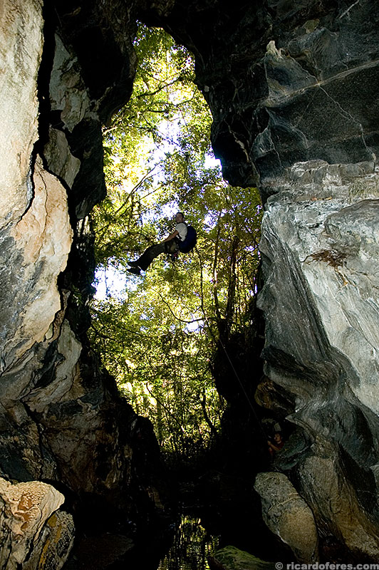
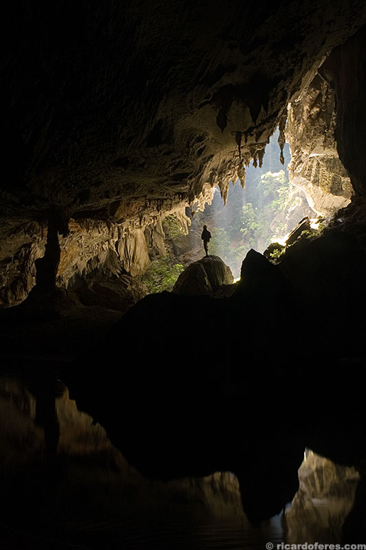
Limestone wall
Contrary to the thinking of who never been in Petar, it’s not so common to find bats in the caves, which does not mean that they are uninhabited. Some of the most frequently seen animals are the frogs, spiders and opilions, which look like spiders but are not dangerous. In some rivers there is the blind catfish, which, because it lives in totally dark areas, has no pigmentation or eyes.

Opilion
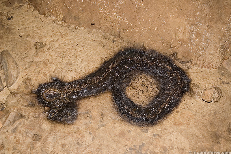
Decomposing snake
Petar is divided in four areas: Santana and Ouro Grosso areas are located in the Betari river valley, near Iporanga city, which has some tourist infrastructure. Casa de Pedra area was used for the visitation of the cave of the same name, but to go inside this cave is currently not allowed for tourists, only being allowed to visit its portico (“entrance” of the cave), one of the largest in the world. And there is Caboclos area, in the center of the park and which is the subject of this article.
Caboclos
Located in the upper part of Petar, the oldest visitor center area is also the one with the least tourist infrastructure. There is only one area to pitch the tents, tanks for washing clothes and dishes, toilets and some houses used by the park rangers and scientists. There are also two showers, but as there is no electricity, it takes courage to take a shower in the winter, when the air temperature is often below 10 ºC (50 ºF) and the water is… Well, the water I prefer not to measure because the last drop of courage could flow down the drain.
On the other hand, this lack of structure has done well to the region, protecting the caves from the impact of mass visitation. Another factor that frighten many tourists is that the trails here are longer than in the other areas, requiring a full day of hiking, sometimes strenuous for those who are not in a good shape.

Camping area
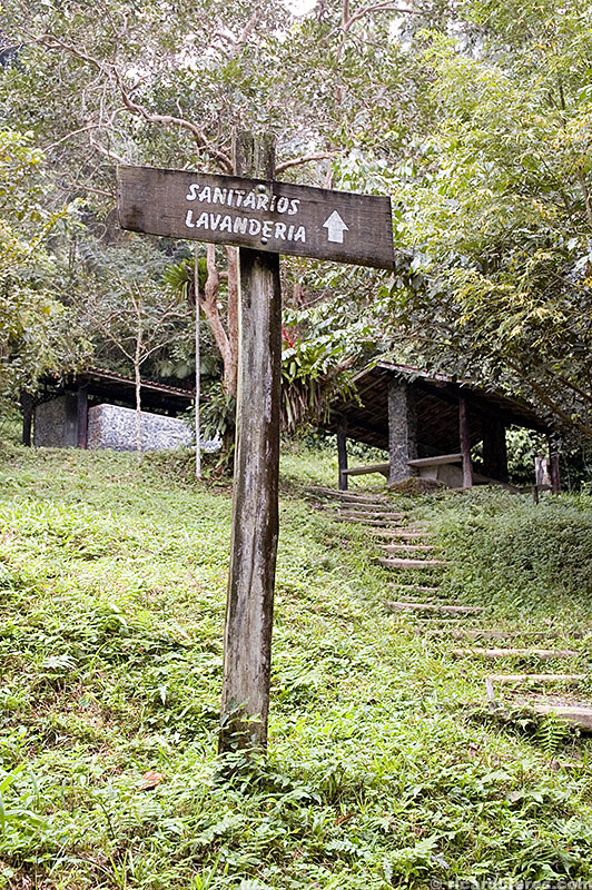
Toilets, tanks and showers with water straight from the cold river
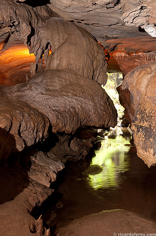
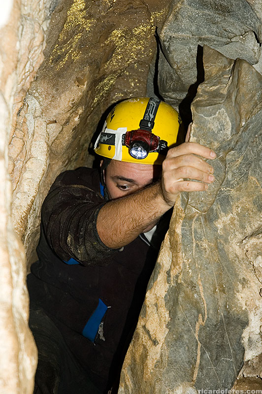
Below there is a brief description, in alphabetical order, of some caves in Caboclos. It is important to note that the trails are not marked and there are many forks, making it essential to hire an accredited monitor, because in addition to the risk of getting lost, it is prohibited to enter the caves without the presence of a guide.
Caves
Aranhas
Following the trail that starts in the camping area, after 5 minutes you arrive at Aranhas cave. In this small cave you will see many opilions, some speleothems and a beautiful view of the river that flows inside the cave.
Aranhas entrance
Arataca
Cave with few speleothems, it is a 4-hour walk (round trip) and is halfway to Casa de Pedra.

Arataca
Chapéu
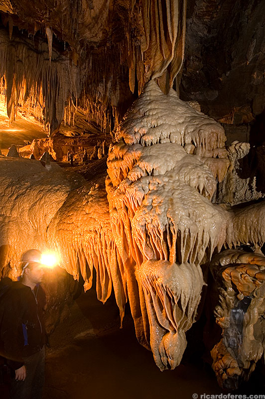
Last and best attraction of the short trail that start at the camping area, it has many halls and some beautiful speleothems, like a small hole close to the ground decorated with travertines and the Giant Mushroom.
Giant Mushroom
Chapéu Mirim I e II
These two small caves do not have great attractions, but they are so close to the camping area that they are worth a visit. They are at the beginning of the trail that head to Aranhas and Chapéu cavern.
Chapéu Mirim I
Cristais
A small cave near the camping area, it is cut by a river and, of greater interest, it has only a small hall after a restriction, since the hall that gave name to the cave has its entrance collapsed, preventing the access.

Cristais
Cristais
Desmoronada
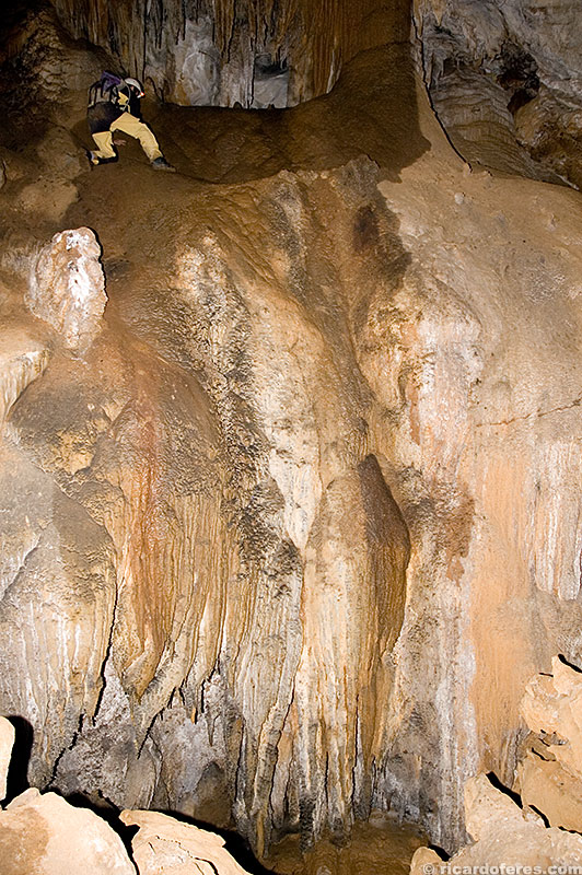
Walking only 20 minutes more on the same trail that leads to Pescaria you’ll arrive at Desmoronada. Hope to have sun when you are in this cave, as the rays of light entering one of the mouths form a beautiful view! To have an idea of the size of this place, look for a small orange dot in the left side of the photo and to the right of the column. That orange dot is a person’s helmet.

Desmoronada Cave. Note that there is a person at the bottom of the photo, on the left side, to have a size comparison with the column and the skylight.
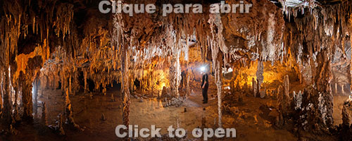
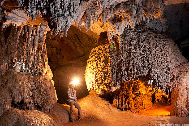
360° image at Canudos saloon
Espírito Santo
The mouth of this cave is almost on the road, so it does not require any physical strength to visit it, but to enter you must crawl until the main hall, where you can see stalactites, stalagmites, travertines, an elegmite and, most interesting, a fossil.

Fossil
Furo da Agulha
Cave discovered only in 2006, it has restricted visitation and is a 3-hour walk (round trip), crossing only one hill. The name was given because its mouth is quite tight, but after this difficult stretch there are saloons well decorated and, fortunately, totally preserved.
First restriction at Furo da Agulha

Little waterfall and stalactites

Saloon with many straws and stalactites

Curtains
Curtains and stalactites
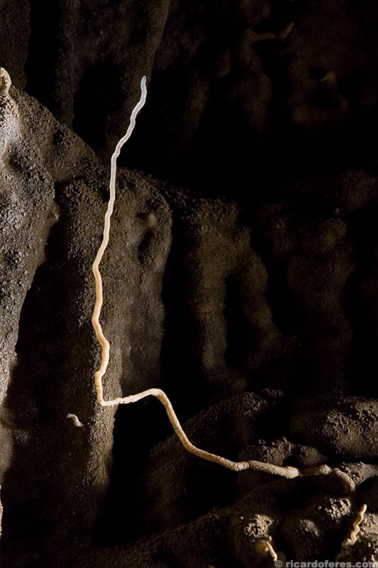
Helictite 20 cm high
Monjolinho
It’s a 20-minute walk after Arataca, (4:40 round trip), this is also a cave with few ornaments, but more beautiful than its neighbor. One must be very careful because there are several chasms throughout the cave.
Monjolinho Giant
This photo show only half of the abyss
Pescaria
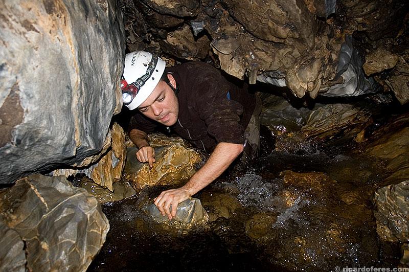
It’s a tiring walk because there is a difference of 400 meters (1,312 feet) to go up (and down) in only 2 km (1.2 mi), and the whole trail takes about 5 hours to be covered (round trip). Long cave, with some beautiful speleothems and in many parts it is necessary to walk inside the river.

Curtains and stalactites

Column and travertines
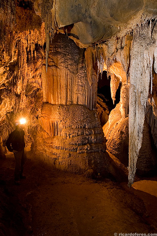
Temimina
It’s a 4-hour walk (round trip) in a good pace, with only a big gap to cross in the arrival to the cave. As it is cut by the Temimina river, get ready to get wet for some time. It has large halls and beautiful speleothems, as the photos below show.

Travertines and column

Temimina
Temimina

Shower

Pearls nest

Hanging Garden
Get to know the photo book "The Most Beautiful Trails of Patagonia"
Torres del Paine, El Chaltén, Bariloche, Ushuaia, Villarrica, Cerro Castillo, Dientes de Navarino and Parque Patagonia