Get to know the photo book "The Most Beautiful Trails of Patagonia"
Torres del Paine, El Chaltén, Bariloche, Ushuaia, Villarrica, Cerro Castillo, Dientes de Navarino and Parque Patagonia
Solo ascent of Ojos del Salado (6,893 m / 22,615 ft)
Introduction
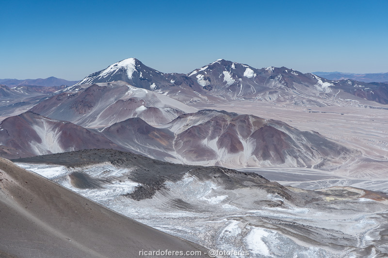
Ojos del Salado is the highest volcano in the world and the highest point in Chile, with 6,893 meters (22,615 ft) above sea level. It is an active volcano, but don’t be excited because you won’t find a crater with lava at its top; it is considered active because it occasionally emits fumaroles in its surroundings.
Located on the border between Chile and Argentina, Ojos has two peaks side by side, with a difference of just a few centimeters between them. Since the 4×4 approach from the Argentine side is much more complicated and the hike is also longer, almost everyone climbs from the Chilean side and that’s what I did.
Despite the always very low temperature, Ojos is located in the south of the Atacama Desert, one of the driest places on the planet, which means it has little snow compared to much lower peaks, but in non-desert regions.
The climbing season runs from December to March, which is also the time of the “Bolivian winter,” which changes the weather quickly and causes snowfall in northern Chile and Argentina. For example, when I was there in early January, there were a few spots with snow, but nothing that required the use of crampons. A week later, a blizzard completely changed the landscape, access to the refuges and, of course, the summit attack.
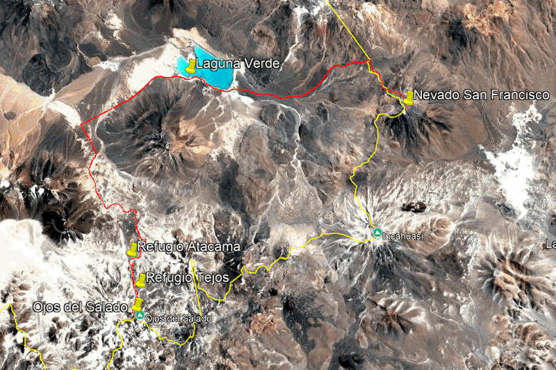
Google Earth image with the main places of this article.
Why climbing Ojos del Salado instead of Aconcagua?
Ojos is the second highest peak in the Americas, and Aconcagua in Argentina is the highest at 6,961 m (22,838 ft), so the obvious question is: why climbing the second highest peak? There are several reasons for this answer, the first being the number of people. Obviously, almost everyone prefers to say they climbed the highest peak, which leads to 6,000 to 7,000 people attempting to climb Aconcagua each season. I couldn’t find a reliable source on how many people attempt Ojos del Salado each year, but on the day I climbed it, in January 2025, there were only 14 people in 5 groups besides me. With so few people, I had the chance to be alone on the summit, an experience I wouldn’t have had on Aconcagua.
The second reason I like Ojos is the cost: the permit to climb Aconcagua, for those who go independently, costs US$ 1,050.00! If you hire a mule or guide, the permit is cheaper, costing US$ 660.00, but you will still have to pay for the guide and/or mule service and, finally, it is mandatory to have a rescue insurance, which also costs a few hundred dollars. There is no fee for Ojos, you just need to request authorization from DIFROL because it is a border region, and this request is made online, this is the link.
For those who are going to climb Aconcagua, the most common option is to acclimatize on Aconcagua itself, either by climbing a little each day or by taking day trips to higher camps and sleeping low. At Ojos, the usual option is to start acclimatizing at Laguna Verde and climb the nearby volcanoes, which I find much more fun and, most importantly, is a much more scenic route. Since I had planned to go by car from Brazil, I was able to start acclimatizing in northwest Argentina until I did the final test at the San Francisco Volcano (6,018 m / 19,744 ft), on the border between Argentina and Chile.
So far I have presented three reasons why I consider Ojos more interesting, but the fourth difference is undeniably in Aconcagua’s favor: altitude. If I wanted to say that I have been to the highest point in the Americas and also the highest point on all continents except Asia, I would have to go to Aconcagua, but what I wanted to know was what it feels like to be in the thin air at almost 7,000 meters (23,000 ft) above sea level, so the lower 68 meters (223 ft) of Ojos would not make any difference.
Acclimatization in the highlands of Argentina instead of around Laguna Verde
The most common way to acclimatize is to fly to Copiapó, Chile, and from there take a 4×4 to Laguna Verde, which is 4,350 meters (14,271 ft) above sea level and is surrounded by volcanoes that are over 6,000 meters (19,685 ft) high and that mountaineers use for training and acclimatization. In addition to being free to camp and the views being beautiful, there are small lagoons with thermal waters for those who want a hot bath after the hike.

Aerial photo of Laguna Verde.
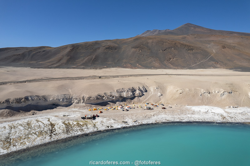
One of the camps of the agencies that use the lagoon for acclimatization.
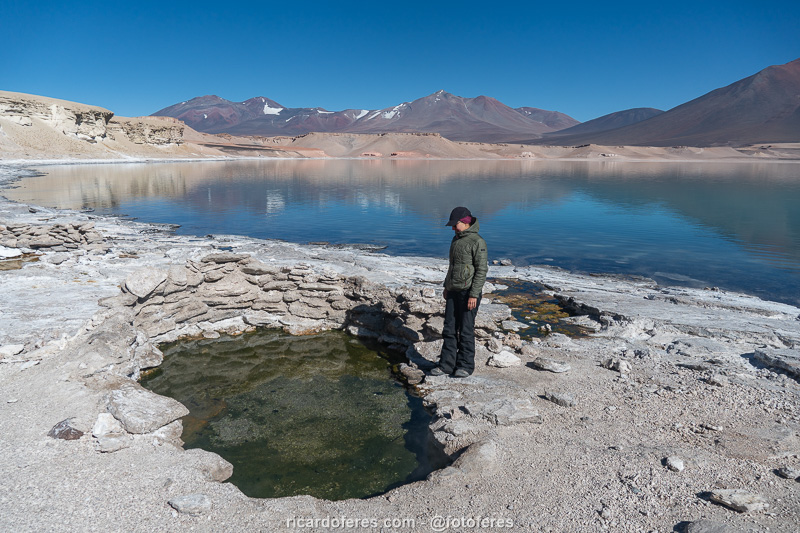
Thermal water on the edge of the lagoon.
Another option, for those traveling by car, is to start acclimatization in the Argentine highlands, and that’s what my friend and I did, driving through some of the most beautiful landscapes in South America and reaching altitudes of up to 5,200 m (17,000 ft) with the 4×4. We saw beautiful formations, lagoons full of flamingos and charming villages over the course of 10 days, but I won’t describe everything here because that would take up an entire article. I’ll just include three photos and you can see what we found there clicking here.

Cono de Arita at Salar de Arizaro, Argentina.

Puente del Diablo is located at an altitude of 4,065 meters (13,336 ft), in the northwest of Argentina, and can be accessed via a 2.5-hour trail, making it a good option for starting acclimatization for Ojos del Salado.

Volcancito de Troya, at Rioja Province, Argentina.
Click here to open the article about Northwestern Argentina.
Testing legs and lungs in Nevado San Francisco
After acclimatization in the Argentine highlands, it was time to find out if I was ready to climb Ojos, and the volcano chosen for the test was Nevado San Francisco, with 6,018 meters (19,744 ft) above sea level.
When we arrived at Laguna Verde (Chile), which we thought we would use as a base, we saw that there were a lot of people and the bathroom was in a horrible state, so we decided to camp at the base of San Francisco and returned to the border. If I have to camp, I prefer wild camping than being surrounded by people and noise. We found a place protected from the wind and set up our tents, but an hour later a group of Argentines arrived and camped near us. It seems that we were not the only ones looking for peace and quiet and, fortunately, they were also quiet during the night.
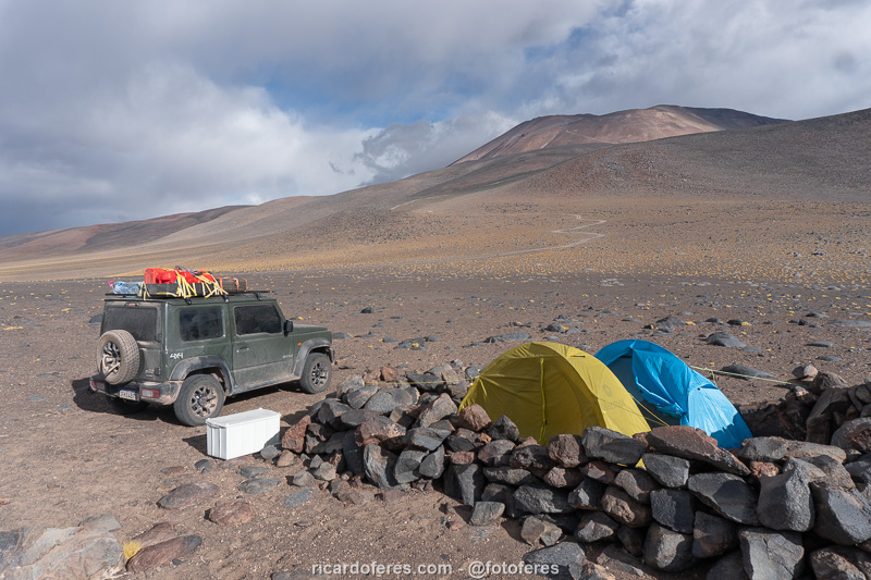
Camp at the base of San Francisco, 4,700 m (15,420 ft) above sea level.
It was still dark when we left the camp, but we couldn’t get to the normal start of the trail because the road was very bad in one place, so we parked 1.5 km (1 mi) down from what would have been the start of the hike. While we were getting our backpacks, the group of Argentines who had camped near us arrived. They were in a Hilux, which is much higher than the Suzuki Jimny, and had tried to pass the night before, but they couldn’t either.
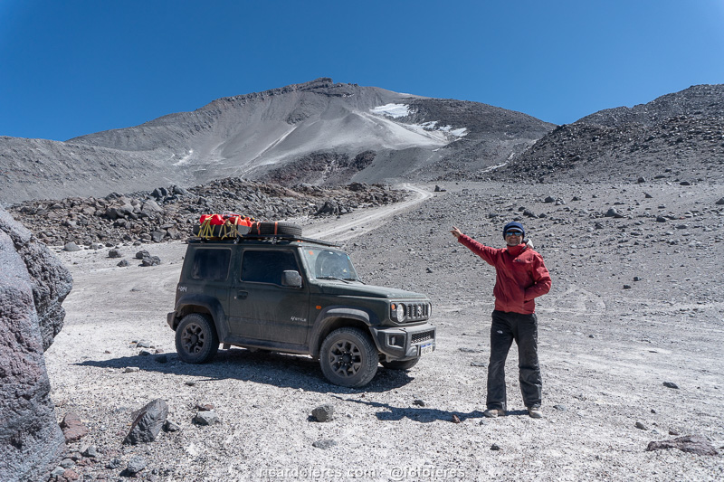
In the foreground is the road where I left the car and in the background the trail to the summit.
At first my friend kept up with me, but halfway up the trail, when we reached a steep place, she started to fall behind. Of course I could have waited for her, but I was testing myself to climb Ojos, so I kept going.
Going up the San Francisco with Laguna Verde in the background.
When I found a nearly flat spot with a view of the summit, I lay down to rest and ended up taking a nap. I woke up shortly after with the Argentines in sight, and Cris showed up a little after. Everyone sat down, we had a snack, and the Argentines left a few minutes before us. My friend walked very slowly, I could see that she was exhausted, and just before the summit she gave up, saying that she would wait for me there.
I didn’t think it was safe to leave her alone, so we talked a little and she decided to continue. I went a little faster than her, but I kept an eye on her to make sure she was okay, and I have to say it was exciting to reach the top of my first six thousand. I took some photos and when my friend arrived, her face showed how tired she was, so we didn’t stay long because we knew it would be a long way back.
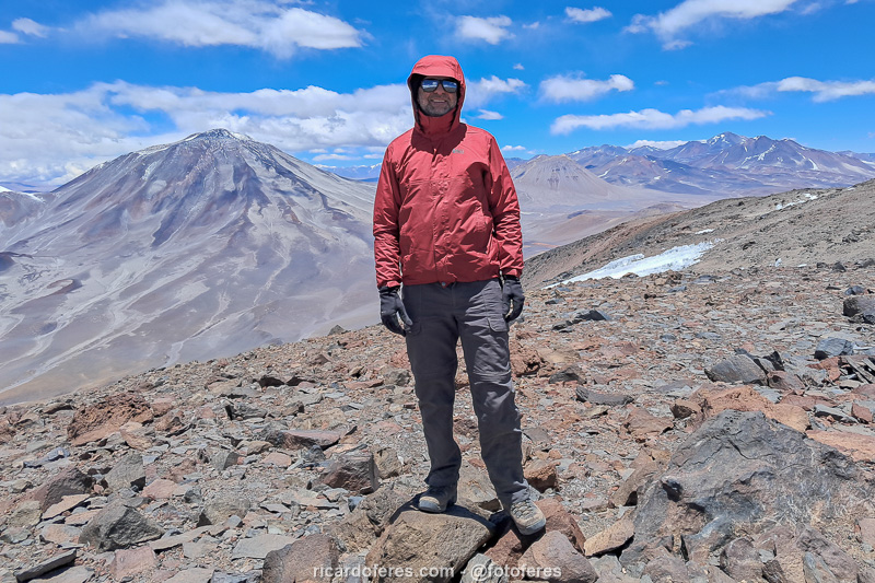
At the summit of Nevado San Francisco, 6,018 meters (19,744 ft) above sea level.

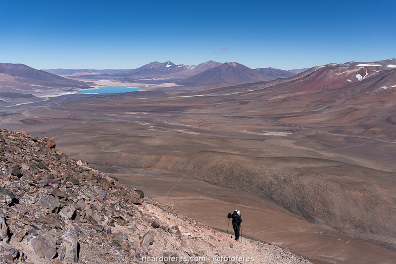
Ojos del Salado seen from San Francisco.
We walked down the mountain with almost no stops, since the lack of oxygen on the way down doesn’t bother us, but the 1.5 km (1 mi) stretch that we couldn’t do with the car seemed endless!
Back to the comfort of the car, we decided not to continue to Laguna Verde or Refugio Atacama, we set up camp again at the base of San Francisco to have a peaceful night, but first we went to the shelter that is on the border to use the wi-fi and check the weather forecast.
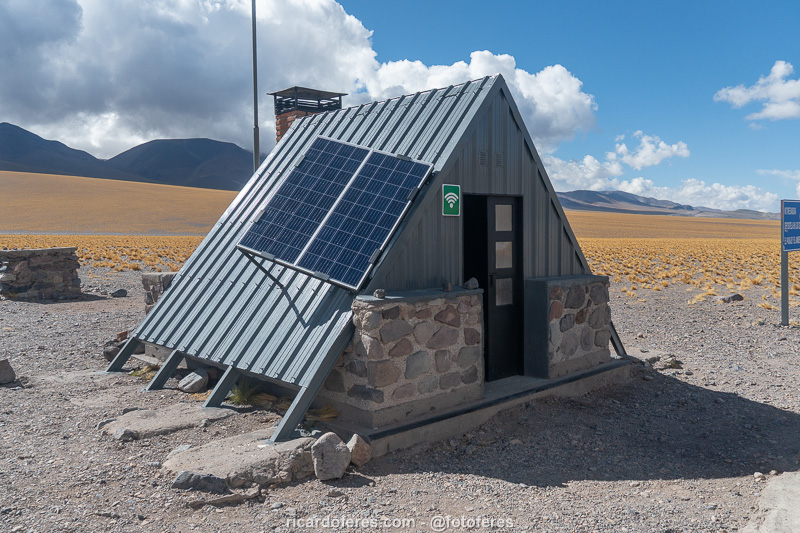
Shelter on the Chile-Argentina border, with open wi-fi.
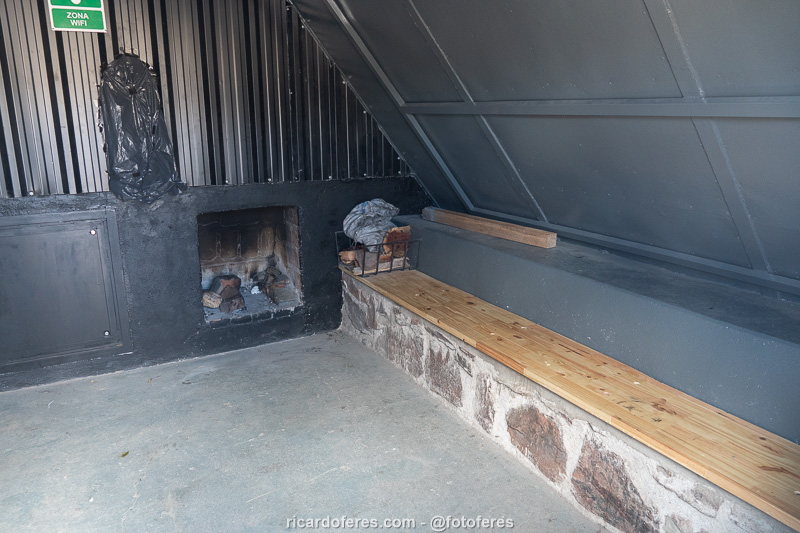
Interior of the shelter, which can be used freely.
Click to open Wikiloc and download the San Francisco tracklog.
The Ojos del Salado climb
We woke up with the sunrise, refreshed after a good night’s sleep and soon set off towards Refugio Atacama (5,292 m / 17,362 ft), from where we would walk to Refugio Tejos (5,835 m / 19,143 ft) the following day.
We passed through Laguna Verde once more and, after leaving the main road, the road became very beautiful, but with stretches of very soft sand. In one of the sandpits, the Jimny got stuck, damn it! Because it is not as tall as a Toyota Hilux pickup truck and also because it was carrying a lot of weight, the bottom of the car got stuck in the sand, so we took out all the luggage, except for the extra fuel cans. With the car lighter, it got off the sand, then we put everything back and continued on, passing through a few more sandpits, but not as deep.
When we arrived at Atacama shelter, there were some tents, but only two Argentines in the camp, who said that they had walked to Tejos shelter the day before, taking part of their equipment, and that today they would go again, but to sleep and try to reach the summit the next day.
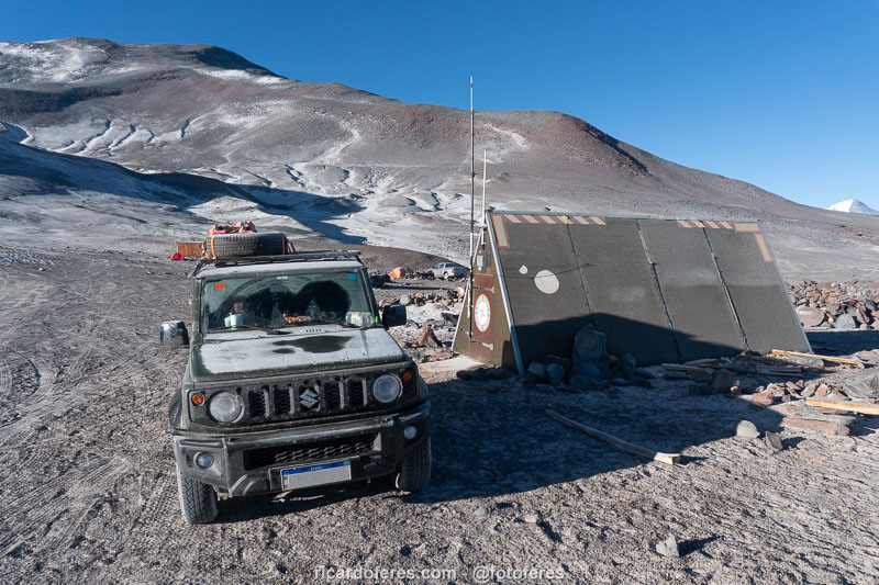
Atacama Shelter and camping area in the background.
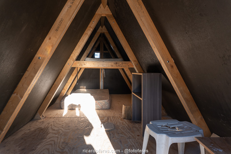
Interior of Atacama Shelter.
They also said that the worst part of the road to Tejos was the climb right in front of the camp, so I decided to try to pass, which would save this walk and bring forward the attack on the summit by a day, which would be good because the forecast said that two days later, in the afternoon, there would be a change in the weather.
To lighten the load, we left many bottles of water in the Argentines’ tent, but we took their backpacks so they could walk light. If the car couldn’t go up, they would take their backpacks back, after all, we were going to do the same route.
The soil was very soft, with rocks and deep potholes, and at that altitude (5,361 m / 17,588 ft) the Jimny’s engine, which is already weak, was even weaker. I tried to pass, but it didn’t work. I asked Cris to get out to lighten the load, but I failed again. Since the effort was all the car’s, why not try a third time? No way… I saw in the Argentines’ eyes that they didn’t believe I would pass, so I said “I’m stubborn”, to which one of them replied “I realized”. I took off as much weight as possible and, on the fourth attempt, the Jimny passed! I felt a little relieved, but I wasn’t really calm because I didn’t know if there would be other difficult places.
When I arrived at Tejos, I met an Austrian who looked at the Jimny and asked “How did you get here with that car?”, and I told him “I don’t know either”.
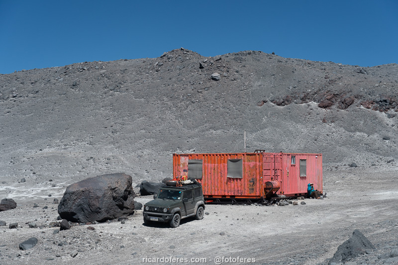
Tejos Shelter, at 5,850 m (19,193 ft) altitude.
Summit of Ojos del Salado seen from Tejos.
The shelter has a room with 6 beds and, at the end of the day, there were me, my friend, the two Argentines, an Austrian, two Swiss and their guide, a Chilean. If you counted correctly, there were eight people, but since we arrived early, we could sleep in the room. However, since I have trouble sleeping with snorers, I chose to stay in the living room, which turned out to be a big mistake because every time someone wanted to go to the bathroom, that is, outside the shelter, they had to go through the living room and the iron door made a loud noise. If it was just once or twice, it would be fine, but at altitude you drink a lot of water and if you drink a lot of water, you pee a lot, so the damn door slammed all the time.
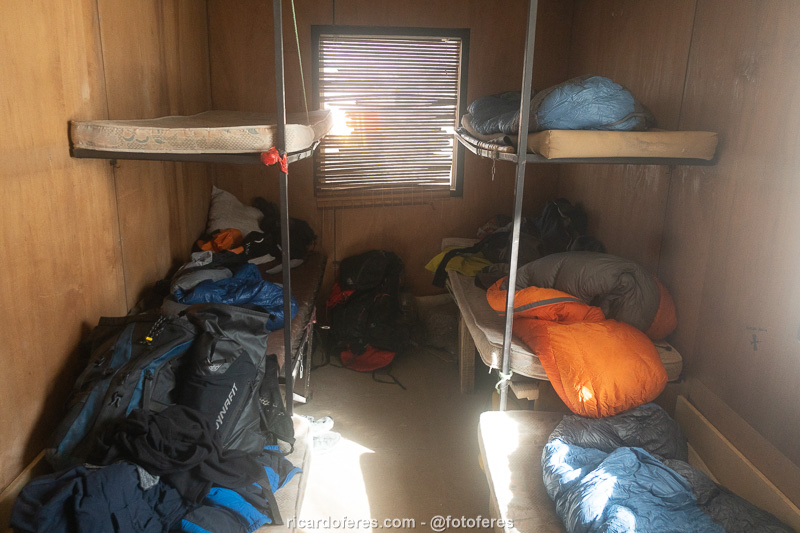
Shared room at Tejos.
When the people finally emptied their bladders, I started to get rhinitis because of the dust in the room. Sneezing, itchy nose, burning eyes, more sneezing… But no sleep! At three in the morning I heard a car passing by, at four another one passed by, and at five I got tired of lying down and started to get ready to go out, and soon after everyone woke up.
I had a lot of swelling under my eyes because of the rhinitis and my friend even suggested that I rest and go to the summit the next day, but I didn’t want to spend another night there and preferred to go even without having slept a single minute.
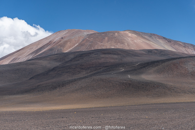
I started walking at 6:12 am, at minus 18° C (0° F), and I soon felt the difficulty, with the steep climb and the ground made of soft dirt and small stones that made me slip from time to time. Half an hour later, the Chilean guide and the Swiss caught up with me and we walked together. Of course, we weren’t racing, but I knew that they walk fast and if I kept up with them without getting tired, it was because I was doing well.

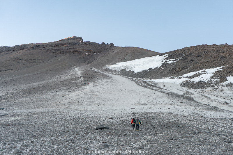
Sunrise on the way up to Ojos del Salado. In the middle of the photo you can see Tejos Shelter and, at the bottom, the Chilean guide with the Swiss clients.
Below me I saw the two Argentines and, below them, the Austrian, who soon passed them, which is not surprising, since he is much younger and had completed the Ironman of Hawaii a few months before, so he was in great condition.
In the foreground are the Chilean with his two clients and above them the two groups that left at 03:00 and 04:00.
I was wearing a pair of thin gloves and thick ski gloves over them, which were very warm, but when I took the thick gloves off to eat and take pictures, my fingers got really cold. I put the gloves back on, of course, but the pain in my fingertips didn’t go away, so I stopped to warm them up because I was getting worried. According to the GPS, it took me 23 minutes to get my fingers more or less warm and start walking again, but I’m glad I did it, because even after warming them up, my fingertips were numb for 11 days!
Since I couldn’t take off my gloves, I couldn’t eat, but even so, the four of us (me, the guide and the two Swiss guys) caught up with the group that had left at 04:00. This made me feel pretty confident, until my stomach started to churn and I thought “Oh shit, not now, not here!” But it wasn’t my choice, so I stood still to let people move away, since there was no hidden place to “use the bathroom”. I lost 40 minutes, but at least it was a false alarm and I was back on my way, now behind everyone except the two Argentines.
Because of the lack of food, I became weaker and weaker and started to walk very, very slowly. This was my second mistake, I should have put maltodextrin (a slow-absorbing carbohydrate) in the thermos, as I always do on long bicycle rides, but since I had plenty of food, I didn’t think it would be necessary.
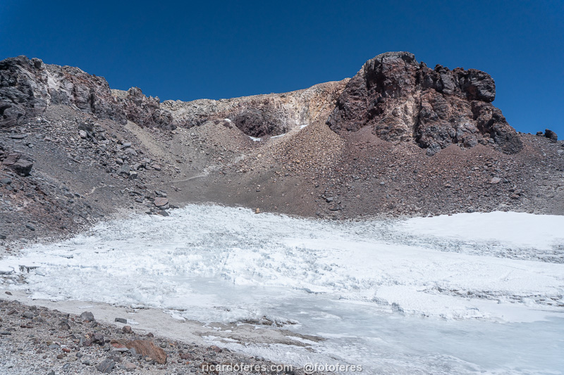
Ice field close to the summit.
Final approach.
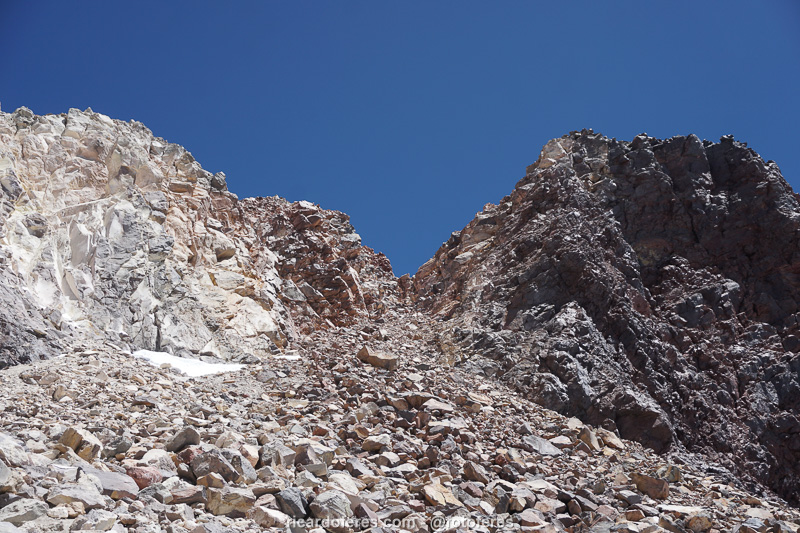
Anyway, I dragged myself up and when I got to the climbing section, there was a group of four people who didn’t seem to know what they were doing. That section has between 10 and 15 meters (30 to 50 ft) of ascent and I waited 51 minutes for the four people to get equipped and climb. If I had known it would take so long, I would have asked to go ahead, because it took me less than two minutes to climb, even though I consider it more of a scramble than a climb.
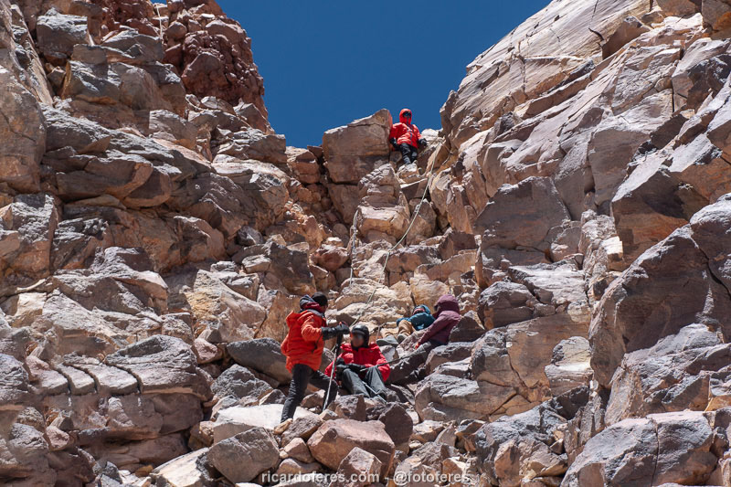
Section that people used to say as a climbing, which I consider a scrambling.
Once at the top, I took some good photos for them and one of them took some terrible photos of me (where are my legs in the photos?). Soon they came down and I was alone taking some more photos and enjoying the view, but I didn’t stay long because it was too cold to stand still in that wind. According to the website Mountain Weather Forecast, which gives the weather forecast for several mountains around the world, that day the temperature felt like -29° C (-20° F).
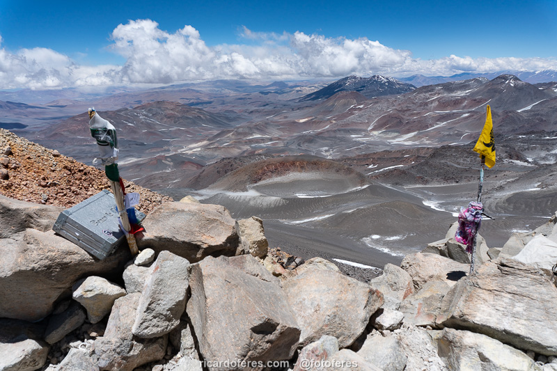
Summit book.
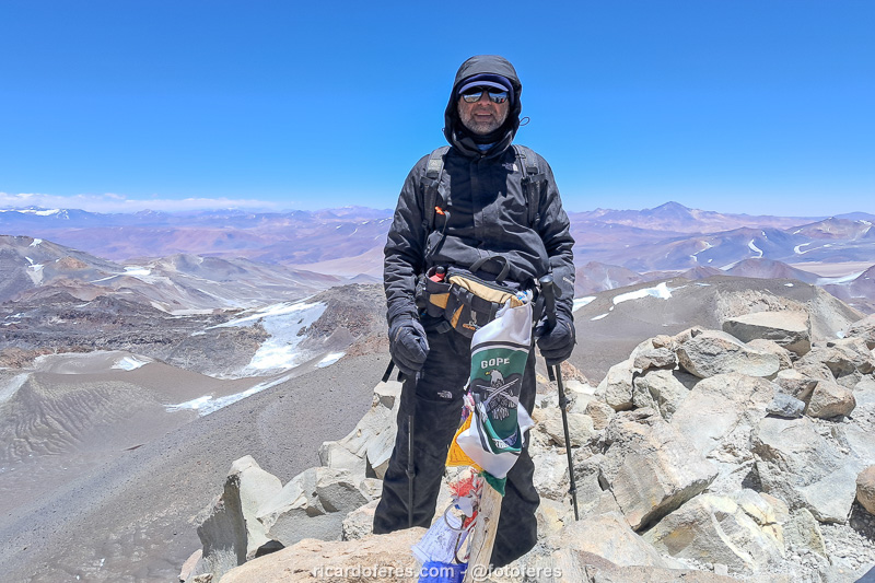
At the summit of Ojos del Salado, 6,893 m (22,614 ft) above sea level.
View from the summit.
The descent was smooth, but with all the delays due to rewarming my fingers, the need to go to the bathroom and the wait on the climbing section, I arrived much later than I imagined, at 5:15 pm. I met my friend and we drove to Atacama Shelter, where we slept in the small shelter, which was empty.
Click to open Wikiloc and download the Ojos del Salado tracklog.
I went to bed quite tired, but happy to have fulfilled this wish that had been in my head for years, and eager to go to the coast of the Atacama Desert to feel the heat and spend a few days in a t-shirt and shorts, facing the Pacific Ocean.
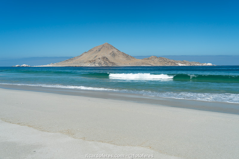
A well-deserved rest on the beaches of Pan de Azúcar National Park.
Get to know the photo book "The Most Beautiful Trails of Patagonia"
Torres del Paine, El Chaltén, Bariloche, Ushuaia, Villarrica, Cerro Castillo, Dientes de Navarino and Parque Patagonia