Get to know the photo book "The Most Beautiful Trails of Patagonia"
Torres del Paine, El Chaltén, Bariloche, Ushuaia, Villarrica, Cerro Castillo, Dientes de Navarino and Parque Patagonia
Lençóis Maranhenses, Brazil – Tours and hiking traverse
Overview
Lençóis Maranhenses are the largest dune field in South America and, to protect this incredible ecosystem of dunes, mangroves and sandbanks, in 1981 the Lençóis Maranhenses National Park was created. With approximately 1,500 km² (580 mi²), the landscape of Lençóis undergoes constant changes in its landscapes, both by the action of the wind, which moves the dunes around 20 meters (65 feet) per year, and by the elevation of the water table during the rainy season, creating thousands of lagoons. Commonly called a desert, some geographers disagree with this definition, but it is a fact that for a good part of the year the region is almost completely dry, since more than 90% of the rain occurs between January and July. Considering that one of the definitions of desert is “barren region that supports few forms of life”, I believe that the word can be used, but the reality is that it doesn’t matter, because what attracts tourists is a landscape that cannot be seen nowhere else in the world. To learn more about this region, click here to see an article from Pesquisa FAPESP magazine (Portuguese).
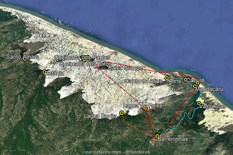
In blue is the route of the boat on Preguiças River, in red the tourist flight and the two paths in brown are 4WD tours to the lakes.
There are two cities to reach Lençóis Maranhenses: Barreirinhas and Santo Amaro do Maranhão. Barreirinhas is the largest city and has more tourist infrastructure, while Santo Amaro, despite being much closer to the dune field, has less tourist infrastructure and therefore receives far fewer visitors. There are also smaller towns, such as Betânia, Lavados and Queimado, which can be used to reach the dune field, but transport to these places is more restricted.
Best season
From February to May there are heavy rains, which fill the lagoons and make the best time to visit from May to August, with the end of the rainy season, but with the lagoons still full. In September and October it is possible that you will still find the lagoons with a reasonable volume of water, but it depends on how the rainy season was. From November to January there are few perennial lagoons and they are shallow, and from February to April it is already possible to find them with medium volume, but the chance of getting rain during your hike or tour is quite high. In summary: go between May and August, with preference for the beginning of the season, but before booking your trip, contact the Lençóis Maranhenses National Park office to find out if the lagoons are full, as in some years the rain is insufficient. Click here to see the ICMBio website and see the means of contact.
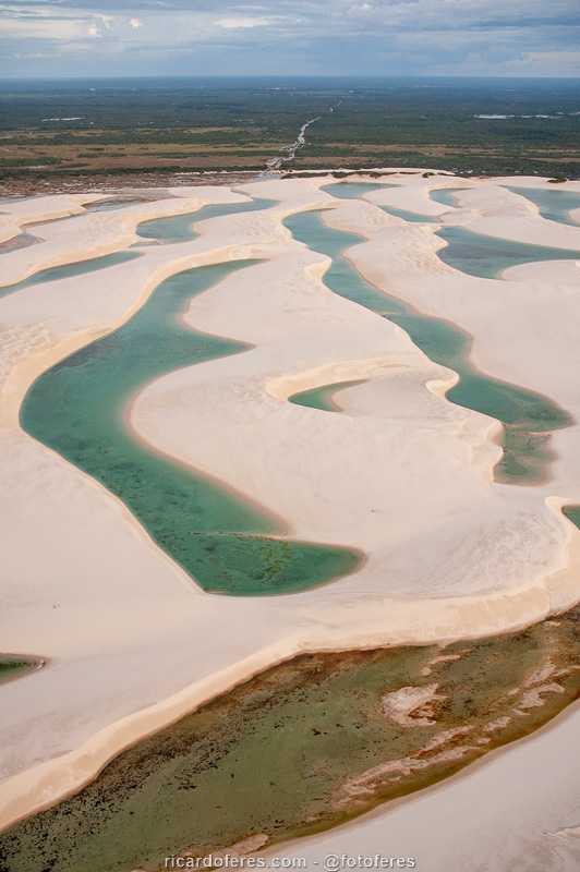
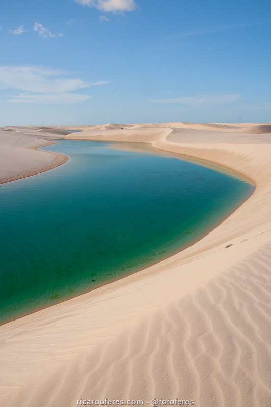
In a year with a good rainy season, there are large and deep lagoons throughout the park.
On the other hand, in a year with little rainfall, as at the time of this photo, the season ends well before August and the landscape is thus dry for tens of kilometers.
Barreirinhas
Located on the banks of the Preguiças River, Barreirinhas has good accommodation and food options, in addition to several local tourism agencies. By the way, the negative point of Barreirinhas is precisely the insistence of the sellers of these agencies, who are chasing customers in the streets and sometimes even following them, causing embarrassing situations for tourists who, at certain times, can only get rid of them by leaving education beside.
Due in the center of Barreirinhas.
There are three types of tours to be done in Barreirinhas: by 4WD to the lagoons, by boat on the Preguiças River and the tourist flight over Lençóis.
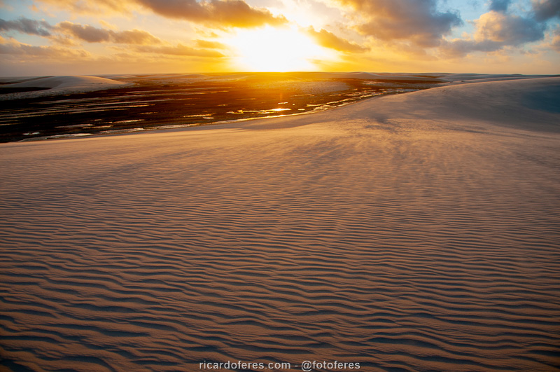
4WD to the lagoons: for those who are going to make the traverse, this tour is not very interesting because you will see many more lakes during your hike, with the advantage that you won’t have the company of dozens of people. But, if you have time and money to spare, agencies sell tours with morning and afternoon departures. I went in the afternoon to see the sunset and it was beautiful, as shown in the photos below.
4WD tour to the lagoons in the Barreirinhas region.
If you can, choose the afternoon tour to see the sunset.
Boat on the Preguiças River: according to the locals, the name of the river (preguiça = lazyness) comes from the fact that it flows very slowly to the sea and this tour is the most beautiful way to arrive in Atins to start the traverse. Leave it to do it when you’ll start the hike, so you won’t have to go back to Barreirinhas. When hiring the boat, see if it stops in Vassouras, where there are several capuchin monkeys. Some tours include the Mandacaru lighthouse, from where you have a beautiful view of the river and, a little further, the sea. However, from the lighthouse you cannot see the lagoons, so it is not a must see stop. Finally, at the mouth of the river, but on the opposite side of Atins, is the village of Caburé, but there are no different attractions than what you will find in Atins, so don’t worry if the boat doesn’t go to Caburé. If you do not want to take the boat trip, it is also possible to arrive in Atins with a 4WD, which run from Monday to Saturday.
Preguiças River tour.
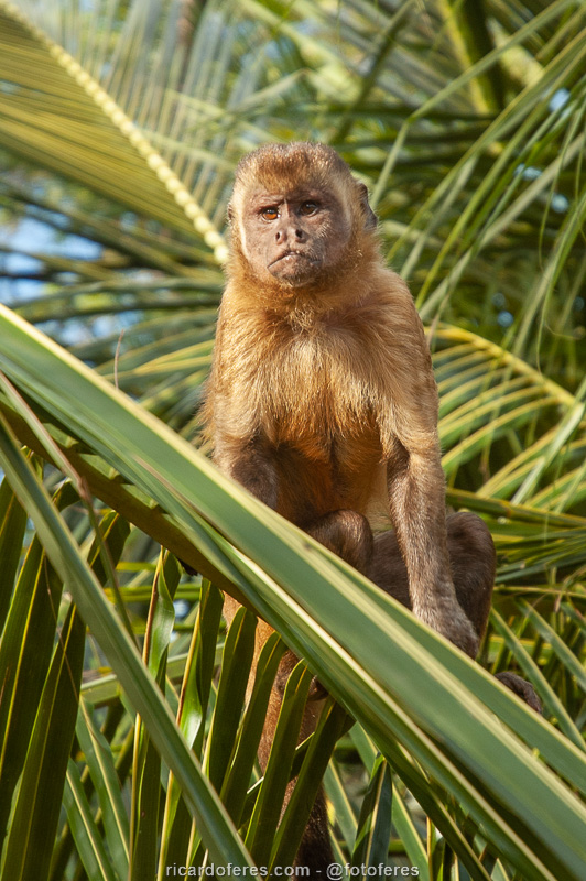
Capuchin monkey in Mandacaru.
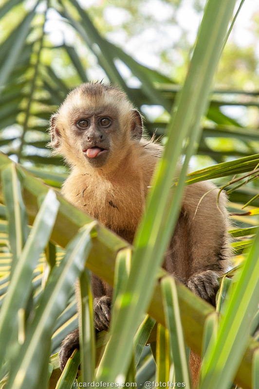
Capuchin monkey in Mandacaru.
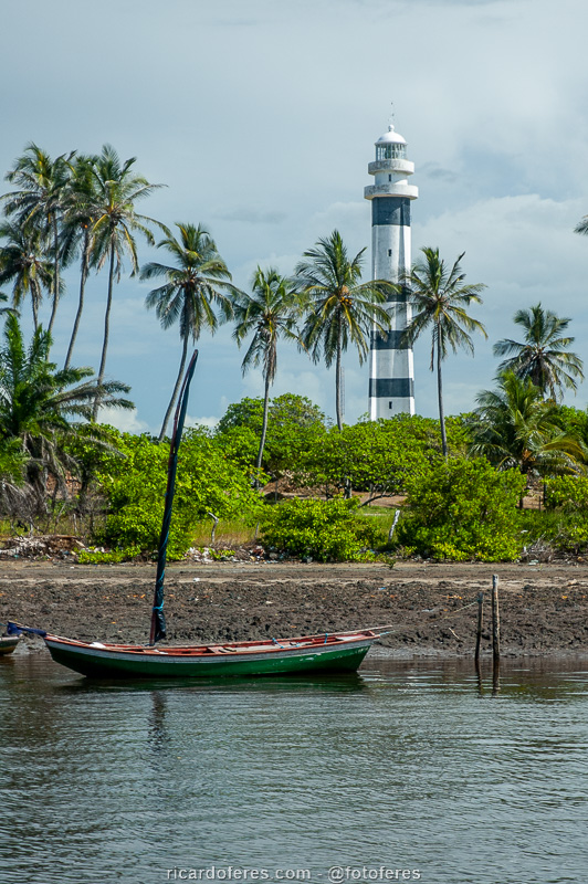
Mandacaru Lighthouse.
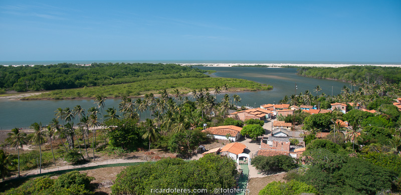
Mandacaru Lighthouse view.
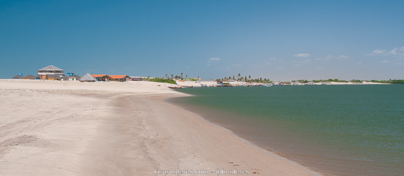
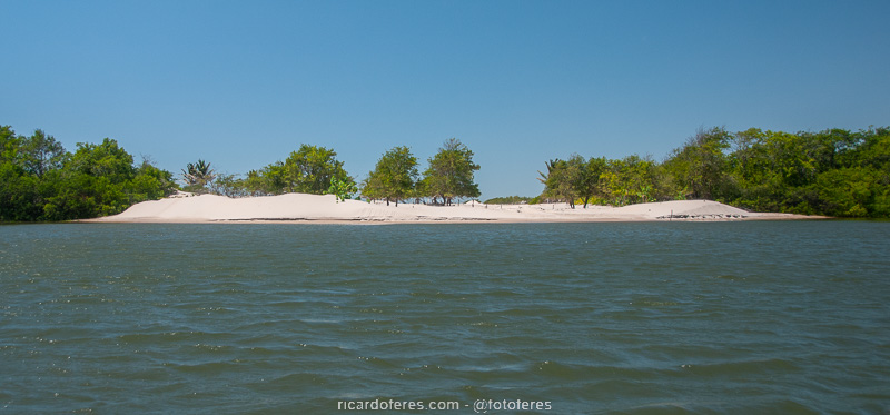
Caburé Village, at the mouth of Preguiças River.
Tourist flight: this is an expensive tour, but worth every penny, as the view of the dunes and lakes from the top is unforgettable! The flight is half an hour long, enough to go to the middle of the park and see hundreds of lagoons, but as there are few tours and can get crowded, try to book in advance.
View from the tourist flight close to Barreirinhas.
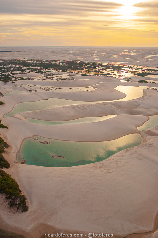
Sunset seen from the plane.
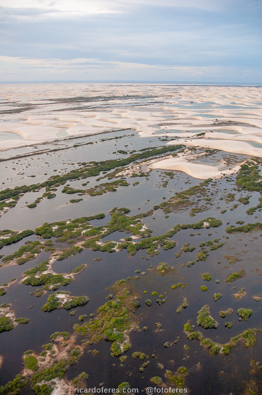
The flight goes to the center of the national park and passes over Baixa Grande, in this photo almost completely submerged.
To get to Barreirinhas from São Luís, you can take a bus, van, taxi or plane. Bus is the cheapest way and there are several times a day. Vans cost a little more, but have the advantage of picking you up from your hotel. Taxis are even more expensive and only leave when the car is full, so I don’t think it’s an interesting choice. Finally, as Barreirinhas has a small airport, you can go by plane, which costs a lot more, but you will see the region from above.
Santo Amaro do Maranhão
Despite having less infrastructure than Barreirinhas, Santo Amaro has been developing a lot since the road was paved. The advantage over Barreirinhas is that the dune field is much closer to the city, and it is possible to reach the lakes walking from your inn. On the other hand, if you want to do the tourist flight, which I highly recommend, you’ll have to go to Barreirinhas.
Canoe trip on the Grande River, in Santo Amaro.
In the flood season, some houses are isolated.
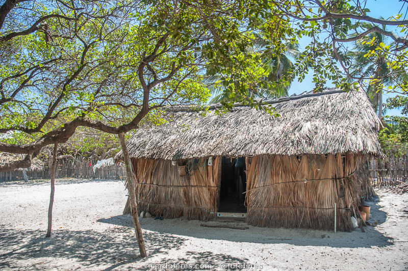
Typical house of Lençóis Maranhenses.
To get to Santo Amaro, you need to take a van from São Luís, as there are no public buses.
Itinerary for the hiking across the National Park
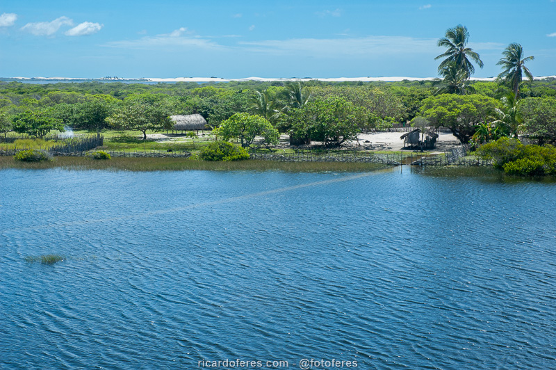
For those who opt for the traverse, it is always done in an east-west direction, as the wind is in favor and, mainly, due to the shape of the dunes, since the slope is gentler to climb them and the descent is made by the steepest side. Therefore, the base city is Barreirinhas, which is on the east side of the national park. In fact, as it is far from the dunes, the hike does not start in Barreirinhas, it is preferable to go by boat to Atins and, from there, start the hike. It is also possible to take a 4WD from Barreirinhas to the dunes and then start the hike, but I recommend that you start in Atins as the boat trip is beautiful and you will visit other villages, such as Vassouras, Mandacaru and Caburé.
If you want to walk without carrying a tent and with food only for snacks during the day, you can do the following route: on the first day, walk along the beach for around 8 km (5 mi) to sleep in Canto do Atins, also known as Canto dos Lençóis. On the second day, walk around 25 km (15 mi) to Baixa Grande, where there are rooms and hammocks for rent. On the third day, walk around 11 km (7 mi) and sleep in Queimada dos Paulos, which also has a simple tourist service structure. The fourth and last day is the longest, with more than 25 km (16 mi) to reach Santo Amaro, but without carrying too much weight, it’s not that difficult. However, this is not my choice to make the traverse, as I prefer to be more isolated and have lagoons all to myself, including sleeping on the edge of them, away from other tourists. Below is the route I prefer.
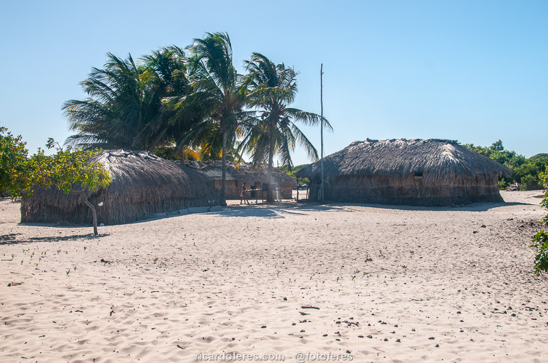
If you choose to go through Baixa Grande, you will find a quiet village at least until the end of the day, when the tourists who will spend the night arrive.
Day 1
In the morning, take a boat trip on the Preguiças River, discover the villages along the way and, upon arriving in Atins, walk 8 or 9 km (5 or 6 mi) along the beach to Canto do Atins, where there are two restaurants. I had dinner at Restaurante da Luzia, which became famous after appearing in some articles, but the truth is that the famous shrimp did not live up to its fame. The flavor was good, but nothing out of the ordinary, the dishes only had 4 large shrimps and, both on my plate and on that of a friend, there was a shrimp that was rotten. It may have been bad luck, but if I go back to Canto do Atins, I’ll try Antonio’s Restaurant, which incidentally is Luzia’s brother.
After eating, enter the dune field and walk until you find a lagoon that makes you want to spend the night, I’m sure it will be an easy task. As in the dry season the wind creates and buries many lakes, there is no point in telling you where I slept, because when you go, the landscape will be different.
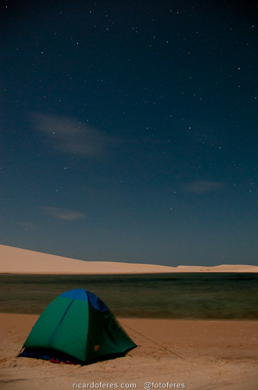
On the first night you can choose between sleeping in a room in Canto do Atins, or by the lagoon, which is my choice.
Day 2
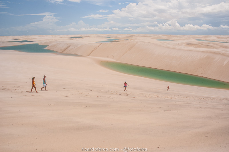
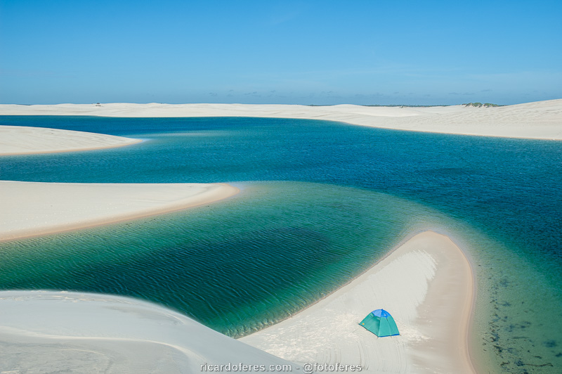
Time to head towards the center of the park and enjoy the incredible view of the blue, green and brown lagoons, which get bigger and deeper as we move away from the sea. If you, like me, like isolation when you’re in nature, don’t head towards Baixa Grande, which is where most everyone goes, and you’ll have the lagoons all to yourself and your group. Walking around 20 km (12 mi), you will distribute the distance well between the days, so you can walk early in the morning, rest in the hottest hours of the day, and go back to walking when the sun is not too strong.
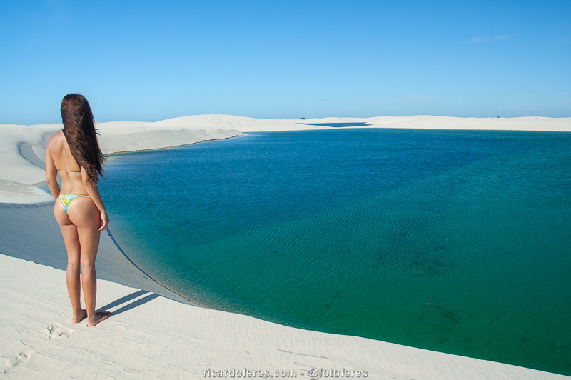
As you move towards the center of the dune field, the lagoons get bigger and more deserted.
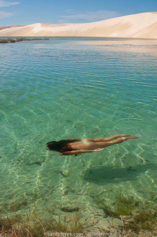
The water is so crystal clear that it doesn’t even look like she’s underwater.
Day 3
As I already wrote, I like isolation when I’m in nature, but on that day I recommend heading to Queimada dos Britos or Paulos, which are a little further away, but within the same oasis. This will give you the chance to experience the lifestyle of these families and get a better overview of the entire national park. If on the previous day you walked around 20 km (12 mi), on that day you will have another 20 km (12 mi) to go to Queimada dos Britos.
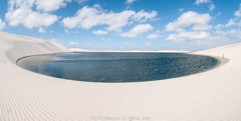
The variety of tones and shapes of the lagoons is so great that, even if you spend several days walking, the landscape is always different.
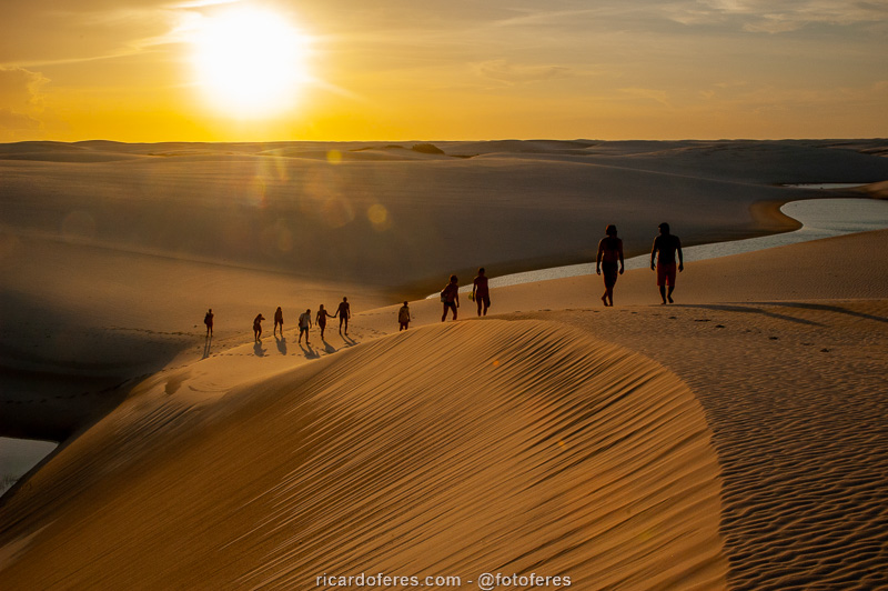
Sunset in the dune field.
Day 4
If you want to do the traverse in 4 days and end up in Santo Amaro, the last day is the longest, with more than 25 km (15 mi). If you think it’s too much, you can divide this route in two or head to Betânia, which is closer, but transportation to leave is more complicated than Santo Amaro, which was my choice both times I was in Lençóis.
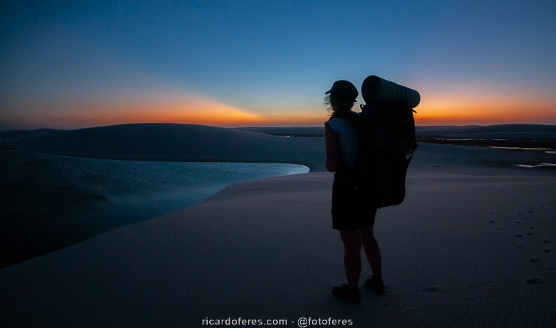
Sunrise and the start of another hiking day.
Waking up with this landscape is unforgettable!!
Waypoints to the GPS
Click here to go to my Wikiloc page and download the waypoints to use in your GPS. As the lagoons change position from year to year, I didn’t put the path I took on any of the trips, as it would be useless.
Tips
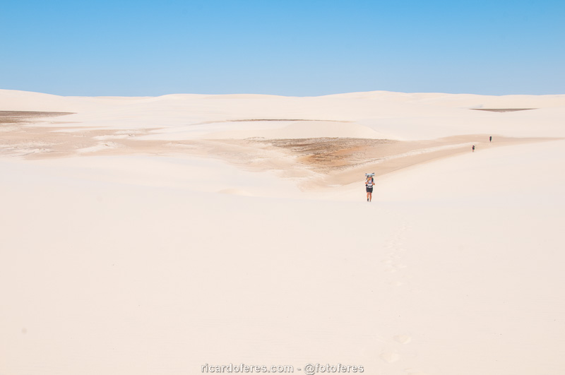
Shoes: some prefer to walk barefoot, others with sandals, but one thing is for sure, closed shoes are not a good choice, as when going down the dunes your foot will sink and your sneakers/boots will be full of sand. I wore sandals with socks (yes, they are ugly but practical and comfortable) to protect the foot when crossing flooded areas, where you can’t see if there are stumps or thorns and the sock serves to protect the skin from abrasion, since there is always sand between the skin and the straps of the sandal.
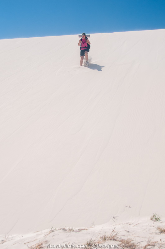
Notice how your feet sink when descending the dunes, so I don’t recommend the use of closed shoes.
Drinking water: although the lagoons are formed by rainwater, it is not good to drink them without sterilizing them, as there are cows, horses and goats around them. Take a filter or another means of sterilizing water so as not to take unnecessary risks.
Get to know the photo book "The Most Beautiful Trails of Patagonia"
Torres del Paine, El Chaltén, Bariloche, Ushuaia, Villarrica, Cerro Castillo, Dientes de Navarino and Parque Patagonia