Get to know the photo book "The Most Beautiful Trails of Patagonia"
Torres del Paine, El Chaltén, Bariloche, Ushuaia, Villarrica, Cerro Castillo, Dientes de Navarino and Parque Patagonia
Dientes de Navarino Circuit, Chile – Hiking report
Overview
Dientes de Navarino, in Chile, is famous for being the southernmost hiking circuit in the world, attracting who wants to experience hiking in a region with a subantarctic climate. For me, what drew me to the distant Navarino Island was the beauty of its lakes and mountains, which I wanted to photograph for the book The Most Beautiful Trails of Patagonia.
The circuit is usually done in 4 days, but as it is short, it can be completed in 3 days by those who are well trained. It’s only 45 km (28 mi) and 3,400 meters (11,155 ft) of accumulated elevation, including the side trail to Cerro Bettinelli, but not including the 3 km (2 mi) from Puerto Williams to the start of the trail and the 7 km (4.3 mi) hike along the road on the last day, in case you have not hired transport or cannot get a ride.

Satellite image of Dientes de Navarino Circuit, also known as De los Dientes Circuit.
Base city
Puerto Williams has around 2,000 inhabitants (2017 Census) and half of them work for the Chilean Navy. Only in 2018 did the Chilean government classify it as a city and, with that, took from Ushuaia the title of southernmost city on the planet, which its Argentine neighbor still uses very well to leverage tourism. Leaving the rivalry between Argentines and Chileans aside, it is important to say that Puerto Williams does not have a great tourist infrastructure and prices are higher than in other regions of Patagonia, due to its isolation.
The only hotel I’ve used and can recommend is Fio Fio, which you can book through Booking.com.
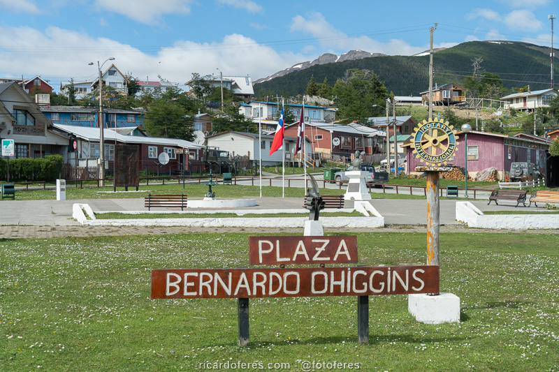
Puerto Williams main square.
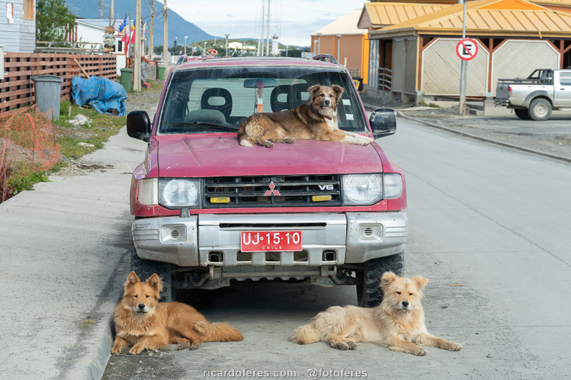
That dog must be important, he even has bodyguards.
How to get there
There are three options to get to Navarino Island, all of which are expensive. The first is to fly to Punta Arenas, Chile, and take a very small plane to Navarino Island. The disadvantage of this flight is that the price is even higher than the boat and there is a luggage restriction, so you may have to buy food for the trail on Navarino Island, which will limit you as there are not many options there. The advantage is that you won’t be dependent on sea conditions, like those who choose to go by boat. The company that operates this flight is DAP, click here to open their website.
The second option is to go to Ushuaia, Argentina, and take a large Zodiac to Puerto Navarino. After crossing the Beagle Channel, the company that transported you by boat will take you by van to the city of Puerto Williams. The advantages are that the cost is a little lower than the plane, although it is still quite expensive for such a short journey, but mainly for being able to carry luggage without size and weight limitations, which is useful especially for those who are on a long trip and carries more than the backpack. The main disadvantage is that, if the sea conditions are bad, which is not very rare, the boat does not make the crossing, so imagine the despair of those who are on Navarino Island needing to go back to Ushuaia to catch a plane, but they can’t. There are two companies that make this route, Hielos Antárticos and Onashaga Expeditions, click on the names to open the websites.
The third option is to take a cargo boat from Punta Arenas, which also takes passengers in simple cabins. The trip lasts around 28 hours and passes through numerous islands, fjords and glaciers, the problem is that this crossing only happens 4 to 6 times a month. Click here to open the Austral Broom website.
Best season
If possible, go between mid-December and the end of March, as before that it is possible that the lakes are still frozen.
Costs
As it is not inside a national park, there is no fee and it is not mandatory to hire a guide, but if you do not have much experience in hiking in very cold climates, I recommend that you hire one as there is a good chance of an accident, like the one I report on the last day of my hike.
I did the trail by myself, but talking with the locals, it seems that Turismo Shila is a reference on Navarino Island. Even though I didn’t hire them, I went before the crossing to clear up some doubts and I was very well received. Click here to open their website.
Clockwise or counterclockwise?
You can do it both ways, but the most common way is to do it clockwise. The advantages of going clockwise are that it is a little easier to cross the Paso Australia and that, as people often do in this direction, you will be in contact with the same people at the camps, which creates a small bond that can be useful in case of a problem. However, the advantage of doing it counterclockwise is that you can take a transport in the city to the beginning of the trail, not depending on it when you finish the circuit if you do it clockwise.
Tracklog for GPS
Click here to download the tracklog from my Wikiloc page.
Report
I arrived at Navarino Island in early December 2019, during a 6-month trip to produce the book The Most Beautiful Trails of Patagonia. As I was in Ushuaia, I used the fast boat service to get to Puerto Williams.
Despite having warned me that the lakes were still frozen, I decided to do the circuit anyway and, after a few weeks, I would do it again to photograph with the thawed lakes. After all, I was already there and didn’t want to be stuck in the city, which I didn’t find beautiful and is a bit expensive because of its isolation.
Day 1 – Puerto Williams to Laguna del Salto (11.4 km / 7 mi – Accumulated ascent of 774 m / 2,539 ft)
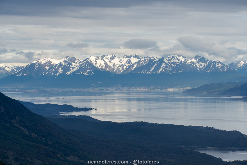
The trail started with a long but not too steep climb up to Cerro Bandera, so named for having a huge Chilean flag near its summit. As there was no wind, the flag was not flying to photograph it with the Beagle Channel in the background, so I moved on with a beautiful view to Laguna Róbalo.
Closer to Laguna del Salto, there were some stretches with a big lateral slope, where a slip on the snow or on soft ground could cause an accident, so I always walked with the poles well firm on the ground.
The day started cloudy, but the clouds dissipated a little and the sun appeared from time to time, allowing me to do good pictures.
Unfortunately, when I arrived at Laguna del Salto I confirmed what I had been told: it was covered by a thin layer of ice. I don’t deny that I had hope that the sunny days would have melted everything, but at least I wasn’t disappointed because that’s what I expected.
Shortly after arriving at the lagoon and pitching the tent, low clouds arrived and blocked the view to the valley and mountains. If the Andean Patagonia is a region where the climate is unstable, here in the extreme south of it I could already see that the climate is even harsher and more unstable, so I could only eat, read and talk with the only hiker who shared the camping area with me until bed sleeping bag time.
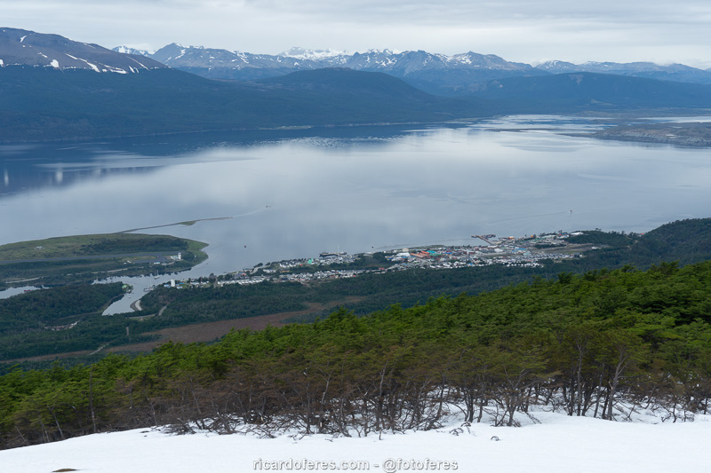
Puerto Williams seen from the climb to Cerro Bandera.
On the other side of the Beagle Channel is Ushuaia, Argentina.
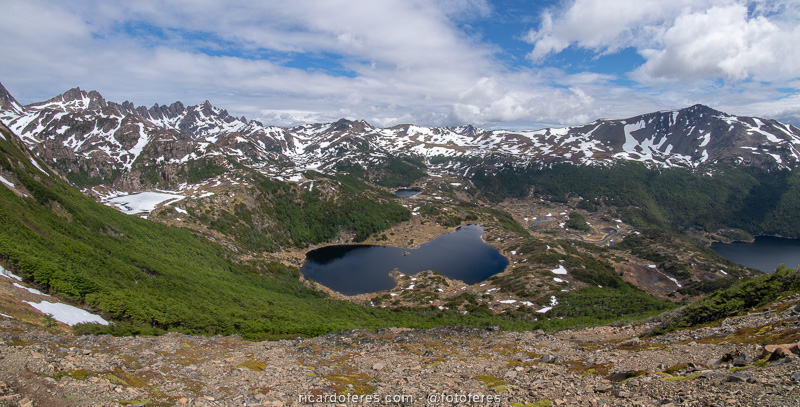
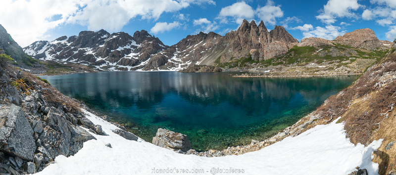
In the center is Laguna Róbalo and, on the left, Laguna del Salto and Dientes de Navarino.

360º photo overlooking Valle Róbalo. Click to open and use the mouse to rotate it.
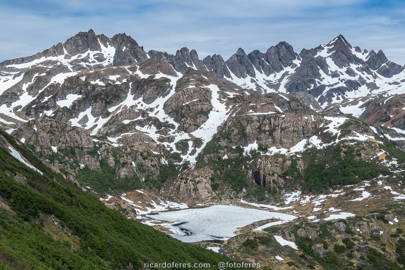
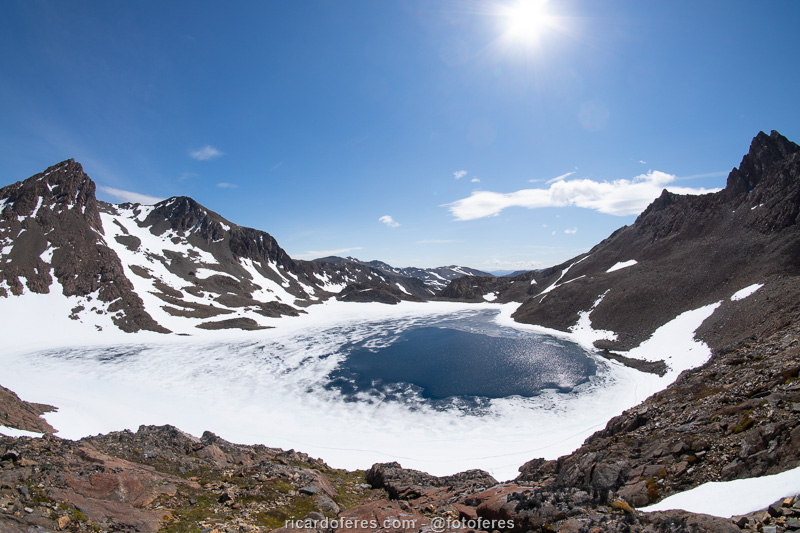
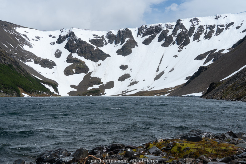
Frozen Laguna del Salto and Dientes de Navarino.
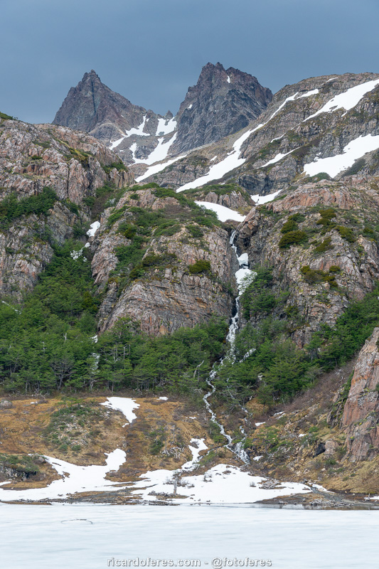
The small waterfall that gives its name to the lagoon.
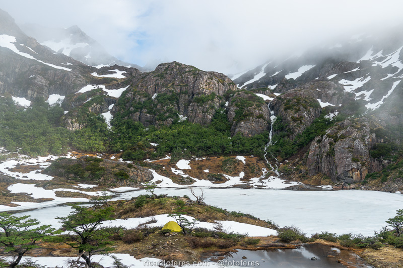
My tent at Laguna del Salto.

360º photo at Laguna del Salto. Click to open and use the mouse to rotate it.
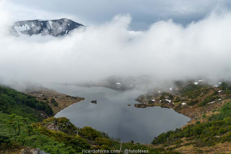
Before long, low clouds arrived and hid the mountains.
Day 2 – Laguna del Salto to Laguna Escondida (11.3 km / 7 mi – Accumulated ascent of 630 m / 2,066 ft)
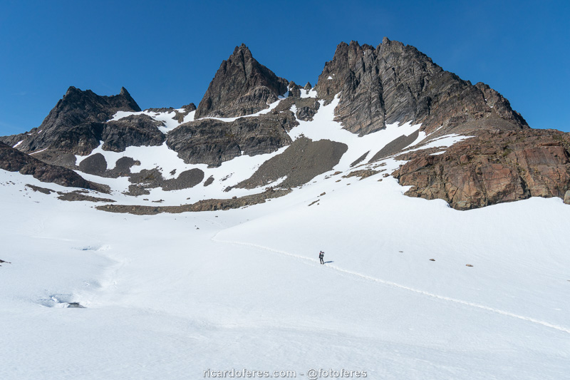
The second day started beautiful, with lots of sun and soon I started the hike, crossing Paso Australia with a blue sky that I haven’t seen in Patagonia for a long time. Arriving on the other side of the mountain, I found Laguna del Paso partially defrosted, which was a good surprise.
Excited by the hope of finding the next lakes with no ice, I arrived at Laguna del Picacho and spent a long time photographing a beaver that, disturbed by my presence, beat its tail in the water in an attempt to scare me away.
Soon after, the sky was overcast and I couldn’t photograph Laguna de los Dientes properly, so I went straight to Laguna Escondida, which had ice only in one part of the lagoon.
I pitched the tent on a beautiful peninsula, well exposed to the winds, but I decided to take the risk because I had an incredible view from the tent. Shortly after, 3 Americans arrived, we talked a little about politics and the environment until I went to sleep, but in the middle of the night I had to move the tent because the wind got too strong and, if it got any worse, the tent would be torn off or it would have the rods broken. I lost the bet for Patagonia!
Self-portrait crossing Paso Australia. This photo is the back cover of the book The Most Beautiful Trails of Patagonia.
Laguna del Paso partially thawed, which filled me with hope for the walk and photo sequence.

360º photo at Laguna del Paso. Click to open and use the mouse to rotate it.
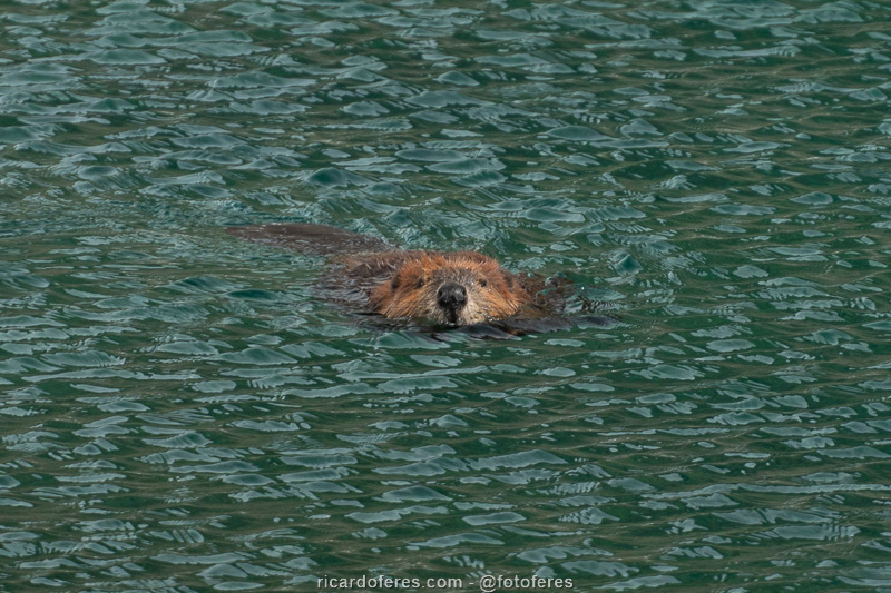
Beaver at Laguna del Picacho.
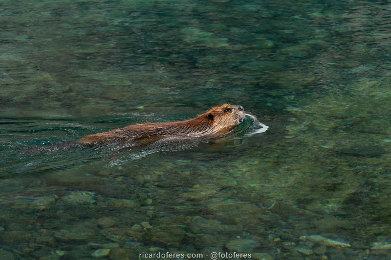
Beaver at Laguna del Picacho.

360º photo at Laguna del Picacho. Click to open and use the mouse to rotate it.
Because of the view, I pitched the tent on this peninsula, but I had to leave at night because of very strong winds.
Day 3 – Back and forth to Cerro Bettinelli (14.1 km / 8.7 mi – Accumulated ascent of 707 m / 2,319 ft)
After breakfast I talked for a while with the Americans, who were a couple, Mary and Manesh, and a friend, Mustafá, who very kindly gave me two hand warmers (a small bag that is placed inside the glove to warm your hands). At first I declined, as I didn’t need it, but he insisted and said he had a lot, so I took it out of politeness. As the day was not good for taking pictures, I decided to go back a little and take the trail to Cerro Bettinelli and, from there, to Lake Windhond. This lake didn’t really appeal to me, but since I can’t continue my work, it would be nice to hike just for fun, without having to think about the pictures.
When I reached the top of Cerro Bettinelli and was about to begin the descent to the lake, I didn’t feel like going on. The weather was bad, the lake did not look attractive and, worse, the way back to Puerto Williams would be through a valley without beautiful views and with many puddles. I changed my mind once more and started the way back to Laguna Escondida, enjoying the freedom of being alone and being able to change plans as many times as I wanted. For those who are doing the Dientes de Navarino Circuit, I recommend the side trip to the summit of Cerro Bettinelli, on the second day, thus having a beautiful view of both the sea and the mountains.
When I arrived at Laguna de los Dientes, I sat down and read to see if at some point it would be sunny and I could take pictures, but instead it started to rain. I put the poncho on top of me and the backpack and stayed there for more than one hour, when not only did it stop raining, but it was sunny and I was finally able to photograph the lake the way it deserves.
As soon as I finished, I walked very fast to Laguna Escondida to photograph it, and today I did what I wanted, as the lagoon was beautiful and was, without a doubt, my favorite spot on this circuit.
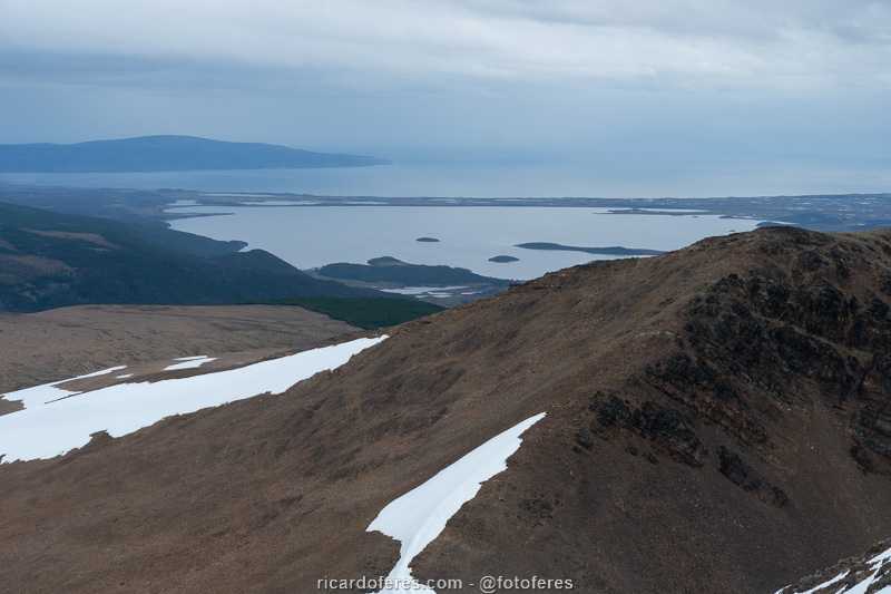
View from Cerro Bettinelli to Lake Windhond and, beyond, the sea towards Cape Horn.
Laguna de los Dientes.

360º photo at Paso de los Dientes. Click to open and use the mouse to rotate it.
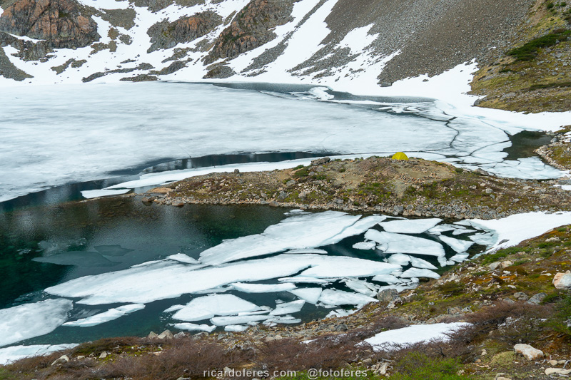
Laguna Escondida and Dientes de Navarino.

360º photo at Laguna Escondida. Click to open and use the mouse to rotate it.
Day 4 – Stuck at Laguna Escondida
On the second night at Laguna Escondida there was light rain and wind, but when I woke up I saw that it wasn’t rain, it was snow, a lot of snow! Anyway, I didn’t even think about hiking and, as I had food for two extra days, I didn’t have to ration meals. I just kept thinking about the 3 Americans who, that day, would cross Paso Virginia, the last mountain on the circuit and which can be difficult to cross when there is a snowstorm with a possible whiteout, leaving everything completely white and making it impossible to differentiate what is ground from what is air.
I spent the whole day in the tent, leaving only to remove the snow that was accumulating and to place stones around the tent, in an attempt to prevent snow from entering the tent under the roof. I spent hours reading on my Kindle, watching movies downloaded from Netflix and, when the strongest gusts came, I held the poles because the roof of the tent was touching my face. As you can imagine, it was one of those days when the hours don’t pass.
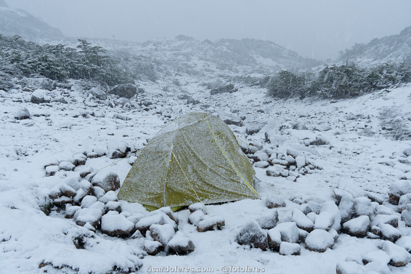
Even in the height of summer it can snow a lot on Navarino Island.
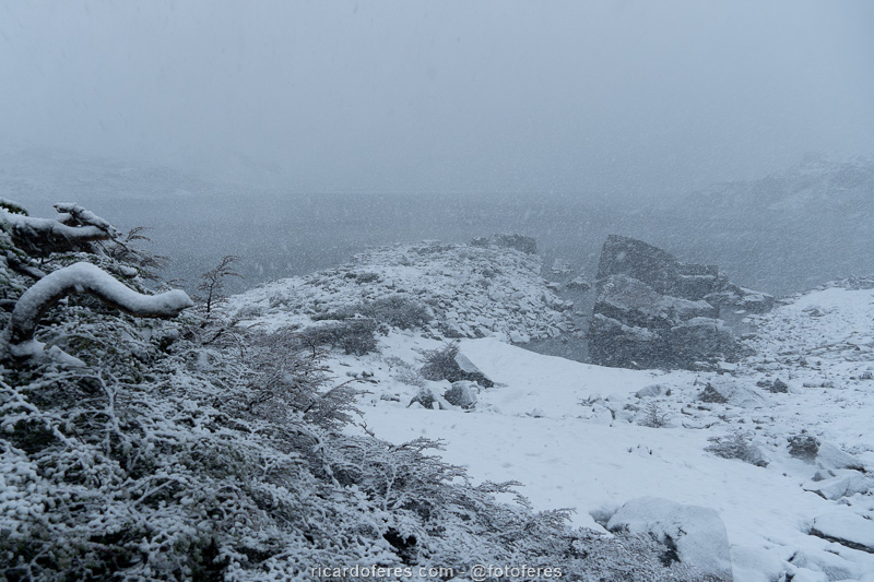
Laguna Escondida (Hidden Lagoon) doing justice to the name, now hidden behind the snow.
Day 5 – Laguna Escondida to Puerto Williams (21.7 km / 13.5 mi – Accumulated ascent of 979 m / 3,211 ft)
I woke up shortly after 4:00 am and since it wasn’t raining or snowing, I decided to move on because I had already been inside a tiny tent for 36 hours and wanted to spend some energy. At 09:00 I was already at the first camping point and I went to the next one, which I reached at noon. So I wanted to do the 3 sections in the same day, heading straight to Puerto Williams, on a long walk but, as I had already done several trails since the beginning of the trip, I was in good shape.
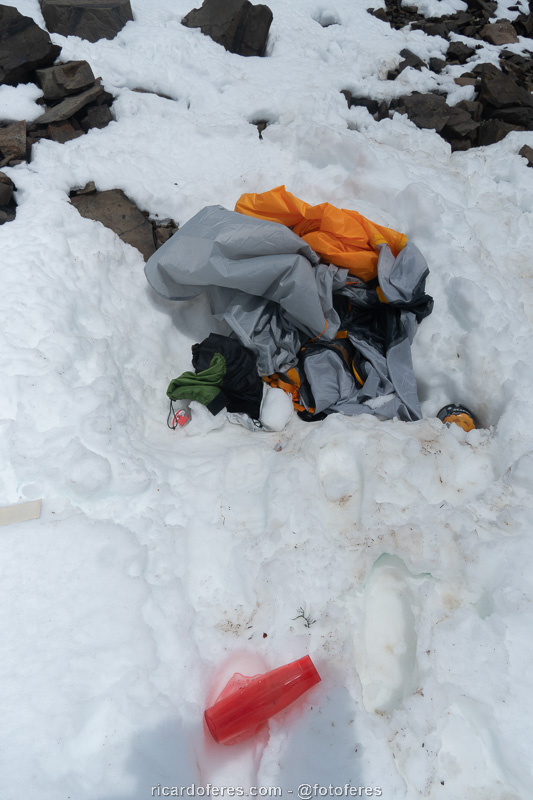
Upon reaching the top of Paso Virginia, I started walking on the snow and realized that it wasn’t firm on the rocks, below there were big holes, so I decided to go back but, shortly after, I sank one leg into a hole and the only reason I didn’t fall anymore was because I held on with my arms. I got up and went very carefully to the area without snow, but just before reaching the rocks I found a tent, a stove, a wool sweater and other equipment. “How did these things get here?” I thought. The tent was new and seemed to belong to the American couple, as well as the pink bottle and the blouse must have belonged to Mary. I looked to see if there was a name engraved on any equipment, but I couldn’t find it, so I collected everything and took it to the stretch without snow, placing stones on top so that they wouldn’t fly away. I thought about taking it to the city, but in case there was an accident, it would be better to leave things there to make it easier to understand what happened.
I started the descent and shortly afterwards I saw a big hole in the snow with a bag on the outside, so I figured the hole could have been made by someone falling and that they had thrown out the bag to signal their location. On the other hand, there were 3 Americans, if someone got into an accident there were other people to help or call for help.
I followed the trail, but I couldn’t stop thinking that something had gone wrong with them, so when I got to Laguna los Guanacos, instead of taking the right trail, I took the old path, which is poorly marked but shorter. Luckily, when I reached the road, the first car that passed gave me a ride, avoiding a 7 km walk on the asphalt. As soon as I got in the car and told them I had done the circuit, they told me that an American was missing and, involuntarily, I taught them a few bad words in Portuguese. I asked to be dropped off at the Carabineros, I showed the police the photos of the equipment and the location and offered to go the next day to show them the exact spot, since it was getting dark and I didn’t have strength to go up Paso Virginia again
Mary had left the island, but Manesh, her boyfriend, was staying at the Carabineros and told me that, on the day of the snowstorm, they were in the middle of a whiteout, which is a climatic phenomenon that prevents the ground from being able to differentiate in the air, there are no shadows or visual references, causing great disorientation. Anyway, Mustafa was walking through the snow without being able to see and fell into a hole. As it was not possible to climb back, he continued in the direction he was walking earlier, while the couple, afraid of falling too, curled up in the tent and called for help through the Garmin inReach satellite communicator. The Garmin US team contacted the Carabineros, and within hours, rescuers reached the summit of Paso Virginia, taking the couple down. Since they couldn’t see or hear anything from Mustafa, they slept in the city to continue their search the next day.
I didn’t understand how Mustafa managed to walk inside a hole and I imagined that he had fallen into a crevice, since, in that stretch, I had also sunk a leg up to the groin and, when I got up, I saw that there was a hole with more than 2 meters deep and a few meters wide. In my mind, Mustafá fell in the same place and, as he couldn’t go up, he kept walking until he fell on the next stretch, opening the hole in the snow that I photographed on the way down the pass. The only certainty I had was that I had the hand warmers and he was in the snow, how many times did he regret having given me this?
I left my contact with the Carabineros and Manesh and finally went to the shower, eat and rest so I could go up the next day with the rescue team. Fortunately, a few hours later a policeman wrote to me saying that the missing man had arrived in the city on his own! Relieved that I didn’t have to go back to the trail the next day and happy that Mustafá was fine, I slept peacefully and met the Americans the next day while we waited for the boat that connects Navarino Island to Ushuaia.
Everything made more sense when Mustafa said that, in fact, he didn’t fall into a hole or crevasse, he fell from the edge of Paso Virginia, but since everything was completely white because of the whiteout, for Mary and Manesh the impression is that he was in a hole. Being impossible to climb back, he walked until he reached the stretch of land and descended into the woods, where he pitched his tent and spent the night. The next day he continued downhill, not knowing where the trail was, since only Manesh had the GPS, but at the end of the day he reached the road, went on to the city and, of course, gave interviews to the local newspapers because he was the subject of the conversations on the island.
For me, this story served to reinforce the importance of having a satellite communicator, especially one that lets you send text messages, not just a SOS call that doesn’t explain what’s going on. I know it is not very cheap, but while a couple was rescued a few hours after asking for help, the person who didn’t have the communicator spent the night on the mountain and just didn’t have bigger problems because, for example, he didn’t break a leg in the fall. I also usually take a little more food than is necessary, just in case an emergency prevents me from returning in the planned time or so that I can stay camped out waiting for the weather to improve. Yes, having more weight on my back is not pleasant, but having the freedom to arrive a day or two later than planned is worth the effort, life is too good to risk because of an extra kilo on my back and a few money less on the wallet.
View from Paso Ventarrón.
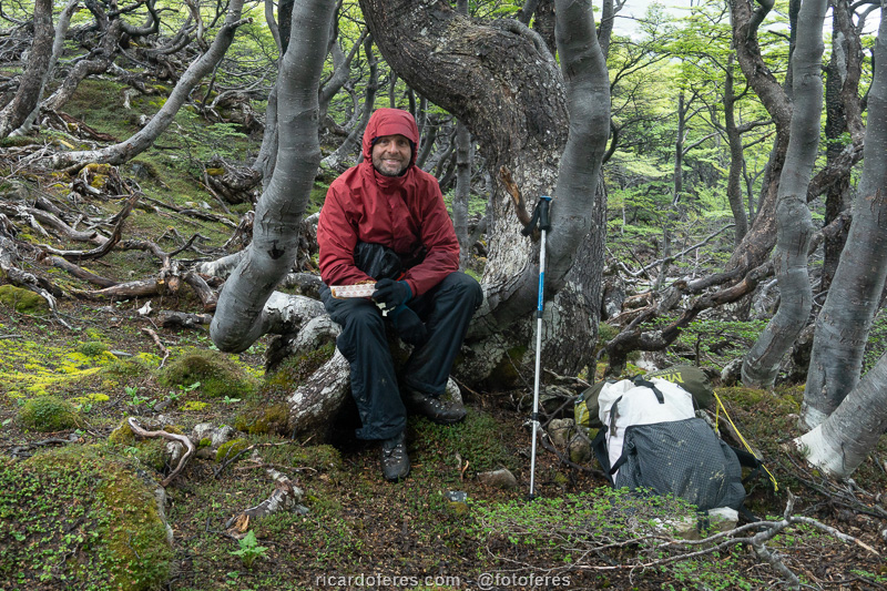
Break for a snack, enjoying the break in the rain.
Equipment I found at the top of Paso Virginia.
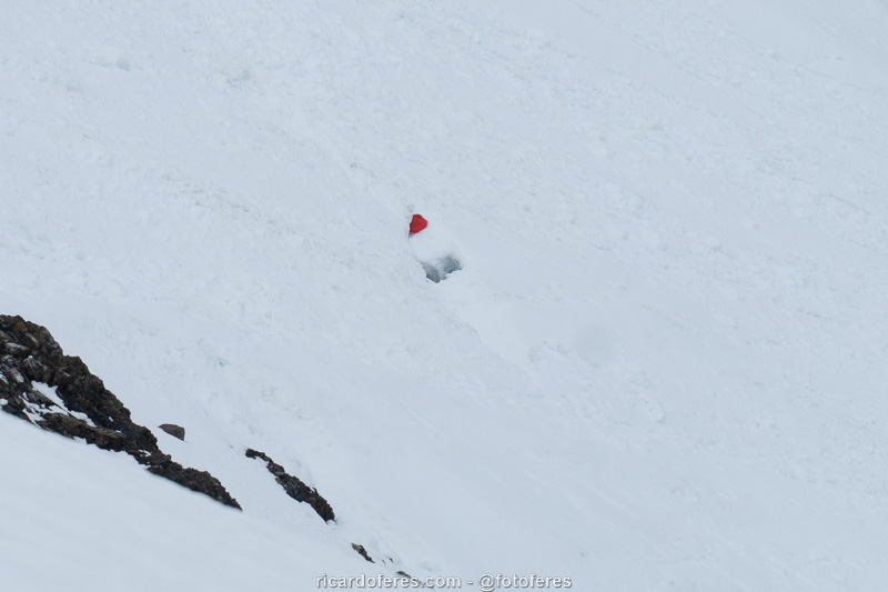
Hole in the snow the width of a person and a bag outside.
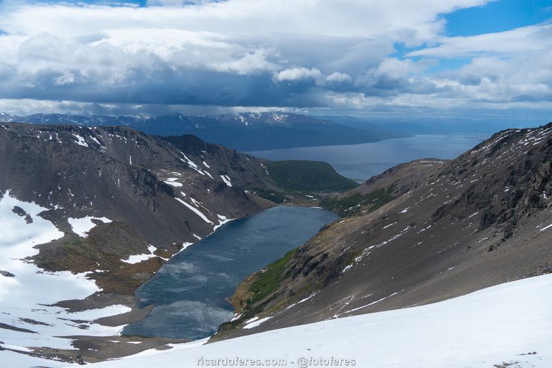
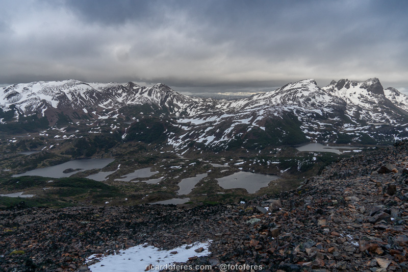
Laguna los Guanacos and Beagle Channel seen from Paso Virginia.
Paso Virginia seen from Laguna los Guanacos.

360º photo at Laguna los Guanacos. Click to open and use the mouse to rotate it.
Get to know the photo book "The Most Beautiful Trails of Patagonia"
Torres del Paine, El Chaltén, Bariloche, Ushuaia, Villarrica, Cerro Castillo, Dientes de Navarino and Parque Patagonia