Get to know the photo book "The Most Beautiful Trails of Patagonia"
Torres del Paine, El Chaltén, Bariloche, Ushuaia, Villarrica, Cerro Castillo, Dientes de Navarino and Parque Patagonia
Colonia Suiza – Pampa Linda Traverse, Bariloche, Argentina – Hiking report
Overview
The Nahuel Huapi National Park, in Bariloche, has dozens of trails with the most varied degrees of physical and technical difficulty, being an excellent destination both for beginners and for those who already have a lot of experience. After researching all the trails, three stood out and as they intersect, it is possible to put them together to assemble a great hike made in 8 or 9 days, with 105 km (65 mi) of distance and almost 8,000 meters (26,250 ft) of accumulated ascent. This itinerary with 105 km is what was published in the book The Most Beautiful Trails of Patagonia, but in this article I will describe my experience doing the Colonia Suiza-Pampa Linda traverse, ending with the ascent to Refugio Otto Meiling, on Cerro Tronador, and the waterfalls of Castaño Overo Glacier. The hike reported here is 92 km (57 mi) long, has 5,300 meters (17,400 ft) of accumulated ascent and is done in 5 or 6 days. I did it in 5 because I wanted to take advantage of a good weather window to photograph, but I would have liked to have done it with one more night, to also sleep in Laguna Negra.
To see the report of 4 Refugios Traverse, which I did a few days later, when the weather improved again, click here.
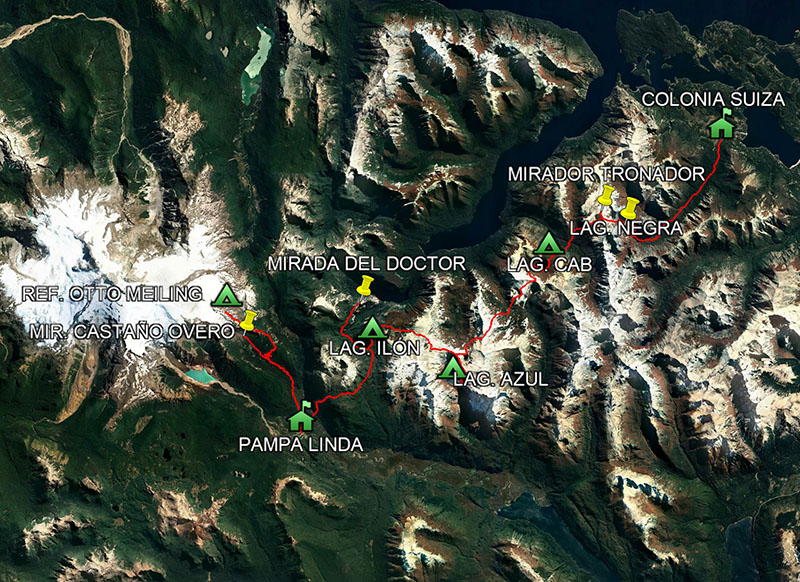
Map of Colonia Suiza-Pampa Linda Traverse, including Refugio Otto Meiling and the waterfalls of Castaño Overo Glacier.
Base City
San Carlos de Bariloche, known only by its last name, has 130,000 inhabitants and is the third city that receives more tourists in Argentina, after Buenos Aires and Mar del Plata. As Bariloche has an airport, it is easy to get there, usually doing a stopover in Buenos Aires.
Regarding to the hotels, there are options for all budgets, from campsites to 5-star resorts, such as the famous Llao Llao. I stayed in 3 different accommodations in my trips and I liked them all, below are the names ordered from the cheapest to the most expensive, click to open the sites:
–Camping Selva Negra
–Hostería La Pastorella
–Hotel Tirol
There are also a huge amount of restaurants, I went to several and the ones I recommend are below, click to open the websites:
–La Marmite
–Familia Weiss
If you want to buy candies, nuts and dried fruits in bulk, look for Repostería Almendra, which has more options than the markets and prices are lower.
It is faster to go to Bariloche by plane, but if you can go by car, you will have beautiful views along the way.

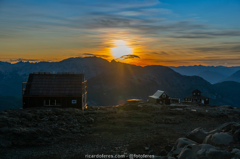
Sunset and Bariloche seen from Cerro Otto.

In summer, Argentines enjoy the beaches of the many lakes around the city.
Best season
From January to March the climate is drier and the trail is usually completely free of snow. From April to December it is mandatory to hire a guide accredited by the national park.
Costs
Admission to Nahuel Huapi National Park is free, but you have to pay to camp at Laguna Ilón, Refugio Otto Meiling and, if you are going to spend the night at Laguna Negra, you have to pay too.
If you are entering the national park through Pampa Linda, there is a fee, but to enter through Colonia Suiza, as described here, there is no.
Trail signs
In the forest stretches, only one place is poorly signed, just before reaching Laguna CAB. In the sections where you walk on rocks, you have to be attentive to find the markings, I saw several people taking the wrong path because they weren’t paying enough attention or didn’t have a good map/GPS.
Tracklog for GPS
Click here to open my Wikiloc page and download this route to use in your GPS.
Report
Day 1 – Colonia Suiza to Laguna CAB (21.3 km / 13.2 mi – Accumulated ascent of 1,651 m / 5,121 ft)
Despite the forecast saying that the day would be cloudy, I decided to start the traverse anyway. Luckily, the forecast was wrong and the sky was clear, how good it is when the error happens in my favor!
The trail to Laguna Negra almost always goes through a forest, following the river. At the beginning there are some rapids and then there is a beautiful waterfall, until the trail gets steeper and there is a view to the mountains.
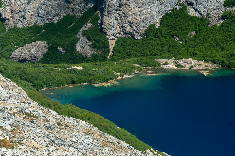
Laguna Negra is beautiful and very popular with those who want to spend a few days camping, swimming and sunbathing. As it was early, I moved on, walking always above the tree line, until I reached Laguna CAB, also known as Laguna Lluvu. As the lagoon was very full, I had to take off my sneakers (the boots were at the cobbler) and walk through the water to get to the other side, as I didn’t want to do this the next morning. I went around the left bank and, hours later, someone who decided to go around the lagoon on the other side fell into a hole and got soaked. Everything but pride got wet, as he arrived at the campsite as if nothing had happened.
Laguna CAB has no shelter and is not as beautiful as Negra, which means that it has far fewer people. Here I met two Argentines, Federico and Matías, both very friendly. Then a group of 6 people arrived and it was hard to sleep because they made a lot of noise, there are many people who think that tents are noise proof.
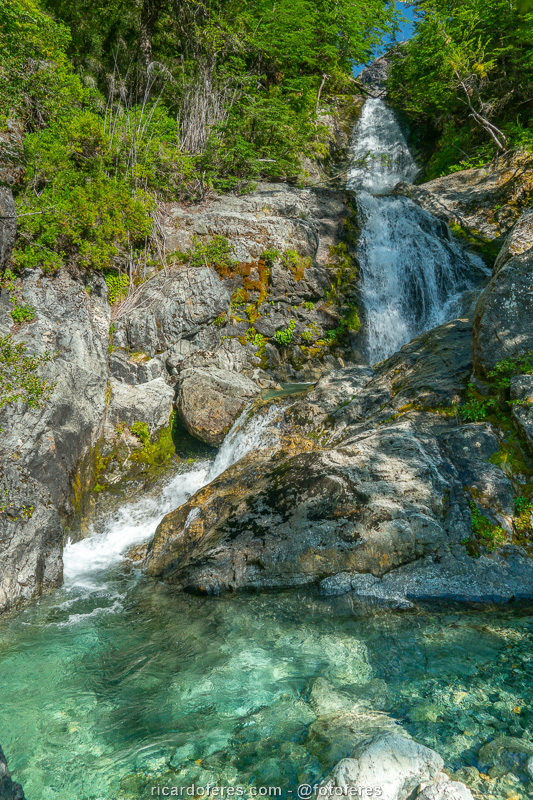
Waterfall on the trail to Laguna Negra.
The trail goes through the valley until it goes up to the lagoon, where I took this photo.
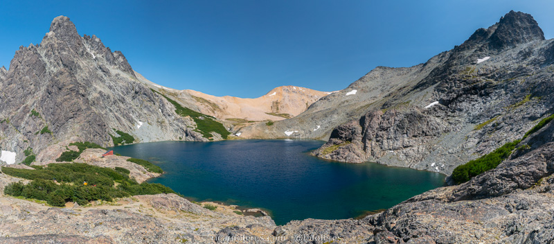
Laguna Negra and, on the left, Refugio Italia.

Refugio Italia and Laguna Negra.

360º photo of Laguna Negra and Refugio Italia. Click to open and rotate sideways with the mouse.
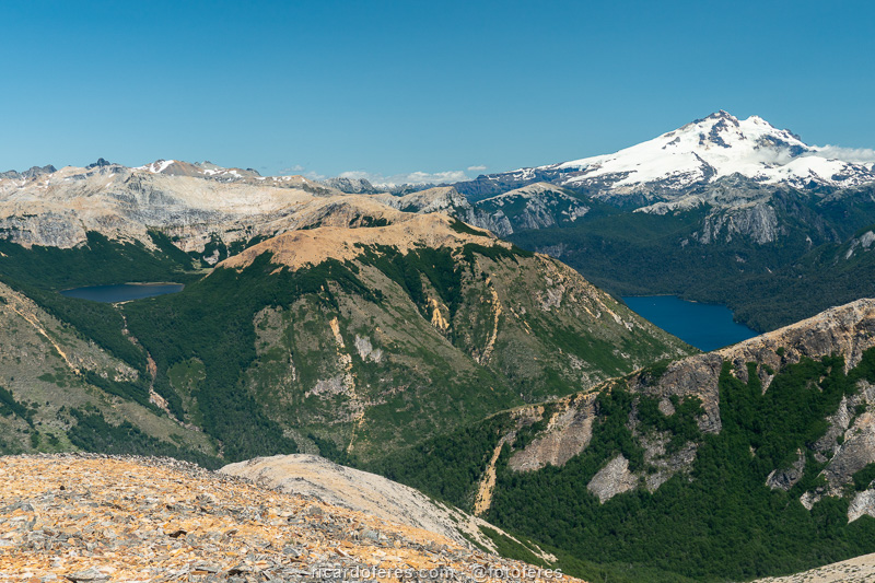
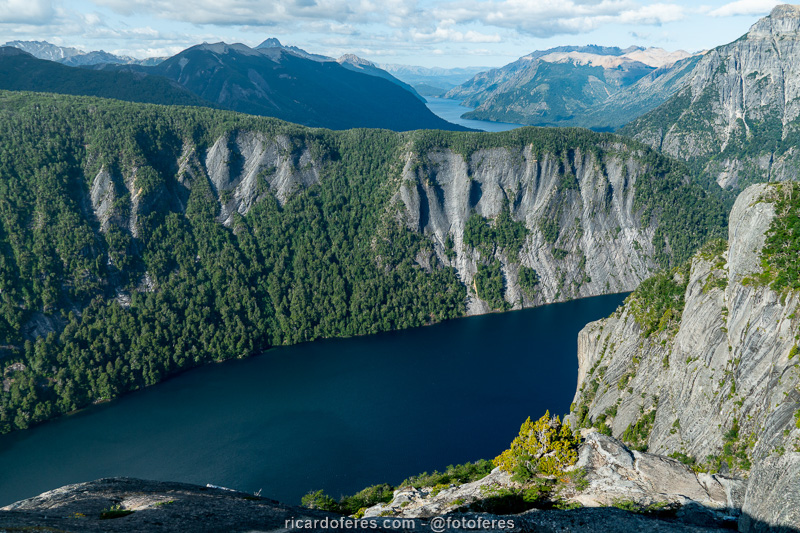
On the left side is Laguna CAB, where I spent the first night. On the right side is Cerro Tronador, where I spent the fourth night, and in front of it is Brazo Tristeza on Lake Nahuel Huapi. Photo taken at Paso Cerro Negro, which is not part of Colonia Suiza-Pampa Linda Traverse, but is a short walk that is worth the view.

360º photo of Paso Cerro Negro. Click to open and rotate sideways with the mouse.
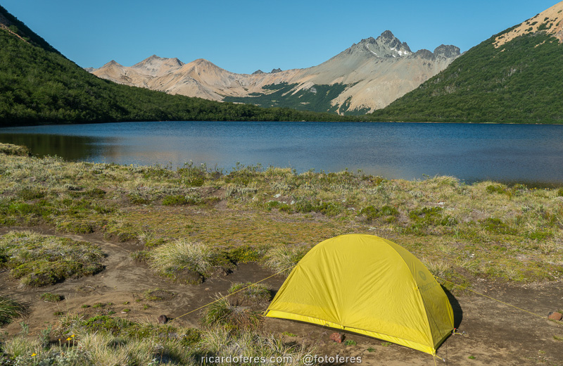
My tent at Laguna CAB.
Dusk at Laguna CAB.
Day 2 – Laguna CAB to Laguna Azul (13.9 km / 8.6 mi – Accumulated ascent of 1,142 m / 3,746 ft)
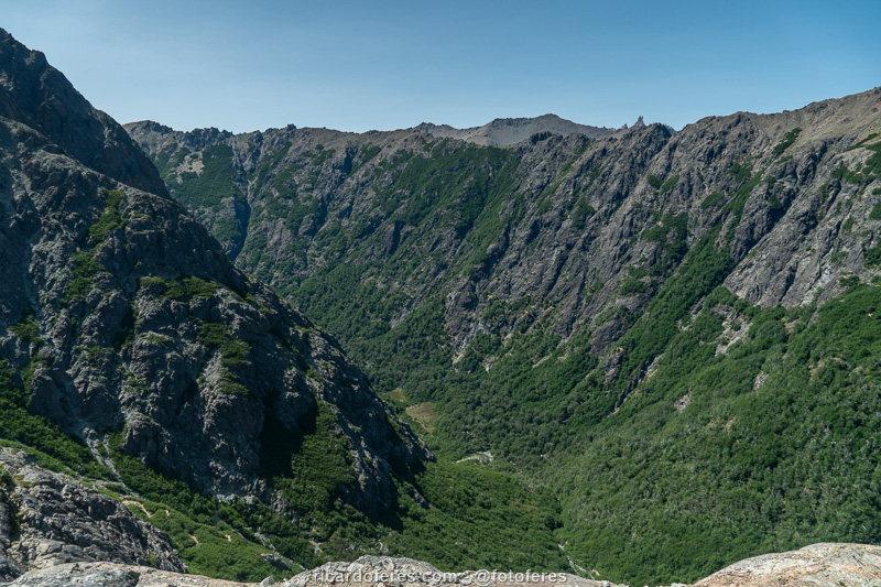
Another day that started with a blue sky and early in the morning I left towards Laguna Cretón. The trail starts with a steep climb and, when I reached the top of Paso CAB and could start the descent, I decided to climb to the summit to have a view of Cerro Tronador and the lagoon, but the attempt was unsuccessful as there are hills blocking the view.
As after Laguna Negra, the hike here also takes place above the tree line, which makes the view always interesting. As for Laguna Cretón, this one is not so interesting and, as there was still time, I went to Laguna Azul.
Before arriving at Laguna Azul camping area, I had one of the most beautiful views of the 6-month trip, from a lookout point that shows the lake with such a deep blue that, in the photos, people always ask if the color is real or it’s Photoshop. Believe me, it’s real and unforgettable, this lake is one of the three most beautiful in all of Patagonia, in my opinion.
I camped away from other people and, for the first time in 4 months in Patagonia, I woke up covered in sweat and had to open my sleeping bag a little, since the minimum was 9° C (48° F), and I was sleeping almost every night below 0° C (32° F).
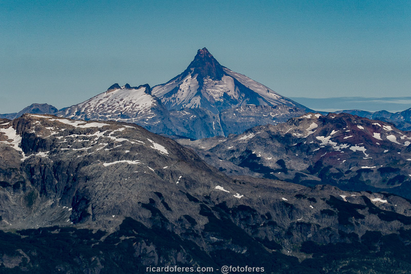
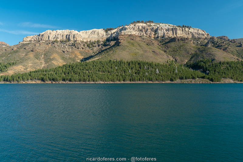
Puntiagudo Volcano, in Chile.
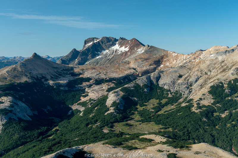
The trail descends to Mallín de las Vueltas and ascends to cross the pass on the right side of the photo.
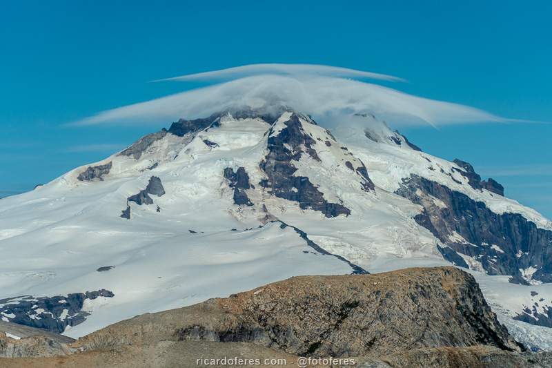
Lenticular cloud over Cerro Tronador.
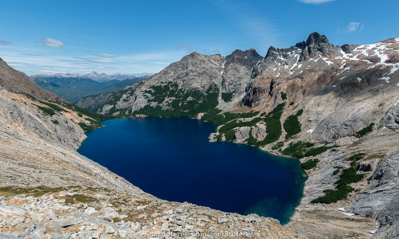
Laguna Azul, one of the most beautiful in all of Patagonia.
The Laguna Azul camping area is among the trees, well protected from the wind..

The crystal clear water of Laguna Azul.
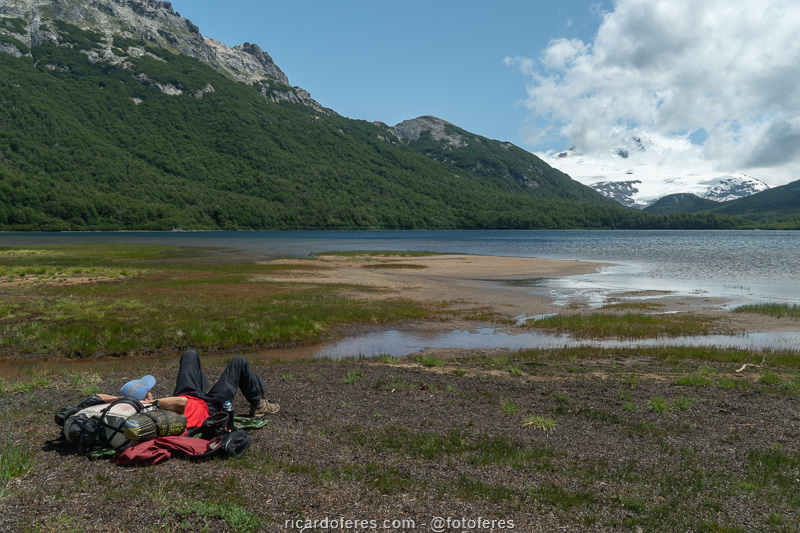
Day 3 – Laguna Azul to Laguna Ilón (19.1 km / 11.8 mi – Accumulated ascent of 1,012 m / 3,320 ft)
I woke up at 05:30, but as the weather was bad, I went back to sleep. I got up at 7:30 am and left towards Laguna Ilón, with cloudy weather. Good thing I had already taken pictures of Laguna Azul because with the lack of sun it is not so impressive.
When I was at the viewpoint of Laguna Azul again, I met Federico and Matías and we walked together to Ilón, which is not as beautiful as Azul, but faces Cerro Tronador and has a good beach for swimming.
At the end of the day, the Argentines invited me to go to Mirada del Doctor, which has an incredible view of Lake Frey, and when we got back, they invited me to eat cream soup with pasta. At first I refused, as I wouldn’t have anything tasty to contribute, but since they didn’t have bread and I had a lot, it wasn’t a very unfair exchange.

Laguna Ilón.
View from Mirada del Doctor.
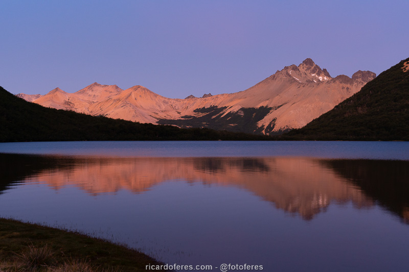
Waiting for the sunset and the clouds move away from Cerro Tronador.

The wait paid off as I had this beautiful sunset.
Day 4 – Laguna Ilón to Refugio Otto Meiling (21.6 km / 13.4 mi – Accumulated ascent of 1,302 m / 4,271 ft)
That night everything returned to normal and the temperature was again below 0 C (32 F). I woke up before sunrise, which I photographed with the lagoon and Tronador in the background, and left right after towards Pampa Linda, the end of Colonia Suiza-Pampa Linda Traverse, also called 5 Lagunas Traverse. However, as I had planned to extend this hike, I went to Refugio Otto Meiling, a very long climb to a shelter and camping area on Mount Tronador.
After finding a good spot for the tent, overlooking the summit, I went out to take pictures and saw a skier walking up the glacier and skiing down. Afterwards, I saw this person in the camping area and I was impressed to realize that he was a gentleman around 75 or 80 years old, amazing!
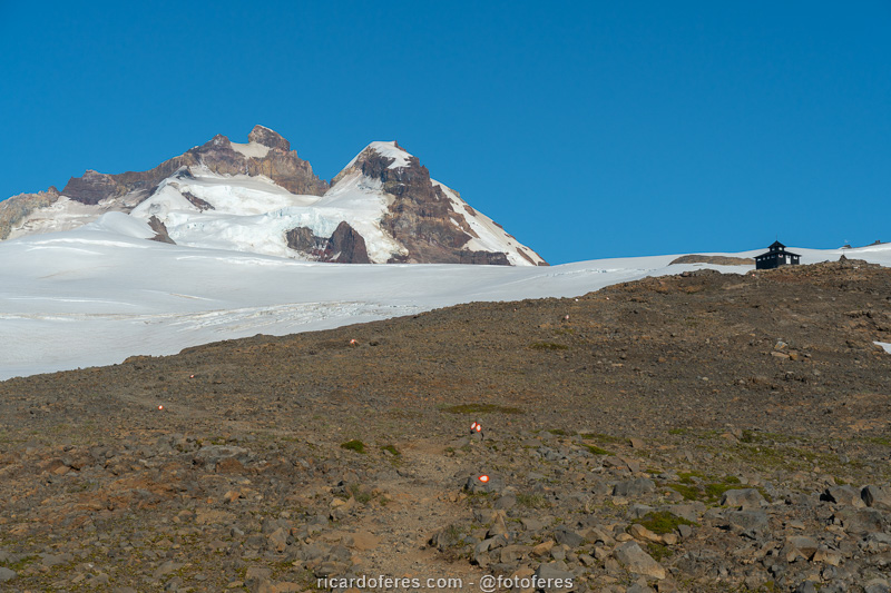
Arriving at Refugio Otto Meiling, on Cerro Tronador.
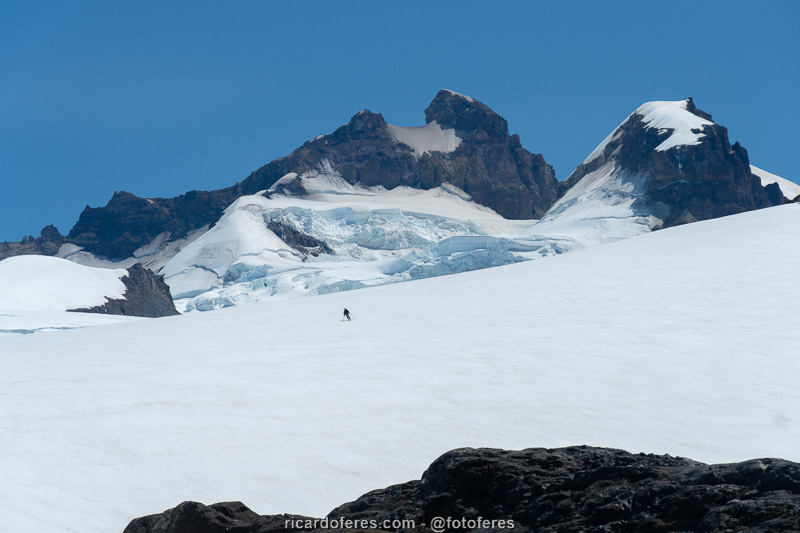
Skier at Cerro Tronador.
Day 5 – Refugio Otto Meiling to Pampa Linda (15.8 km / 9.8 mi – Accumulated ascent of 201 m / 659 ft)
Once again I had a beautiful sunrise and, after taking some photos, I went to the base of Castaño Overo Glacier to photograph the waterfalls formed by the melting ice, which are 120 meters (400 ft) high. So I went back to Pampa Linda and took the van to Bariloche, where there was just me and one other customer, who asks me:
-Did you see what is happening in China?
-I didn’t see anything, I’ve been in the mountains for days.
-They are closing entire cities because of a virus, that’s madness.
-Oh, okay.
I didn’t even care about this issue and thought “China is far from Patagonia and must be media sensationalism again”. I wish what I thought was true and we didn’t have to go through a damn pandemic!
In the city, I took a bus to the campsite, but the only way to pay was with a city card, which I didn’t have. An Argentine noticed, paid for my ticket and, very kindly, did not accept that I paid him in cash, in another proof of the great Argentine hospitality.
Sunrise on Cerro Tronador.
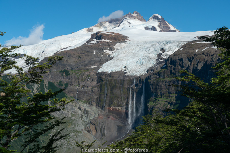
Castaño Overo Glacier, on Cerro Tronador.
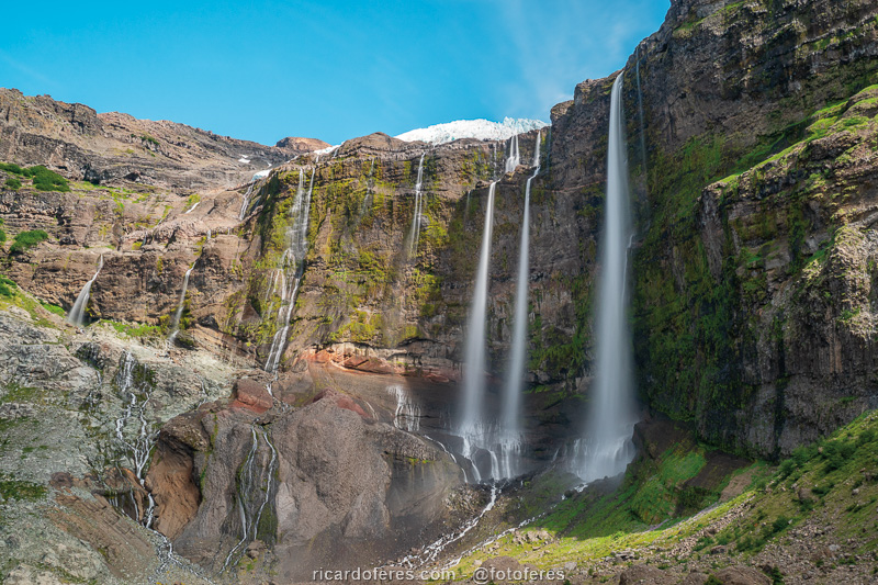
Waterfalls on the Castaño Overo Glacier.
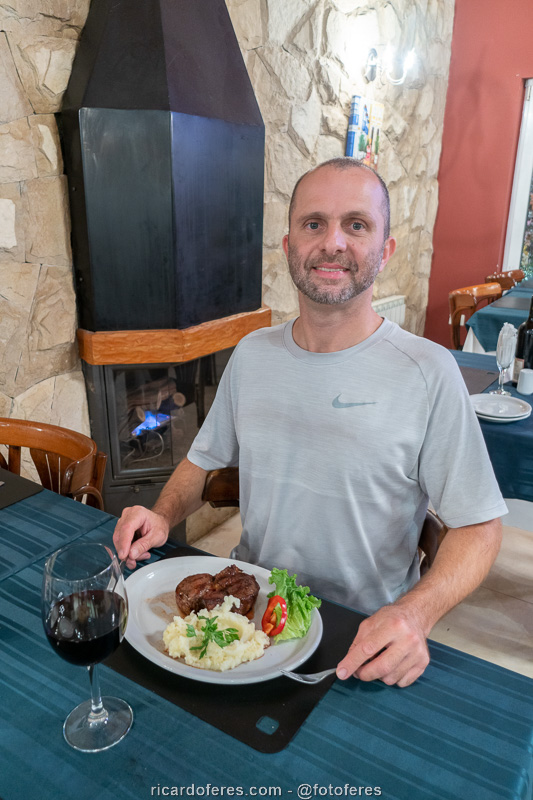
Trail and photos finished, time to celebrate.
Get to know the photo book "The Most Beautiful Trails of Patagonia"
Torres del Paine, El Chaltén, Bariloche, Ushuaia, Villarrica, Cerro Castillo, Dientes de Navarino and Parque Patagonia