Get to know the photo book "The Most Beautiful Trails of Patagonia"
Torres del Paine, El Chaltén, Bariloche, Ushuaia, Villarrica, Cerro Castillo, Dientes de Navarino and Parque Patagonia
W Circuit, Torres del Paine, Chile – Hiking report
Overview
Considered one of the best hiking destinations in the world, Torres del Paine has two routes that are becoming more popular every year: the O Circuit and the W Circuit, which is part of the O and covers most of the most beautiful landscapes.
Located in the south of Chile, the National Park was created in 1959 and, in 1978, declared by Unesco as a Biosphere Reserve. In its 181,000 hectares there are several trails for one day, in addition to areas that can be visited by car or boat, making the park accessible to anyone, from those who like to spend several days camping to those who want to travel in comfort.
Despite not having high altitudes, winter is quite rigorous and even in summer it is possible to snow, although it is not very common. What is common, when it comes to the climate, is that there are big variations in a short time and strong winds, which can make the thermal sensation drop below freezing even during the day.
I had done the O Circuit in 2011 and already had enough photos to use in the book The Most Beautiful Trails of Patagonia, but of course I couldn’t drive near the park and not go in to do the trail again, in addition to doing day trails that are out of circuits. Unfortunately, I wasn’t able to book all the campsites for O Circuit, as you now have to do this well in advance, but I managed to book for W Circuit, the most popular.
To see the article of when I did the O Circuit, click here.
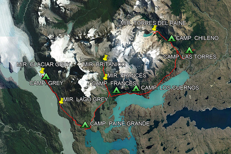
Map of W Circuit with possible overnight places. In total, there are 62 km (39 mi) of distance and 3,800 meters (12,500 ft) of accumulated elevation.
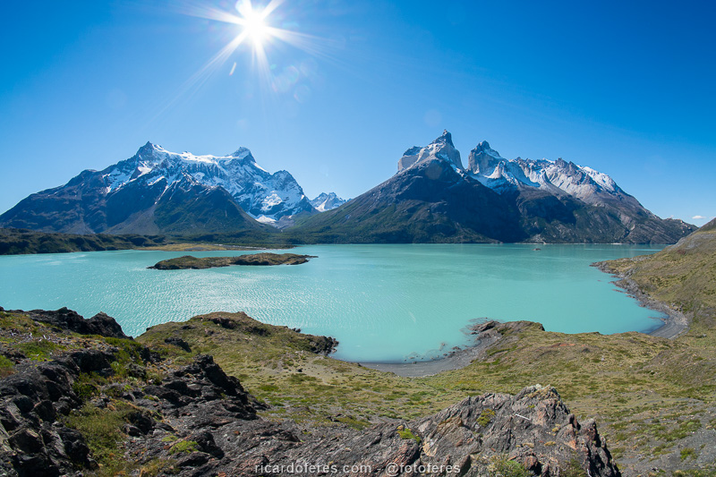
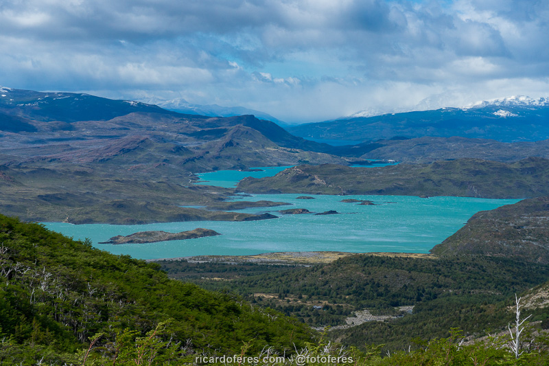
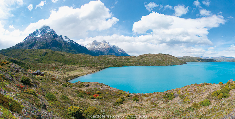
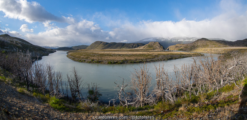
Lake Nordenskjöld, Paine Grande (left), Valle del Francés (center) and Cuernos del Paine (right). The trail passes between the mountains and the lake..
The buildings on the left side of the photo are from Camping Pehoé, a beautiful place to spend at least one night, before or after your hike.
Best season
The season runs from October to April, when it is allowed to do the entire trail without a guide. However, looking at historical climate data, it is easy to see that December and January are the months with the most cloudy days throughout the year.
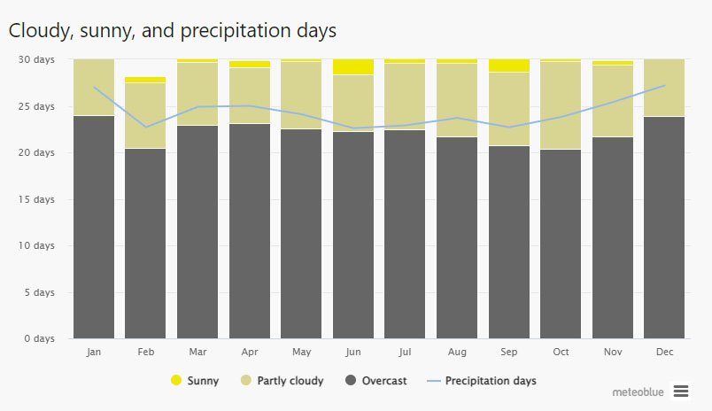
Graph taken from the Meteoblue website, click on the name to open the page.
Costs
Being such a famous and popular destination, you can understand why the costs in Paine are the highest in Patagonia. Entry only for foreign adults staying more than 3 days, costs US$49.00 (value for 2023).
To sleep, you also have to pay and there are 3 options: the cheapest is taking your own tent, but there are few spaces for those who travel that way. The second cheapest is renting tents in the camping areas, walking with less weight. The most expensive is sleeping in shelters, but prepare your pocket because the cost is quite high. The overnight areas are managed by two different companies, Vertice and Las Torres Patagonia, click on the names to open their websites.
If you bring your own food, there will be no costs inside the park, but if you want to hike light, it is possible to have dinner in the shelters and, as you can imagine, the cost is high, so check with the administrators using the links in the paragraph above.
Trail signage
The trail is well marked, it is not necessary to use GPS. But if you want, below is the route.
Tracklog for GPS
Click here to open my Wikiloc page and download this route to use in your GPS.
Report
Day 1
After spending eight days at the Pehoé Lake campground doing one-day hikes, photographing and looking for pumas, the day of my reservation arrived to start the circuit.
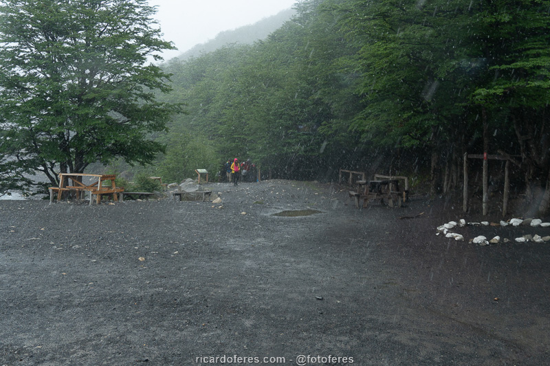
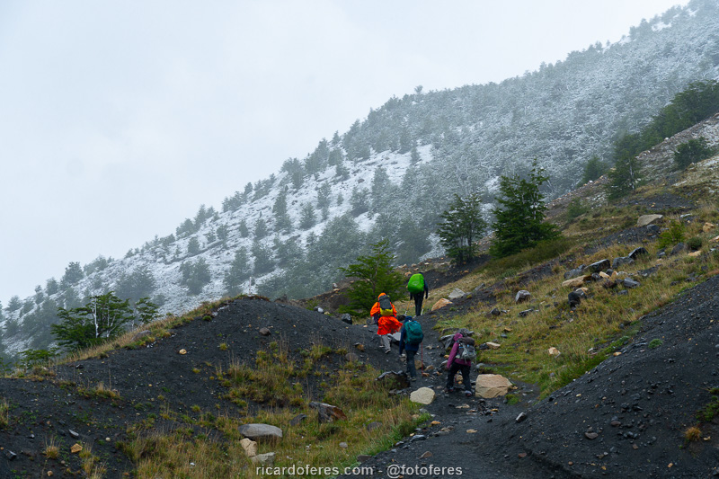
The climb to Chileno campsite was without rain, but with cloudy weather, as it was for almost all the 15 days I spent in the park.
When I arrived at Paso de los Vientos, the wind was very strong (the name Winds Pass is not for nothing) and I found two women sitting on the ground, afraid of being thrown down the hill. One decided to go back on all fours, while the other I carried holding her backpack, until the strongest wind passed.
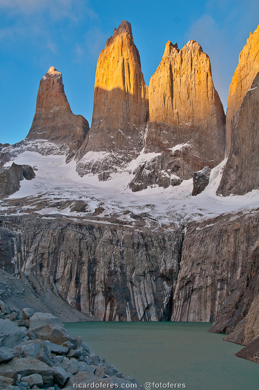
Upon arriving at the Chileno camping and shelter area, I decided not to go up to the base of the Torres as they were hidden by the clouds, so I thought it best to do this at dawn the next day to see them at sunrise.
I spent the end of the afternoon reading and talking with a Mexican woman I met at Lago Pehoé camping site and who ended up accompanying me on the first 3 days of the hike.
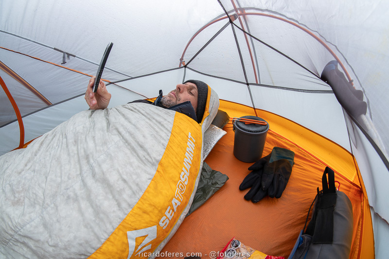
At Chileno camping, cooking is not allowed, so either you eat something you brought ready, like a sandwich, or you pay the price they charge. To disguise this annoying rule, they give you boiling water in case you want to make pasta, but they don’t allow you to wash the dishes used for cooking, that is, they mistreat of you one way or another.
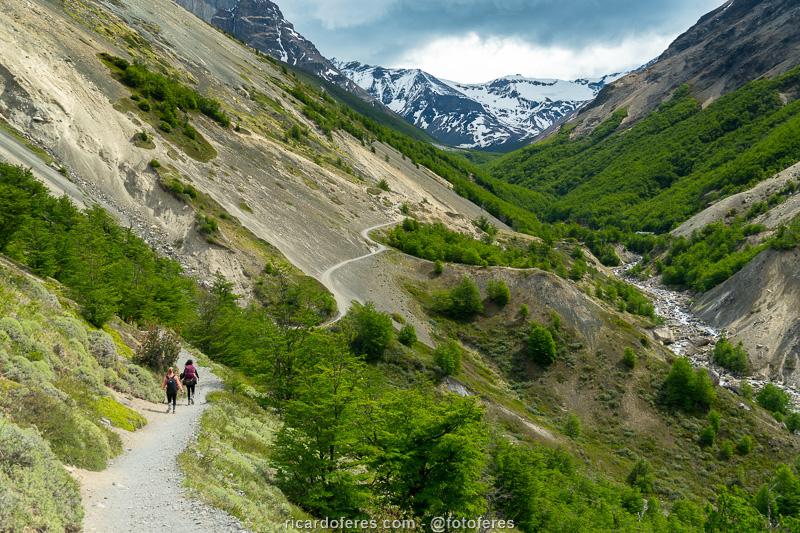
Trail that leads to Chileno camping.
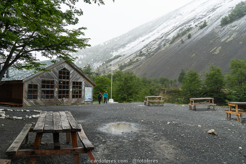
Chileno camping area and shelter.
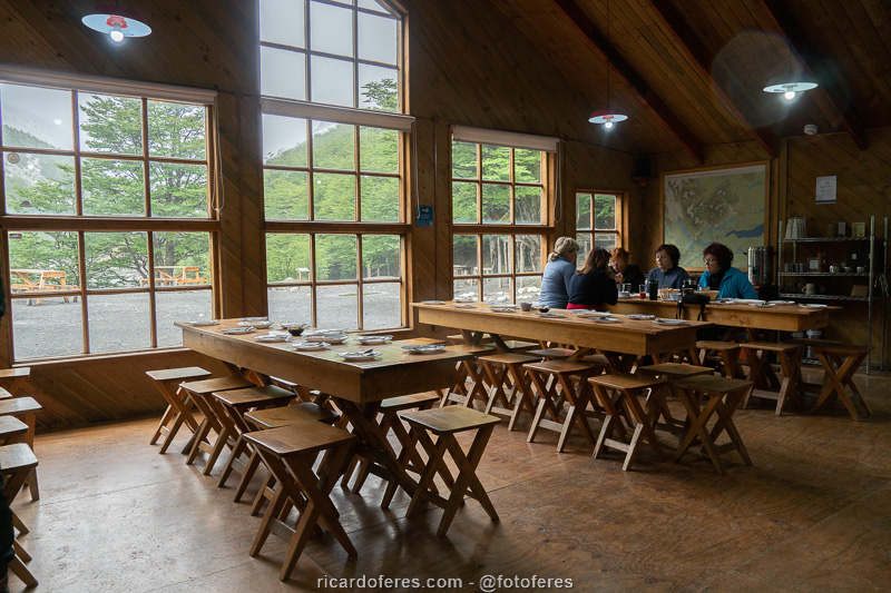
Inside the Chileno shelter.
Day 2
The snow fell throughout the night, so I didn’t even consider going to the base of the Torres because I wouldn’t be able to see them. It’s frustrating, of course, but as I had already seen and photographed them years before, when I did the O Circuit, I didn’t worry because I already had the necessary photos for the book The Most Beautiful Trails of Patagonia.
While waiting for time to pass and the clouds to dissipate a little, I met a couple of Brazilians who were finishing the W Circuit (this point could be the beginning or end of the circuit) and they said they weren’t sad for not having seen the Torres because they never they had seen it snow, so I remembered the first time I saw snow falling and I understood perfectly what they were feeling.
The Mexican woman and I left at 09:30 towards Francés camping and, despite the heavy snow, I walked only with the fleece because the wind was at my back and, walking, I didn’t feel cold.
When I did the O Circuit, in the section close to Valle del Francés, I slept at Los Cuernos camping, very close to Lake Nordenskjöld, but this time I booked Francés camping, not only to get to know it, but also because it is a little closer to Valle del Francés. The idea was good, but the structure of Francés camping is much worse, so I recommend you to stay at Los Cuernos because it costs the same.
A rather boring day, without any outstanding views or photos worthy of such a beautiful place.
That’s how the second day dawned, so I didn’t even consider going up to the Torres.
This is one of the photos I took on my first trip, if you want to see the others, click here.
Hike to Francés camping.
Day 3
Third day on the trail, third day without seeing the sun, not even for a minute! Even so, the Mexican and I went to Valle del Francés, hoping that the weather might improve. Upon arriving at Mirador Francés, the first viewpoint on this climb, the clouds began to give way to the sun and I managed to take good photos towards Lake Nordenskjöld, which made me happy because the photos I had from my previous trip, in this place , were not how I would like.
Excited to finally be photographing, I continued the climb until I heard a loud noise and, looking to the left, I saw a large avalanche on the other side of the valley. I quickly took the camera that was in the fanny pack and started to photograph it, losing only the first few seconds. I had seen avalanches several times before, but this was by far the biggest and most beautiful one I’ve ever seen.
Excited to have photographed something so impressive, I went to Mirador Británico and managed to take some photos a little before arriving, as soon the clouds returned to hide the mountains. All right, at least that day was productive and I went to Paine Grande campsite almost always under drizzle.
Lake Nordenskjöld seen from Valle del Francés.
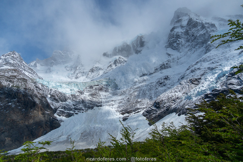
Avalanche at Valle del Francés.
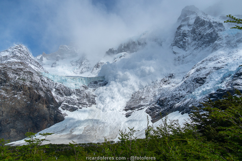
Avalanche at Valle del Francés.
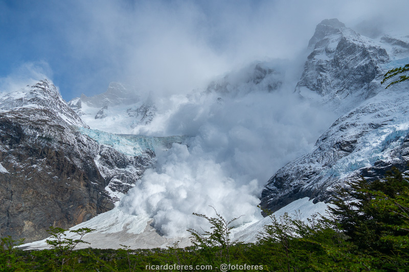
Avalanche at Valle del Francés.
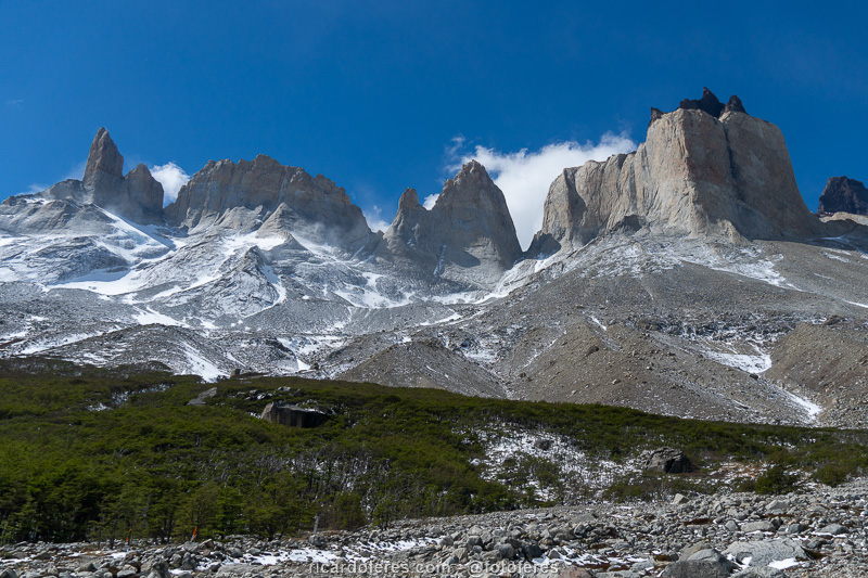
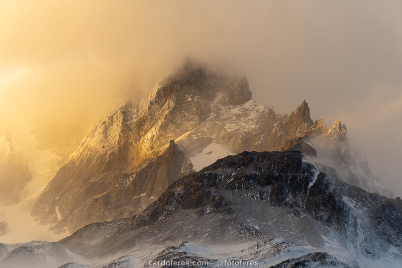
Cerros Espada, Hoja and Máscara, almost arriving at Mirador Británico.
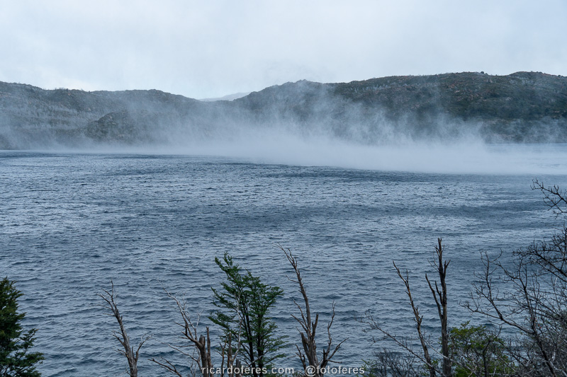
It looks like rain, but it’s the wind lifting the water from Lake Skottsberg.
Day 4
It rained all night and as it didn’t stop when I got up, I decided to stay one more night at Paine Grande, instead of staying two nights at Grey. This exchange was only possible because the two campsites belong to the same company, I already had two reservations for Grey and there was a place in Paine Grande for that night.
During the day the rain decreased, but it didn’t stop, it was good to have stayed still because I wouldn’t have taken any pictures.
I spent the day watching movies downloaded from Netflix, reading books on my Kindle, and around 8 pm, the sky turned a little blue to give hope for the next day, when I would have to carry on even under a deluge, because of the reservations already made.
This is how I spent the fourth day…
And that’s how I would have liked to have spent it, photographing this incredible view of Lake Pehoé. This viewpoint is close to Paine Grande camping and hotel area, which is on the left side of the photo. Photo taken on my first trip to Torres del Paine, if you want to see others, click here.
Day 5
It was drizzling when I woke up, but while I was having breakfast, it stopped drizzling… And it started to snow. Shortly after, the snow stopped and I took the chance to quickly dismantle the tent, but the walk to Grey camping was almost all the time under light rain and with a lot of head wind.
After pitching the tent in Grey campsite, I hiked to the lookout in front of the glacier and there was even a bit of sun to help me show off the beautiful shade of blue of the icebergs.
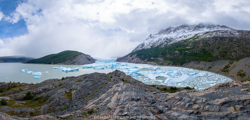
Lookout to the Grey Glacier, near Grey campsite.

Lookout to the Grey Glacier, near Grey campsite.
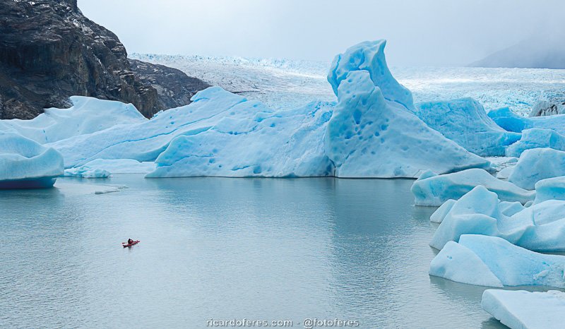
Lookout to the Grey Glacier, near Grey campsite.
Day 6
The trail back to Paine Grande was pretty uneventful, always with cloudy weather. No rain at first, then it drizzled and snowed, and it was not a light snow.
Already decided to take the 18:35 catamaran, which is how most people arrive or leave, I decided to leave using a trail I haven’t been on my previous trip, which is always interesting and encouraged me to spend another night at the camp.
Sunset tinting Paine Grande, seen from Paine Grande campsite.
Day 7
I woke up at 05:00 to photograph the sunrise, which was not very beautiful, but I took the opportunity to start walking very early. Breakfast was a cake that I ate while walking, not to waste time as I wanted to get to the road before the bus passed.
At the beginning, the trail has short ups and downs and then follows a long plain, where I saw several rabbits.
Arriving at the road, I would still have to wait two hours for the bus, so I decided to hitchhike. After one hour, about 15 cars had passed and a very nice couple from Prague, in the Czech Republic, who were in their 65s or 70s, stopped. They left me on the road to Pudeto (where the catamaran arrives) and I soon got another ride, this time with two men in their 20s and 25s and, huge coincidence, also from Prague!
They left me at Laguna Amarga entrance, where I took the bus to the parking lot, got my little 4wd and headed to Puerto Natales, the base for the Cape Froward hike, which you can check out by clicking here.
View from the trail that connects Paine Grande campsite to the road.
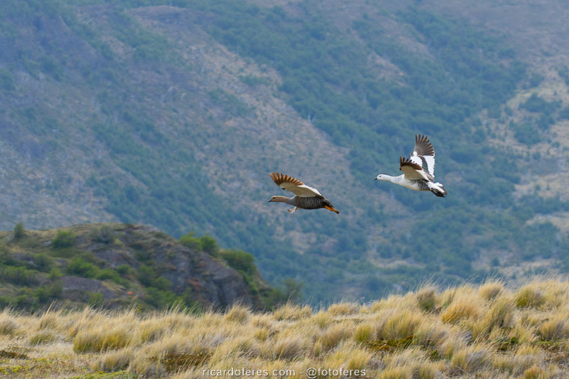
A couple of avutardas.
Get to know the photo book "The Most Beautiful Trails of Patagonia"
Torres del Paine, El Chaltén, Bariloche, Ushuaia, Villarrica, Cerro Castillo, Dientes de Navarino and Parque Patagonia