Get to know the photo book "The Most Beautiful Trails of Patagonia"
Torres del Paine, El Chaltén, Bariloche, Ushuaia, Villarrica, Cerro Castillo, Dientes de Navarino and Parque Patagonia
The Atacama Desert beyond the beaten path
Introduction
The Atacama Desert is a very famous destination around the world and this fame is deserved, as it is a region of exceptional beauty, but Atacama is not just the San Pedro region, the destination of almost all international travelers, it is more than 1,000 km (600 mi) long in a north-south direction and also extends to the Pacific Ocean, not limited to the Andean highlands.
Being so well known, I guess you have already seen several photos and texts about Atacama, but this article will cover not only the most famous attractions, but also little-known spots, from the summit of the highest volcano in the world to some of the most beautiful beaches in Chile.
San Pedro de Atacama and surroundings
Located in the central region of the desert, at an altitude of 2,400 meters (7,900 ft), San Pedro de Atacama has just over 11 thousand inhabitants (data from the National Institute of Statistics of Chile for 2025) and, as it is close to many tourist attractions, it has good infrastructure spread across its dirt roads and adobe buildings, being the base for the points that I will mention below.
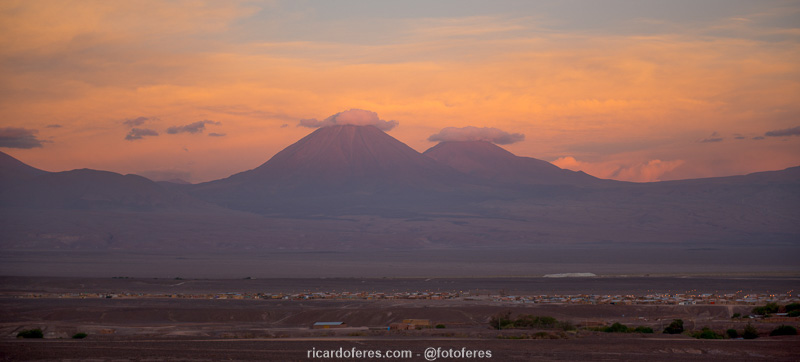
Sunset overlooking San Pedro and the Licancabur volcano, on the border with Bolivia.
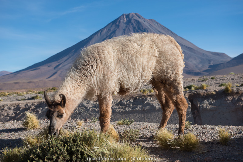
Llamas can be found throughout the Atacama Altiplano and are the largest species of camelid in South America. They were domesticated thousands of years ago by Andean peoples for their wool, meat and milk.
Valle de la Luna (not to be missed)
Just 5 km (3 mi) from San Pedro, Valle de la Luna has incredible formations, a large dune that offers panoramic views of the valley, salt caves, etc. Set aside at least three hours to visit it, but I believe that four to five hours would be a better time to see everything without rushing.
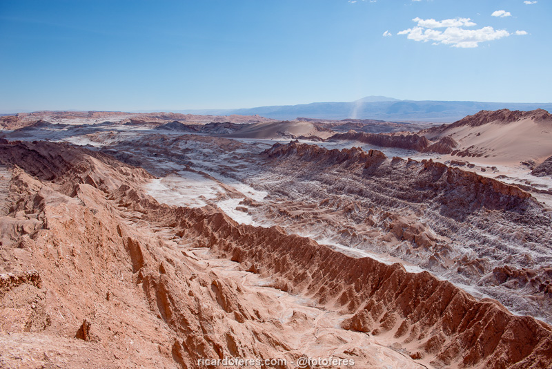
View from the top of the Valle de la Luna dune.
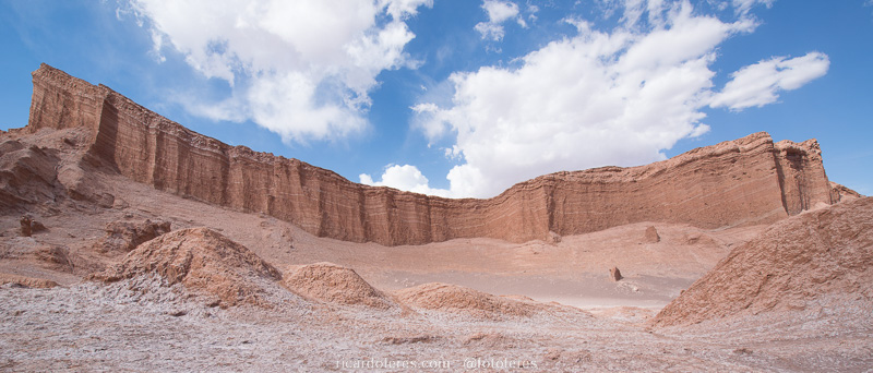
One of the beautiful formations of the Valle de la Luna.
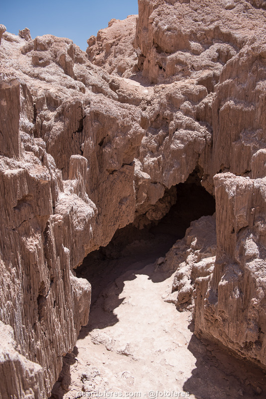
Salt cave.
Tatio Geysers, Flamenco Lagoon, Putana River and Machuca (not to be missed)
Another very famous destination is the Tatio geysers, where heated underground water springs up and creates very beautiful and photogenic fumaroles, especially at dawn, when the greater temperature difference between the water and the air creates more fumaroles. Located at an altitude of over 4,300 meters (14,100 ft), the temperature at dawn can reach -20° C (-4° F), so dress accordingly.
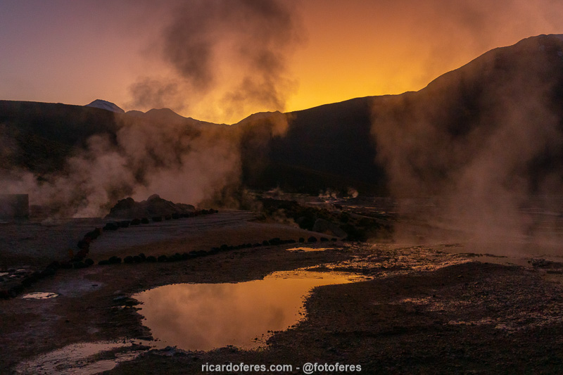
Fumaroles at dawn.
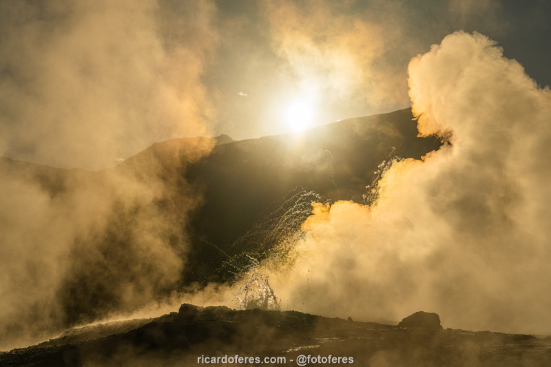
The earlier you arrive, the more fumaroles you will see due to the greater the temperature shock.
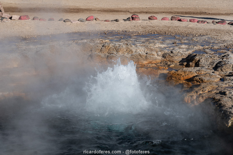
In some geysers the water bubbles due to the pressure with which it reaches the surface.
On the way back, it’s worth stopping at Putana River to watch beautiful birds as the Andean goose, and also at Laguna Flamencos, where you can see, guess what… Flamingos, of course!
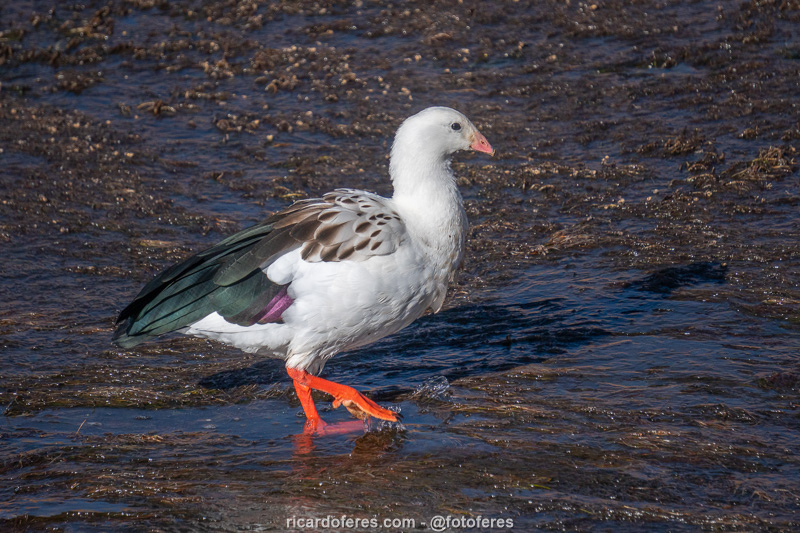
Andean goose on the Putana River.
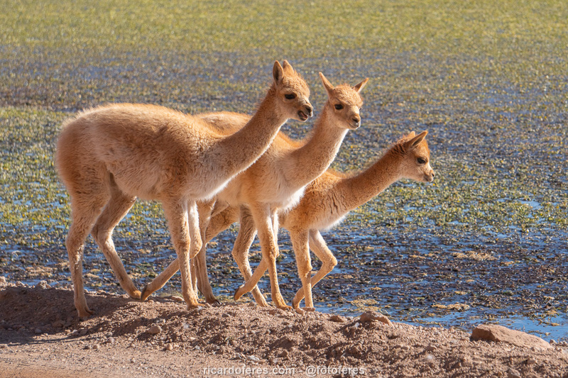
Guanacos on the banks of the Putana River. Guanacos are wild camelids that are smaller than llamas and have short fur. They are also easily seen on the Atacama plateau.
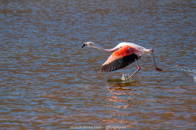
Flamingo at Laguna Flamencos.
You will also pass in front of the town of Machuca, which didn’t attract me much. The only interesting thing I saw was a small church and, if you want to eat something or buy handicrafts, there are some street vendors.
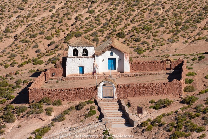
Small church in the village of Machuca.
Monjes de la Pacana (not to be missed)
Right next to the road that connects San Pedro to Argentina lies Monjes de la Pacana, large rocky columns at an altitude of 4,500 meters (14,700 ft) that can be accessed by car. Continuing another 30 km towards Argentina is the Salar de Quisquiro, which in summer is a good place to spot flamingos, but they are not usually close to the road.
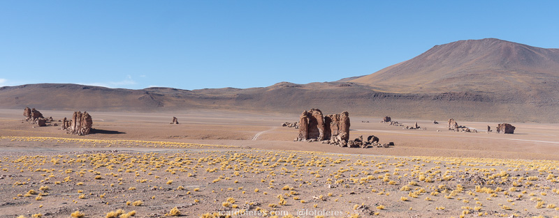
Panoramic view to the Monjes de la Pacana.
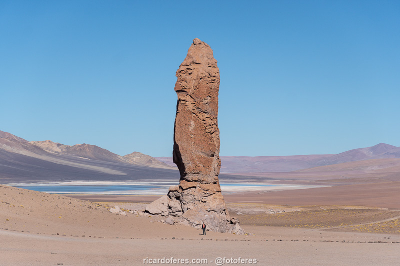
Note that there is a person in front of the Monje de la Pacana, to give you an idea of the size of this formation.
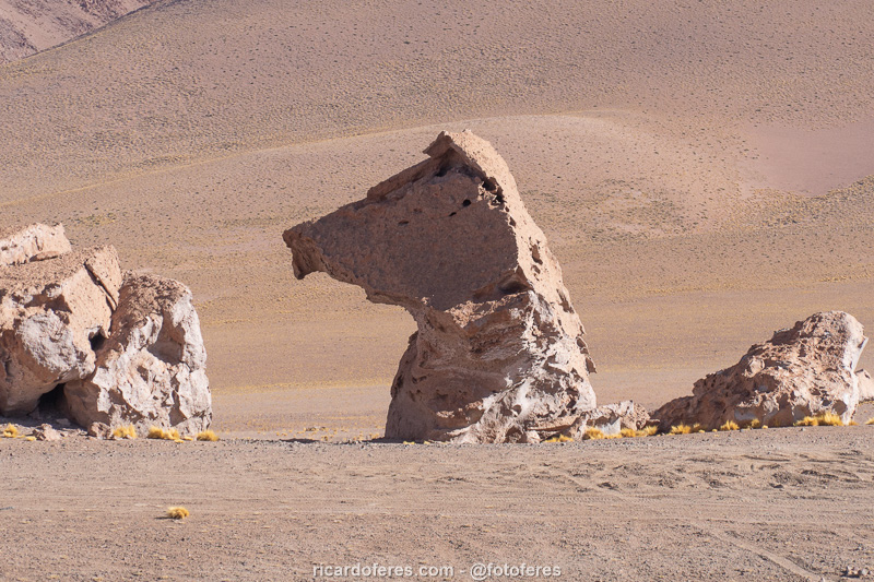
El Perro Sentado (The Sitting Dog).
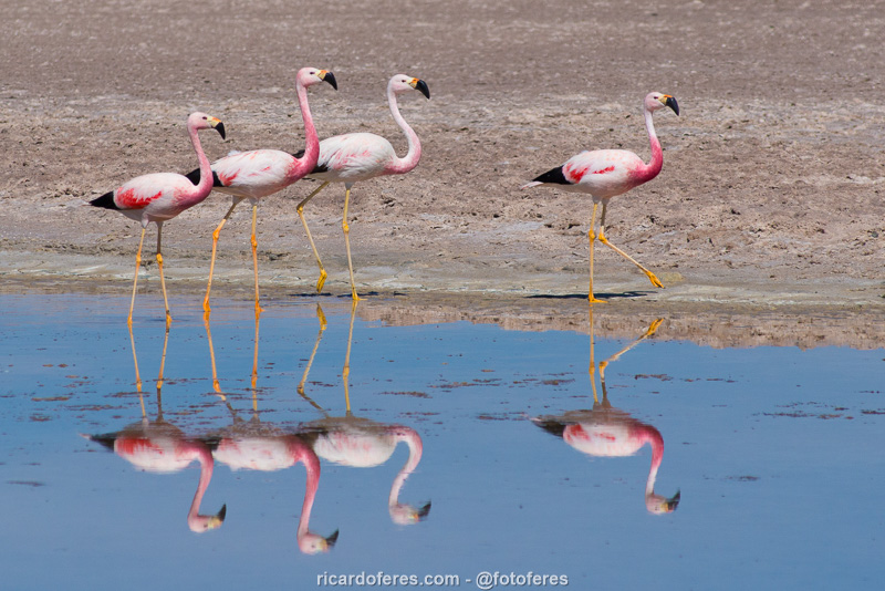
The Salar de Quisquiro has water in the summer and the flamingos take advantage of it to feed.
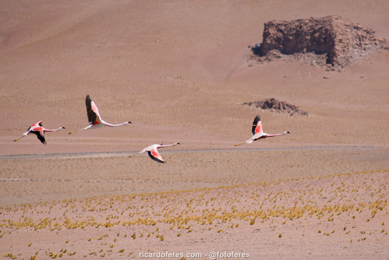
Flamingos at Salar de Quisquiro.
Monjes Blancos and Catedral de Tara (not to be missed if you have a 4×4)
The road to Monjes Blancos and Catedral de Tara is 55 km / 34 mi (round trip, starting at Monjes de la Pacana), but you need a 4×4 and know how to drive on stretches of soft sand, so this attraction is rarely visited by agencies and, if you are lucky like me, you will have the whole place to yourself.
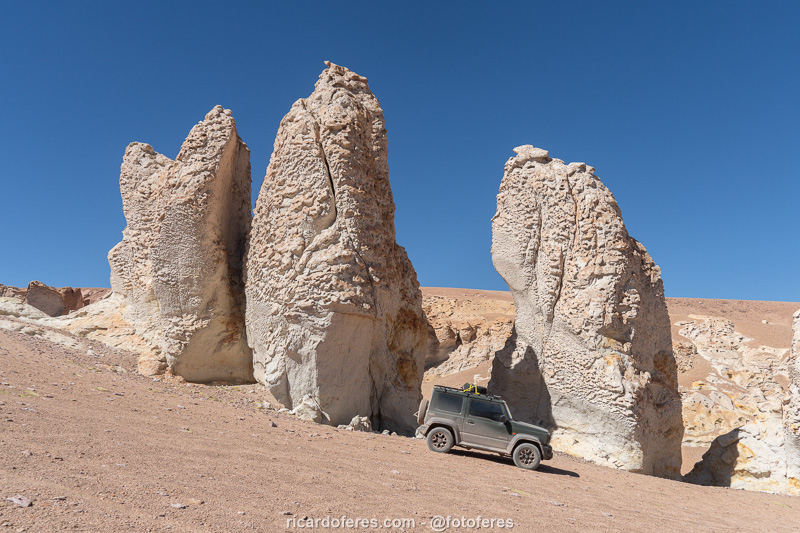
Monjes Blancos.
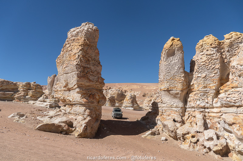
Monjes Blancos.
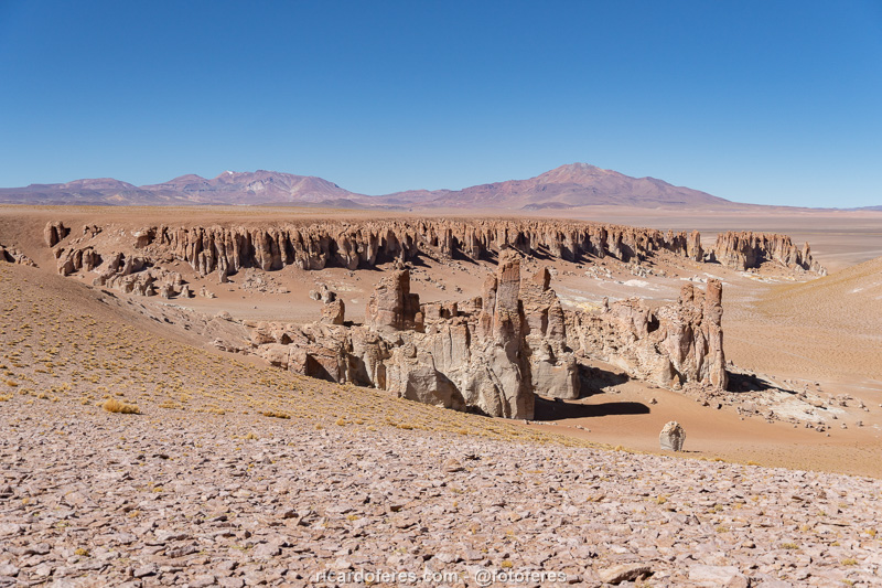
Panoramic view to Catedral de Tara, also known as Catedrales de Cenizas.
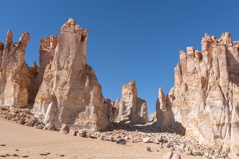
Look at the car to see the size of the formations.
Click to open Wikiloc and download the tracklog.
Laguna Cejar and Laguna de Piedra (not to be missed)
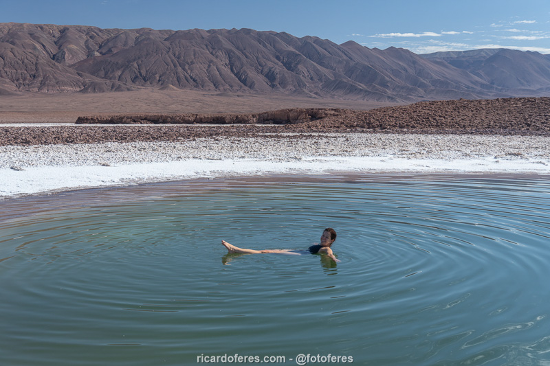
There are several lagoons with high salinity in Atacama, and in the San Pedro region, I think the most beautiful is Laguna Cejar. It is not allowed to enter it so as not to damage the salt structure on its shore, but next to it there is another lagoon, called Laguna de Piedra, where you can swim and it is very interesting to feel the difference in buoyancy compared to the sea.
Laguna Cejar.
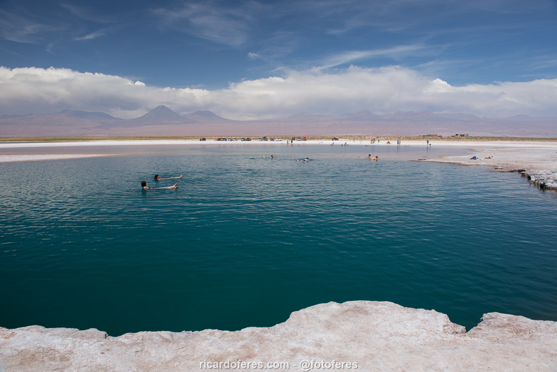
Laguna de Piedra.
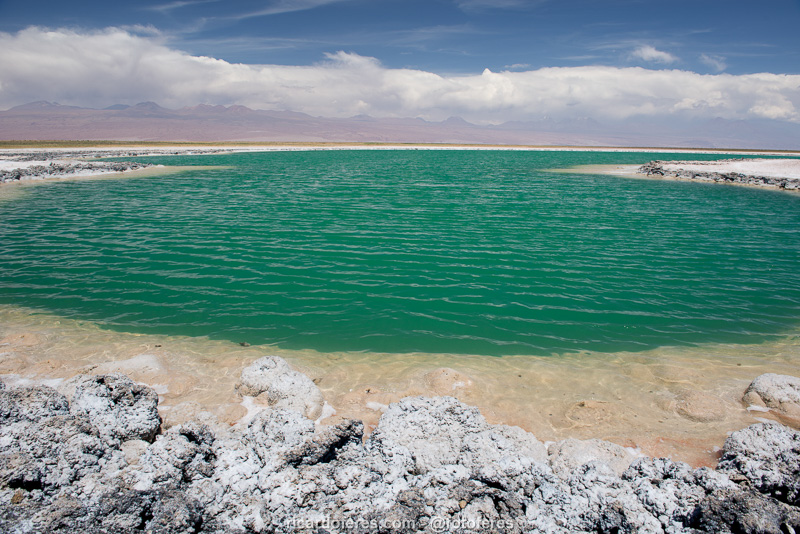
Lagunas de Baltinache (not to be missed if you don’t go to Laguna Cejar)
Another lagoon with high salinity is Baltinache, which is almost as beautiful as Cejar. Here, there is only one lagoon where you can swim; the others are just for observation. The disadvantage is that it is further from San Pedro than Cejar, but the advantage is that fewer people visit it, precisely because of the distance, so you won’t have to share the place with so many people.
One of the lagoons at Baltinache.
Lagoon where swimming is allowed.
Laguna Miñiques, Laguna Miscanti, Socaire, Toconao and Jere Valley (very interesting)
These two lagoons are in the same place and are beautiful, so if you have never been to a highland lagoon, enjoy the opportunity. However, if you have already visited others, they are no different. On the way, you can visit the town of Socaire, the charming village of Toconao and also the Jere Valley, a true oasis in the midst of so much aridity.
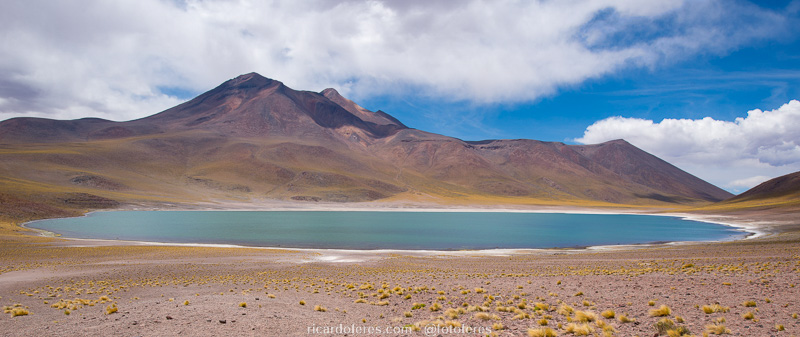
Laguna Miñiques.
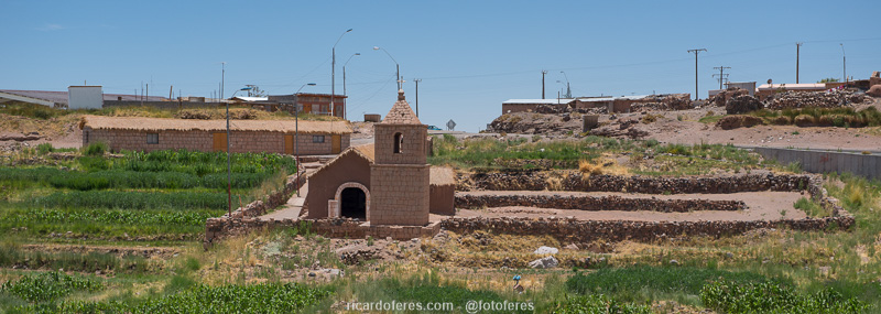
Socaire.
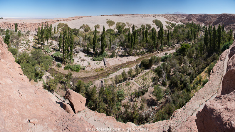
Valle de Jere.
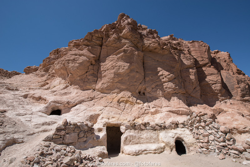
The Trojas of Jere were used by the ancient inhabitants to store food collected from the oasis.
Laguna Tebinquiche and Ojos del Salar (interesting)
Laguna Tebinquiche is a good place to see flamingos, but if you have already seen them at Laguna Flamencos, Salar de Quisquiro or any other spot, I think you can leave this tour aside if you don’t have much time.
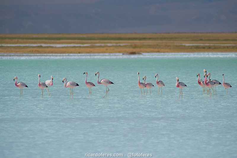
Flamingos at Laguna Tebinquiche.
On the way to the lagoon are Ojos del Salar, two freshwater lakes next to the road that worth a stop for photos, especially if you have a drone, which I didn’t when I visited.
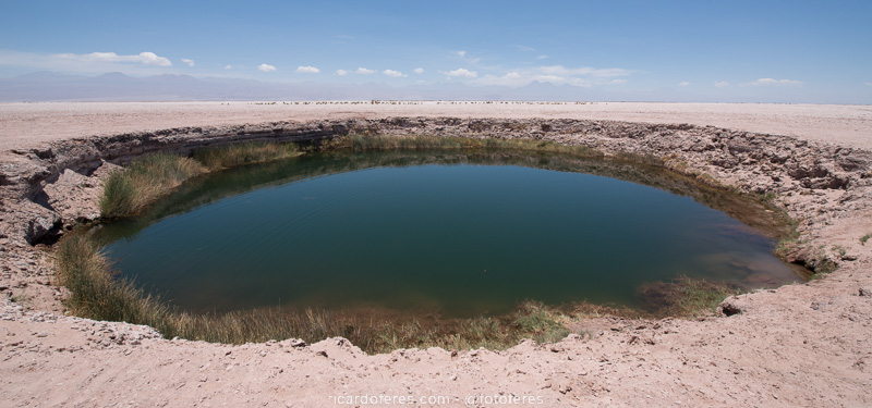
One of the Ojos del Salar.
Southern Plateau
More than 900 km (560 mi) from San Pedro de Atacama, the closest airport to the attractions I will mention below is in the city of Copiapó, but if you are traveling by car, there are many others that can serve as a base.
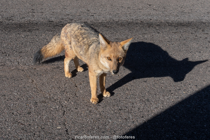
The Andean fox is the second largest canid in South America and can be found throughout the Atacama.
Ojos del Salado (not to be missed if you are a mountaineer)
At the southern tip of Atacama is its highest point, which is also the highest point in Chile and the second highest in the Americas, the Ojos del Salado volcano, at 6,893 meters (22,614 ft) above sea level! If you are an experienced mountaineer, click here and see the article about my solo ascent, but even if you are not a mountaineer, you can go by 4×4 to the Refugio Atacama, which is almost 5,300 meters (17,400 ft) above sea level, but do not do this without acclimatizing first because people have died sleeping there without having acclimatized correctly and climbing directly from the coast.
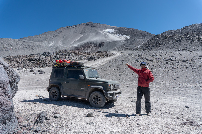
Ojos del Salado seen from Refugio Tejos.
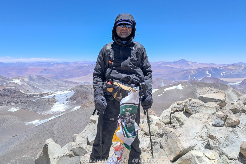
Summit of the Ojos del Salado volcano, at an altitude of 6,893 m (22,614 ft).
Laguna Verde (very interesting)
This large and beautiful lagoon is located next to Route 39, which connects Copiapó (Chile) to Fiambalá (Argentina) and is used as the first stage of acclimatization for those who are going to climb the volcanoes that are over 6,000 meters (19,685 ft) high that surround it. If you don’t want to go mountaineering but want to see beautiful lagoons, you can go to Laguna Verde, which has small natural pools with thermal waters, and on the way you can visit Nevado Tres Cruces National Park.
Laguna Verde is one of the camps used by mountaineers to acclimatize to the altitude.
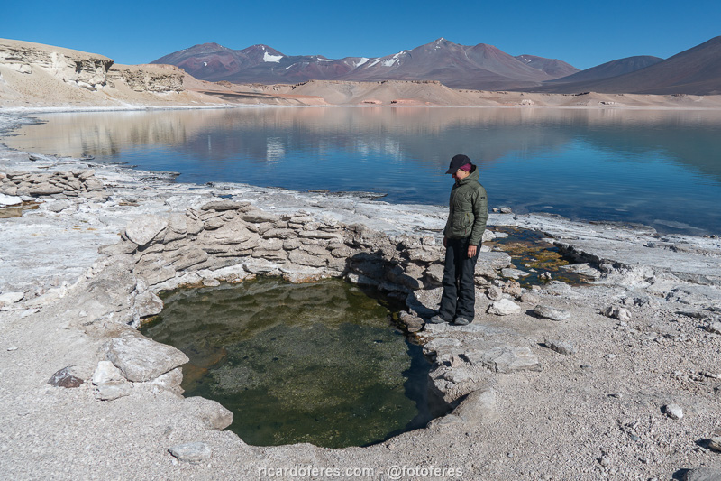
Thermal water on the edge of Laguna Verde.
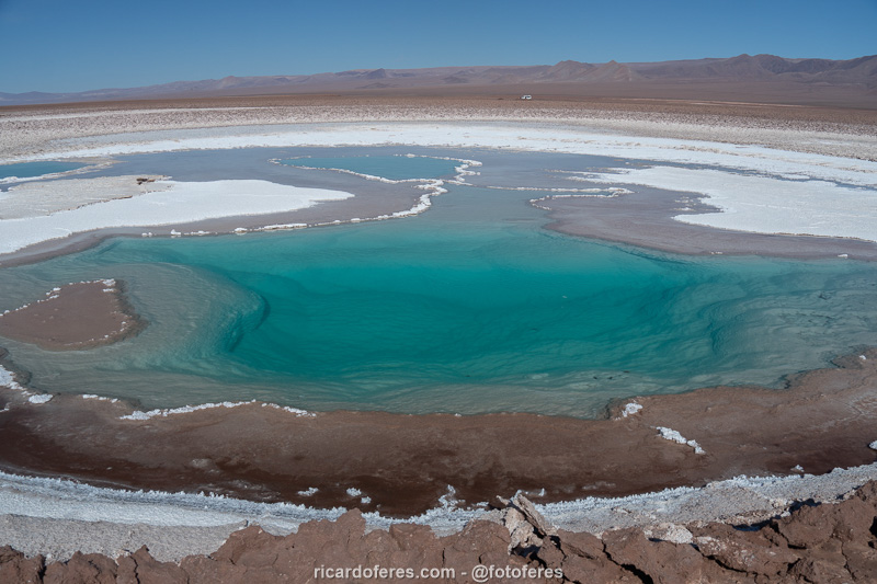
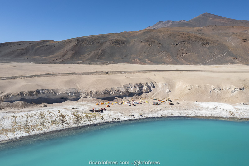
Lagunas de Pedernales (not to be missed)
Also in the south of Atacama is Salar de Pedernales, which would be just another of the many Andean salt flats, were it not for a group of lagoons at an altitude of 3,400 meters (11,150 ft). With varied colors, these lagoons are generally not very interesting, except for one called Laguna Turquesa, which has crystal clear water with a mesmerizing turquoise color and, to top it all off, you can swim in it, which makes for excellent photos.
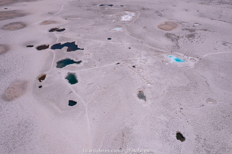
Aerial photo of the Lagunas de Pedernales, in the Salar de Pedernales.
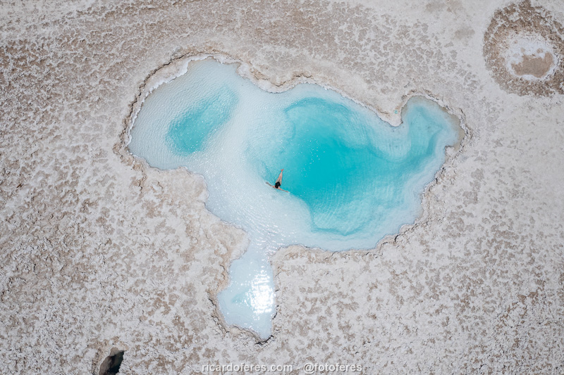
Laguna Turquesa, the most beautiful high salinity lagoon in Atacama.
The Coast
Of course, I’m not going to recommend that you travel to Chile to see beaches, after all, there are better countries for that, but the meeting of the aridity of the desert with the sea creates some very beautiful landscapes, which are worth a visit if you are travelling to the Atacama highlands.
I rode from Caldera (south of Atacama) to Iquique (north), a route of almost 1,000 km (620 mi), and below I describe the places I liked the most.
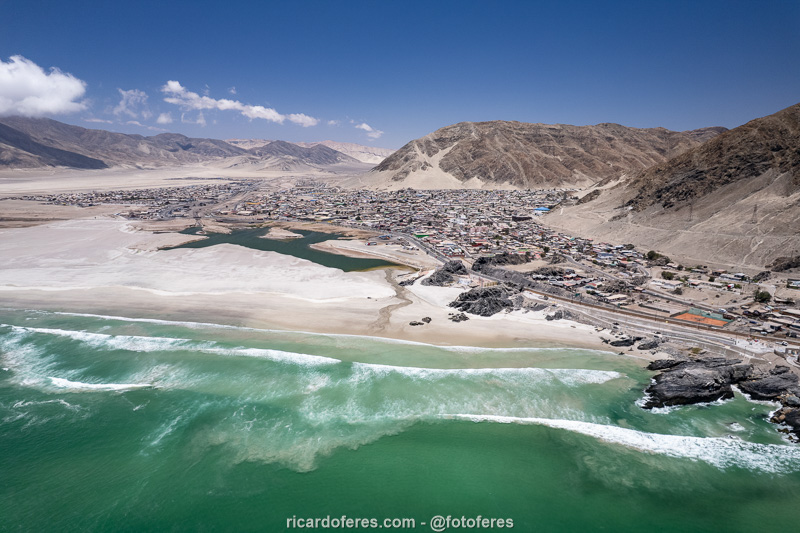
Chañaral is one of the coastal cities of Atacama and serves as a base for exploring the Pan de Azúcar National Park.
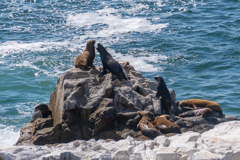
Colony of sea lions in Chañaral.
Pan de Azúcar National Park (not to be missed)
Located next to Chañaral, which is not a pretty town, is this park with crystal clear (but very cold) water and some beautiful beaches that, even in January, are usually almost empty. There are also some hiking trails, the most beautiful being the one that leads to the viewpoint to Pan de Azúcar Island. This park is worth a visit of one or two days if you like empty places with few tourist facilities.
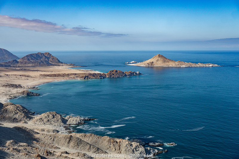
The trail to Pan de Azúcar viewpoint is 5 km / 3 mi long (round trip) and has 150 meters (492 ft) in elevation.
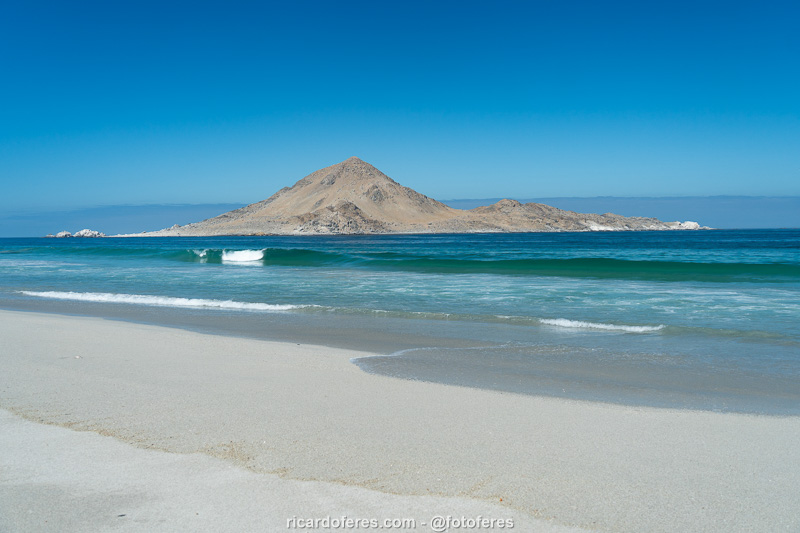
Even though it was January, Pan de Azúcar beach was empty.
Bahía Inglesa (very interesting)
Located in the municipality of Caldera, Bahía Inglesa beach is beautiful and ideal for those looking for good restaurant and accommodation options, and is an interesting counterpoint to Pan de Azúcar. If you want to save money on accommodation, the center of Caldera is just a 10-minute drive away and prices are much lower.
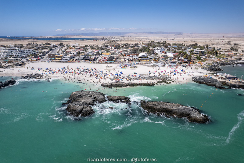
Aerial photo of Bahía Inglesa.
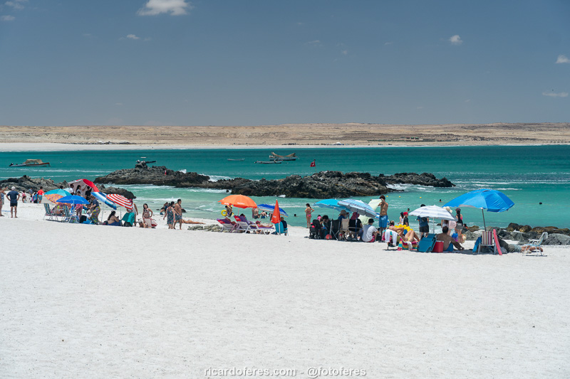
Bahía Inglesa.
La Virgen Beach (interesting)
Also in the municipality of Caldera, but almost one hour’s drive from the center, is this beach that is on private land and you have to pay to enter. The beach is beautiful, but not at all better than the ones at Pan de Azúcar, so I included it in this article only because you will probably see photos of it when planning your trip and I thought I should give my opinion.
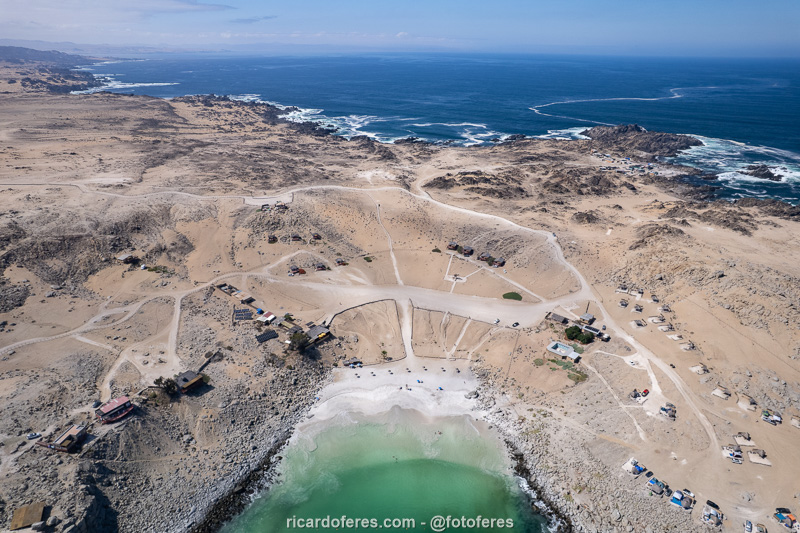
Aerial photo of La Virgen Beach.
Antofagasta (interesting)
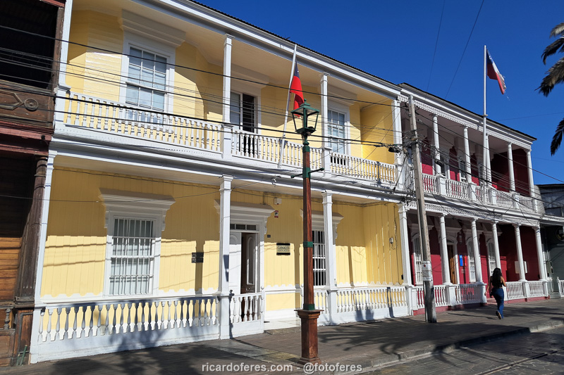
Antofagasta is the largest coastal city in the Atacama, with 479,000 inhabitants in 2025, according to the National Institute of Statistics. The city’s beaches didn’t catch my attention, but the buildings around Plaza Colón are worth a visit, as is the Muelle Histórico.
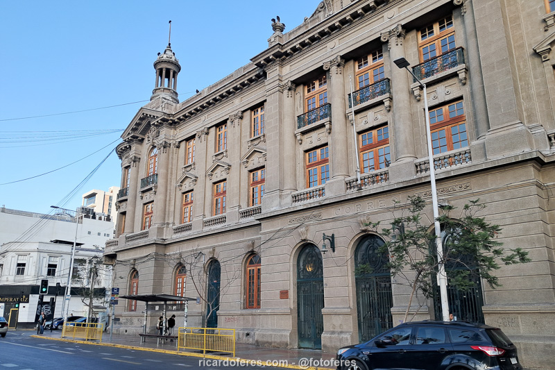
Plaza Colón.
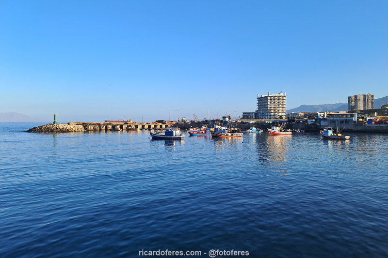
View from Muelle Histórico
The most interesting attraction is located a little north of the city, where there is a beautiful stone arch in the sea, called La Portada Natural Monument. Unfortunately, I lost the photos I took with the camera and the drone, so below is just a photo taken with my friend’s cell phone, but it gives you an idea of what the place is like, and it is certainly worth a visit.
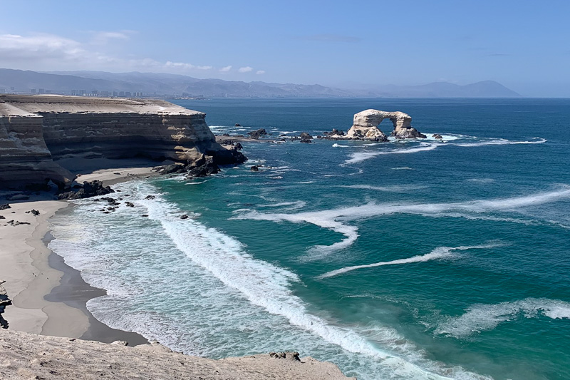
La Portada Natural Monument and, in the background, the city of Antofagasta.
Iquique (interesting)
Iquique has 233,000 inhabitants (Instituto Nacional de Estadísticas, 2025) and I found it more interesting than Antofagasta because it has a larger tourist area and also because of the beaches, which, although not as beautiful as those of Bahía Inglesa or Pan de Azúcar, are good for spending a few hours. The most famous is called Cavancha, but in the summer it is impossible to find peace and quiet due to the amount of vendors shouting at the bathers. I liked Playa Brava better because the waves scare people away and it is possible to sunbathe in peace.
Paseo Baquedano, a pedestrian-only street with restaurants, bars, travel agencies, etc.
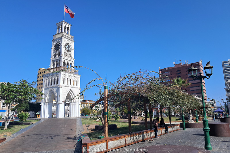
Torre del Reloj.
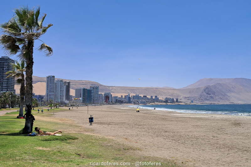
Playa Brava, much quieter than Cavancha Beach.
Between the two beaches is El Rincón de Cachuperto restaurant, famous for its empanadas, which are really delicious, don’t miss it. As for Zofri, which is a shopping mall with supposedly good prices because it’s in a free trade zone, I didn’t see anything really interesting, the only thing worth visiting was to have ice cream at Emporio La Rosa, the best ice cream shop I know in Chile.
Gigante de Tarapacá (very interesting)
The Nazca geoglyphs in Peru are known internationally, but it is not only there that you can see these drawings made by pre-Hispanic peoples. 90 km (56 mi) from Iquique is Cerro Unita, a small hill with approximately 30 figures made between the years 500 and 1,000, with the Gigante de Tarapacá, measuring 120 meters (393 ft) long, being the most beautiful geoglyph.
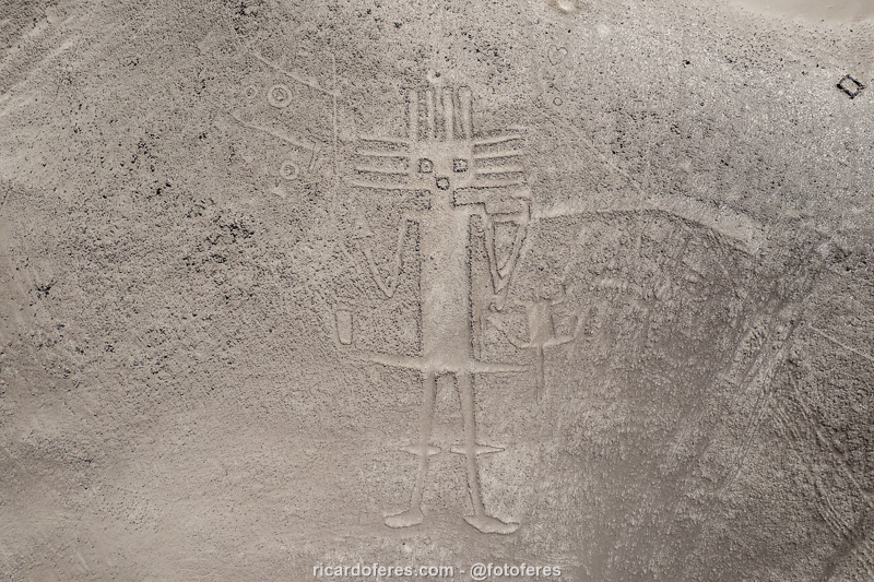
Gigante de Tarapacá, a 120 meters (393 ft) long geoglyph.
Get to know the photo book "The Most Beautiful Trails of Patagonia"
Torres del Paine, El Chaltén, Bariloche, Ushuaia, Villarrica, Cerro Castillo, Dientes de Navarino and Parque Patagonia