Get to know the photo book "The Most Beautiful Trails of Patagonia"
Torres del Paine, El Chaltén, Bariloche, Ushuaia, Villarrica, Cerro Castillo, Dientes de Navarino and Parque Patagonia
4 Refugios Traverse, Bariloche, Argentina – Hiking report
Overview
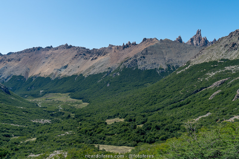
The Nahuel Huapi National Park, in Bariloche, has dozens of trails with the most varied degrees of physical and technical difficulty, being an excellent destination both for beginners and for those who already have a lot of experience. After researching all the trails, three stood out and as they intersect, it is possible to put them together to assemble a great hike made in 8 or 9 days, with 105 km (65 mi) of distance and almost 8,000 meters (26,250 ft) of accumulated ascent. This itinerary with 105 km is what was published in the book The Most Beautiful Trails of Patagonia, but in this article I will describe my experience doing the 4 Refugios Traverse, .
mas no artigo dessa página vou descrever como foi minha experiência fazendo a Travessia 4 Refúgios, with 41 km (25 mi) of distance and 3,700 meters (12,100 ft) of accumulated elevation, which is done in 4 or 5 days.
To read the article about Colonia Suiza-Pampa Linda Traverse, which I finished a few days earlier, click here.
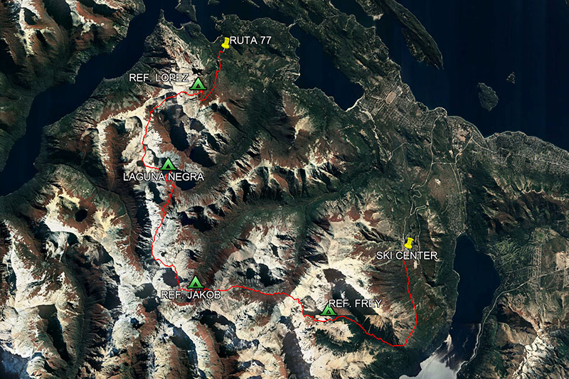
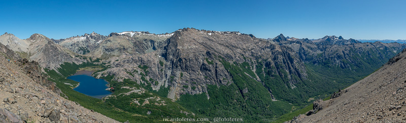
4 Refugios Traverse map with recommended overnight spots.
Base city
San Carlos de Bariloche, known only by its last name, has 130,000 inhabitants and is the third city that receives more tourists in Argentina, after Buenos Aires and Mar del Plata. As Bariloche has an airport, it is easy to get there, usually doing a stopover in Buenos Aires.
Regarding to the hotels, there are options for all budgets, from campsites to 5-star resorts, such as the famous Llao Llao. I stayed in 3 different accommodations in my trips and I liked them all, below are the names ordered from the cheapest to the most expensive, click to open the sites:
–Camping Selva Negra
–Hostería La Pastorella
–Hotel Tirol
There are also a huge amount of restaurants, I went to several and the ones I recommend are below, click to open the websites:
–La Marmite
–Familia Weiss
If you want to buy candies, nuts and dried fruits in bulk, look for Repostería Almendra, which has more options than the markets and prices are lower.
It is faster to go to Bariloche by plane, but if you can go by car, you will have beautiful views along the way.

Sunset and Bariloche seen from Cerro Otto.

In summer, Argentines enjoy the beaches of the many lakes around the city.
Best season
From January to March the climate is drier and the trail is usually completely free of snow. From April to December it is mandatory to hire a guide accredited by the national park.
Costs
The entrance to P. N. Nahuel Huapi is free, but you have to pay to camp at Laguna Negra.
The stretch between Laguna Jakob and Laguna Negra is only allowed with the hiring of a guide accredited by the APN (Asociación de Parques Nacionales), as there is a stretch with a high risk of accident, if the person does not know exactly what he is doing.
Trais signs
In the forest stretches, only one stretch is poorly signposted, just before reaching Laguna CAB. In the sections where you walk above the tree line, you have to be attentive to find the markings, I saw several people taking the wrong path because they weren’t paying enough attention or didn’t have a good map/GPS.
Tracklog for the GPS
Click here to open my Wikiloc page and download this route to use in your GPS.
Report
Day 1 – Cerro Catedral Ski Center to Refugio Frey/Laguna Toncek (13.5 km / 8.4 mi – Accumulated ascent of 1,020 m / 3,346 ft)
The trail from Cerro Catedral ski center parking lot to Refugio Frey is well marked as it is heavily used. By the way, because it is a very requested campsite, this is the only camp that requires advance booking.
As for the hike, it’s the easiest day, with less than 10 km. The first half has a very gentle climb and the second half has a medium steepness. In case you’re wondering why I wrote 13.5 km on the first line, it’s because the total distance of my hike includes a climb up Torre Frey and a loop around the lake.
At the beginning of the day there were a lot of clouds, but even so, the view of Lake Gutiérrez is beautiful. Luckily, after I arrived at Laguna Toncek, in front of Refugio Frey, the clouds started to dissipate and I had an amazing view from Torre Frey.
At the end of the day, I spent some hours in the tent, reading until sunset, which wasn’t very pretty. As every night, I woke up to look at the sky and this time it was full of stars, with the moon litting the lake and the mountains. I went out to take pictures and did the photo that would later become the cover of the book The Most Beautiful Trails of Patagonia.
Lago Gutiérrez seen from the trailhead to Laguna Toncek. On the other side of the lake passes the road that goes to the south of Patagonia.
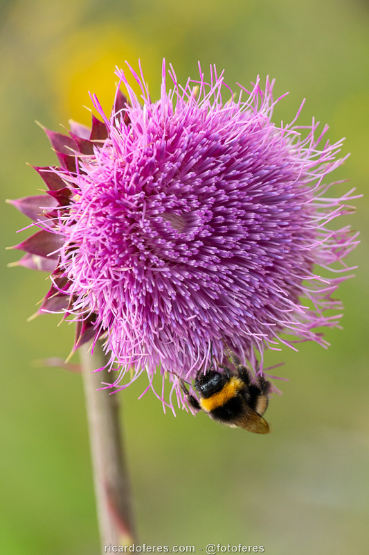
This large bee is called mangangá and is the only species native to Patagonia, but which is in danger of extinction. The cardo-mariano plant has medicinal properties, being used to treat liver diseases..
Forest on the way to Laguna Toncek.
Refugio Frey.
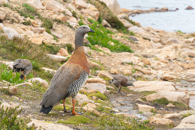
Cauquén at Laguna Toncek.
Torre Frey.
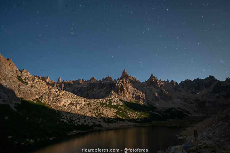
Cerro Catedral Massif lit by the moon.
Day 2 – Refugio Frey/Laguna Toncek to Laguna/Refugio Jakob (14.2 km / 8.8 mi – Accumulated ascent of 889 m / 2,916 ft)
The sunrise was one of the most beautiful I had during my 6 months in Patagonia, with the sun painting the craggy mountains of Cerro Catedral orange.
The trail of the second day is even shorter than the first, but the climbs are steep and the walk is often over rocks that slide a little and make the hiker slide down, so it was much more tiring than the previous day.
The whole day was sunny, with blue skies and beautiful views of the mountains, ending with an incredible view to Laguna Jakob and a side trip to Laguna de los Témpanos. Finally, to end an amazing day, I spent a few hours by the lake, reading and enjoying the sun.
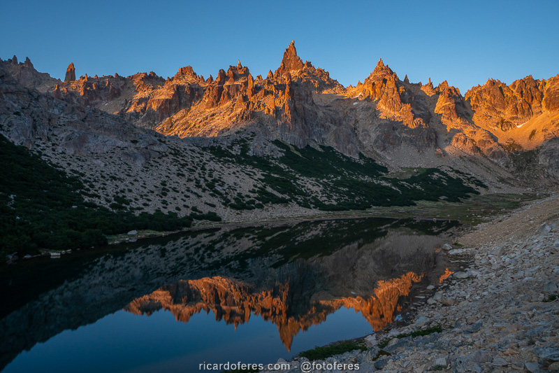
Sunrise seen from Refugio Frey campsite, with view to Laguna Toncek and Cerro Catedral massif.
Mallín del Rucaco, between the two mountain passes of the second day.
Laguna Jakob and the two paths that are options for the third day. The safest way is to go through the valley to the road and the shortest and most beautiful way is to cross the mountain that is almost in the center of the photo.
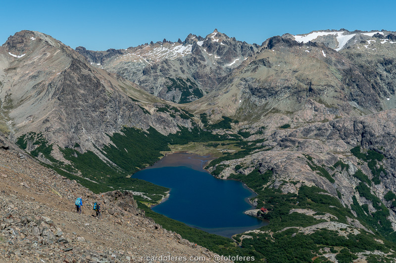
Laguna Jakob and Refugio Jakob.
Laguna Jakob and Refugio Jakob.
Day 3 – Laguna/Refugio Jakob to Laguna Negra/Refugio Italia (10.7 km / 6.6 mi – Accumulated ascent of 1,060 m / 3,477 ft)
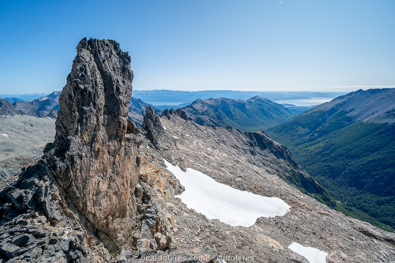
There are two ways to go from Laguna Jakob to Laguna Negra: the safest and longest one goes through the valley to the road, where you need to sleep before going up the trail from Colonia Suiza to Laguna Negra the next day. The other option, which I chose, is to go straight through the mountains, passing a short section that the national park classifies as a grade 4 climb. I can’t say if this rating is right, but I can assure you that the exposure is great, a fall would certainly result in serious injury or death.
I took a good look, evaluated the path and missed the first attempt, stopping at a point where it would not be possible to climb any further. Going down was tense, since the heavy backpack alters the center of gravity too much and the hiking boots are terrible for climbing, but as I am writing this article, you already know that everything went well. The second attempt was the good one, the chosen path did not present much difficulty and soon I was safe again.
The whole day had steep ascents and descents until Refugio Italia, which is in front of Laguna Negra, where there were dozens of people sunbathing and swimming.
Pico Refugio pass.
Descent after Pico Refugio pass. At the end of the descent, the trail turns to the left, going up to Laguna Negra.
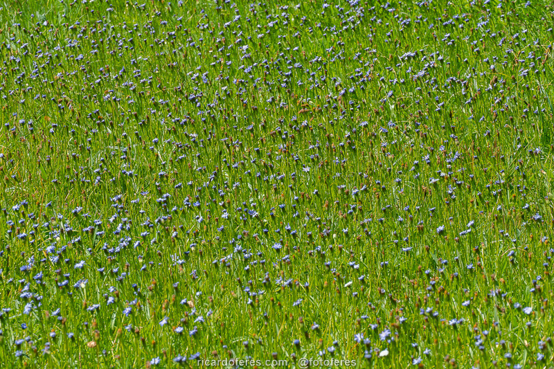
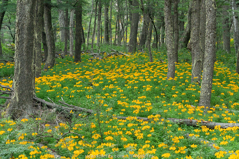
In summer there is a great variety of flowers in the Nahuel Huapi National Park.
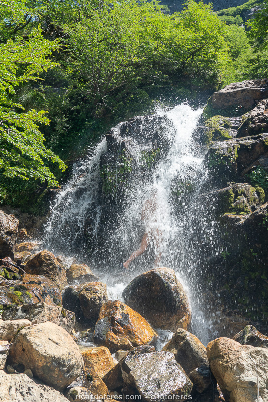
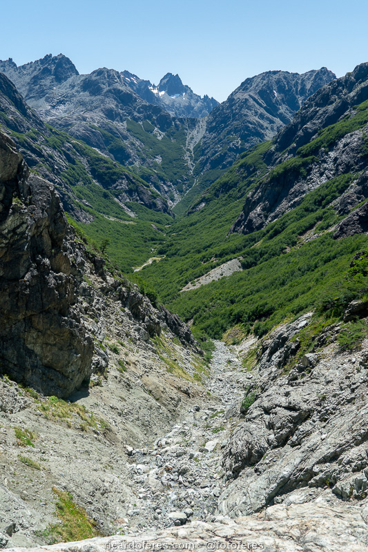
Waterfall on the last descent before going up to Laguna Negra.
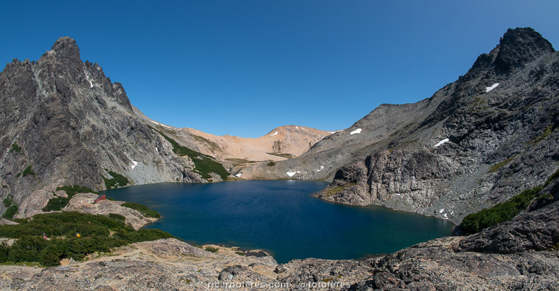
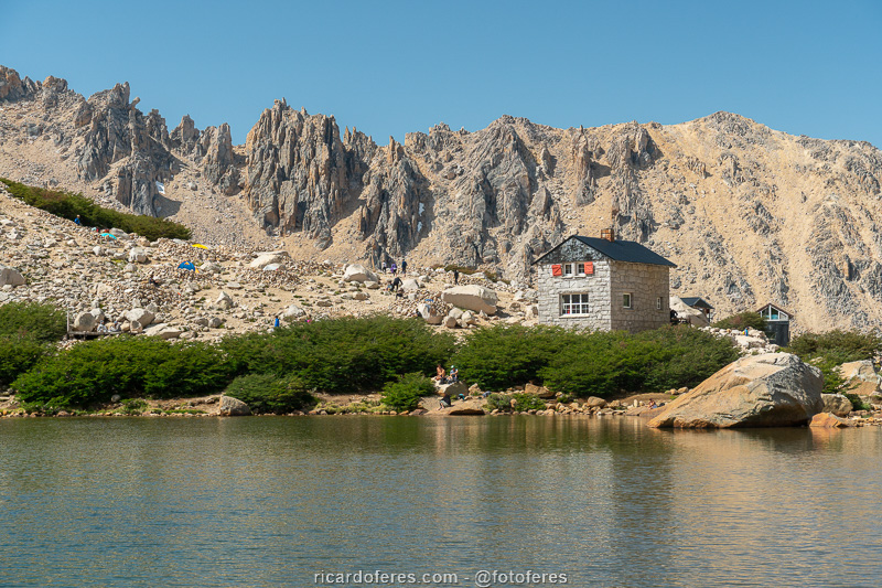
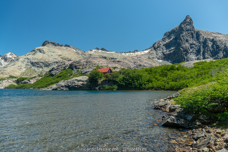
Laguna Negra and Refugio Italia.

360º photo of Laguna Negra and Refugio Italia. Click to open and rotate sideways with the mouse.
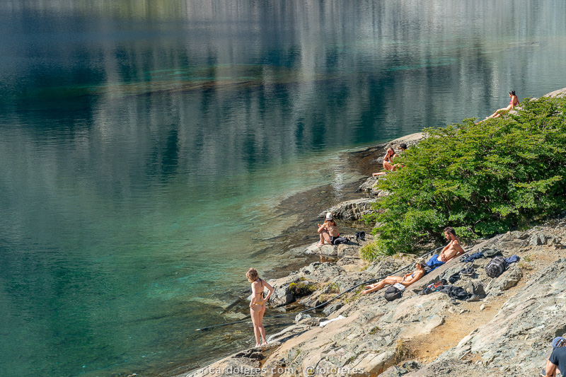
Many people do the hike to Laguna Negra to enjoy the summer days..
Day 4 – Laguna Negra/Refugio Italia to Refugio López and the road (12.5 km / 7.7 mi – Accumulated ascent of 860 m / 2,821 ft)
The forecast had said that the window of good weather would last until yesterday, and unfortunately, they were right. Today I woke up, I saw that it was very cloudy, but I went to Refugio Lopez anyway, as this section would not be part of the book The Most Beautiful Trails of Patagonia, since the route described in the book goes from Laguna Negra in the direction of Cerro Tronador, on a trail described in this article, click to open.
Another day with a short but difficult trail, as the ascents and descents are steep.
The view from Refugio Lopez on a sunny day must be incredible, but I could only see the lakes through the clouds at one time or another. Fortunately, as I descended to the road, I started to get better views as the clouds began to be above me, so I was able to enjoy the view a bit while savoring the happiness of having completed the photos I needed for the book.

Cerro Tronador and Lake Nahuel Huapi (Brazo Tristeza) seen from Paso Cerro Negro. This photo was taken during the Colonia Suiza-Pampa Linda Traverse, when I did a shrt side trail to come to this lookout and I used the photo because on the day of this article, the weather wasn’t good.

360º photo of Paso Cerro Negro. Click to open and rotate sideways with the mouse.
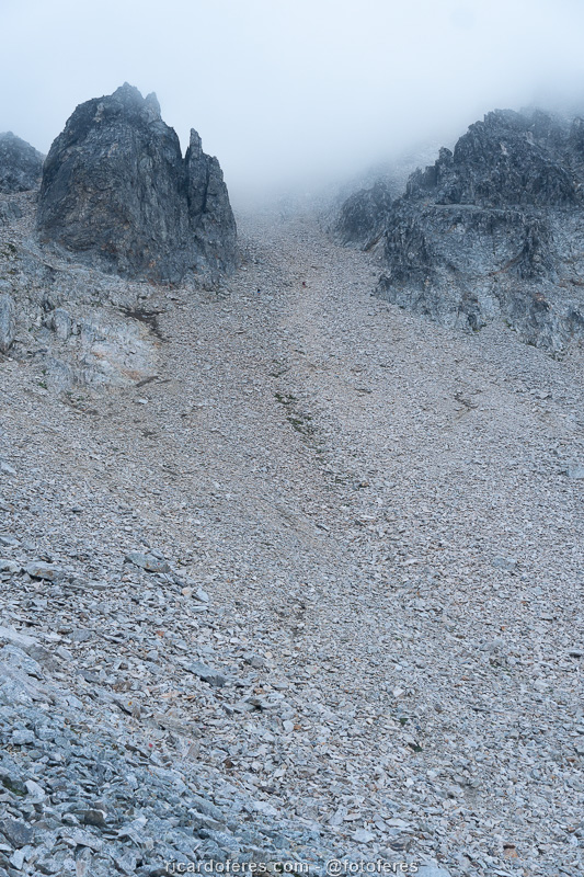
The slope of Pico Turista is very steep and all with loose stones, which sink with the steps and make the ascent quite exhausting.
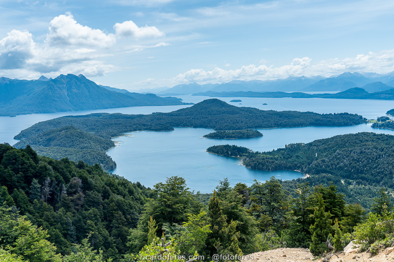
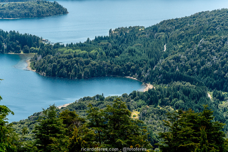
Lakes Nahuel Huapi and Perito Moreno.
Beach on Lake Perito Moreno.
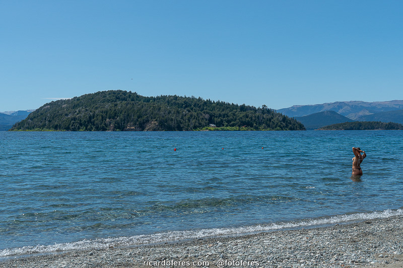
Photos for the book finished, I celebrated with a nice bath in Lake Nahuel Huapi.
Get to know the photo book "The Most Beautiful Trails of Patagonia"
Torres del Paine, El Chaltén, Bariloche, Ushuaia, Villarrica, Cerro Castillo, Dientes de Navarino and Parque Patagonia